
Yesterday saw the return of Rains in Chennai with multiple spells of thunderstorm activity around the region. Not only Chennai but many parts of North & Interior Tamil Nadu enjoyed spells of good rains. In particular the good spell of thunderstorm for Dharmapuri has been continuing with places like Paiyur, Palacode, Pochampalli recording moderate rains. Poonamalle topped the charts for stations around Chennai recording nearly 7 cms along with Puzhal. Both the IMD observatories recorded moderate rains with 26 & 46 mm respectively at Nungambakkam and Meenambakkam respectively.
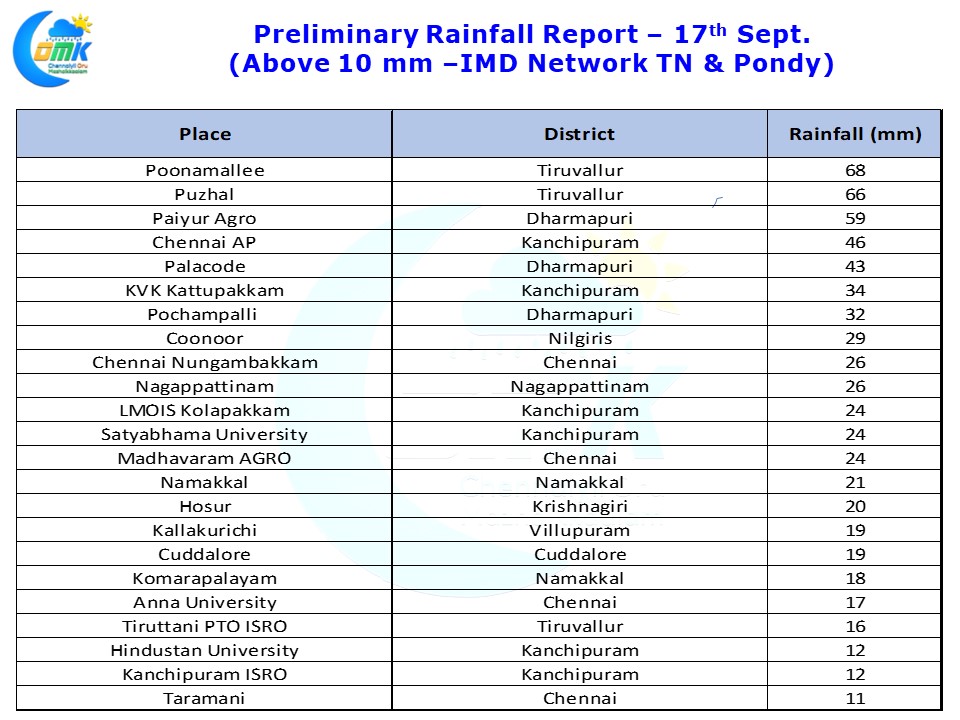
In a classic case how thunderstorms most of the time are very erratic in spatial spread of rainfall Taramani recorded only 11 mm though it is almost at the same latitude as Meenambakkam. Once again it reiterates how the movement of thunderstorms decide the rainfall pattern and often you could just see rains happening a couple of kms away from your place while you just sit as a spectator.
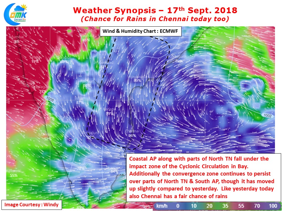
In the context of Rains in Chennai we cannot ignore the fact that the cyclonic circulation in Bay of Bengal played a crucial role. The angle of winds created by this circulation brought the wind convergence right over North TN & South AP and made it conducive for thunderstorms to develop. Today also the convergence over parts of North TN & South AP is persisting though models indicate it to have shifted slightly to the North compared to yesterday. Additionally we are also seeing a fair bit of moisture being circulated by the circulation at mid level making conditions conducive for thunderstorms to develop and thrive.
While its difficult to say whether Chennai could get a repeat of yesterday in terms of rainfall intensity but there is a strong possibility for Rains in Chennai to continue today too.