
As Summer bears down across Tamil Nadu the wheels of motion has started to slowly churn towards the most critical weather event of the country the Southwest Monsoon. A glance at the wind charts indicate the seasonal change process is slowly underway in anticipation of the Monsoon Onset. A North South Trough that runs Perpendicular all the way through Peninsular India running from Haryana / West UP to Comorin Sea area is a pre monsoon phenomenon created by the changing winds.
Thanks to the changing winds the atmosphere in the interiors of Tamil Nadu and the states of Kerala & Karnataka become conducive for some evening thunderstorms aided by the radiation created by the hot day time conditions. Yesterday saw Karnataka & Kerala see a fair bit of thunderstorms while most of Tamil Nadu saw dry conditions except for some isolated rains in a few areas around Delta and parts of South TN along the ghats.
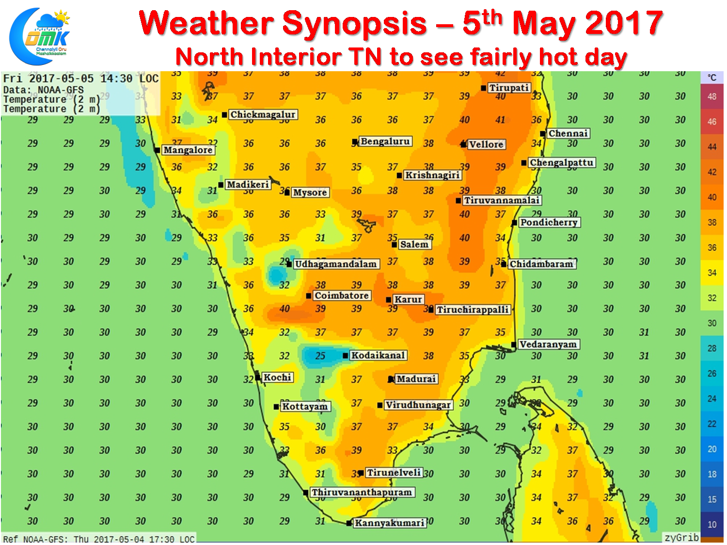
Though Agni Nakshathiram has started with effect from yesterday temperatures continue to remain normal and close to normal with no place in Tamil Nadu seeing abnormally hot day time conditions. Today we are likely to see parts of North Interior TN see a fairly hot day with the maximum temperatures for the day staying a degree or two above normal for this time of the year. Coastal areas like Chennai will continue to get moderated by the sea breeze keeping temperatures around 35 / 36°C.
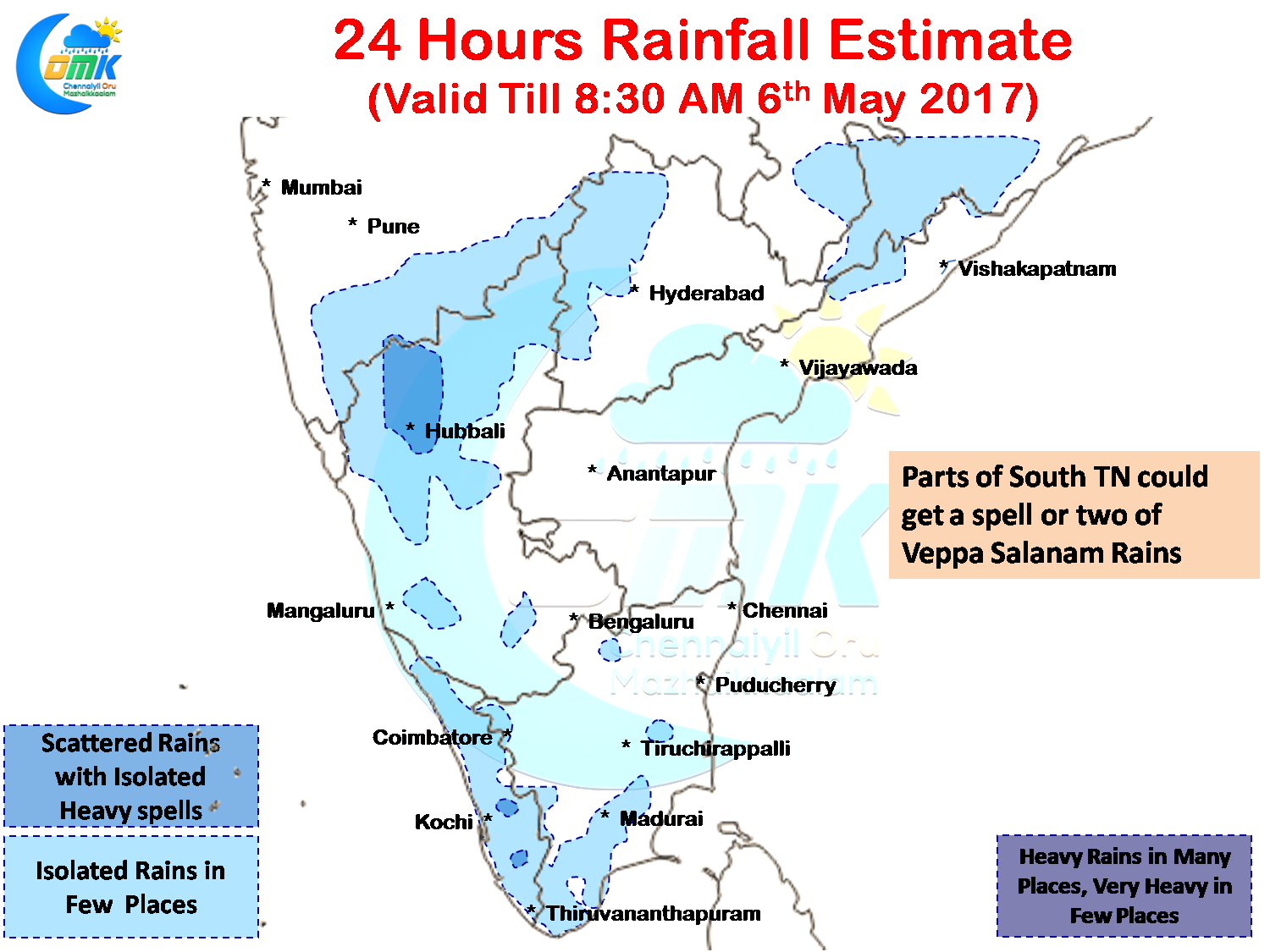
As far as rainfall goes today could see some Veppa Salanam rains over parts of South TN around Madurai, Tirunveli, Virudhunagar districts with one or two places getting a spell or two of heavy rains. Places along the Western Ghats and adjoining parts of Kerala will see moderate spells at a few places while parts of North Karntaka under the influence of Trough could see heavy spells of rains in one or two places during the course of the day.
Powered by WPeMatico