With all eyes on Bay Of Bengal the deep depression is on the verge of becoming Cyclone Nivar over the next 12 to 24 hours or so, In a preview of what to expect many parts of Chennai recorded moderate to heavy overnight rains. The IMD obserbatory at Nungambakkam recorded more than 7 cms rains from the overnight spells.
Bay Depression shows Potential for Rapid Intensification
Weather bloggers of Chennai by default are an impatient lot. When a possible disturbance emerges over the Bay they start becoming hyper analyzing every drop of water in Bay of Bengal scouring every known source of weather maps in the internet to understand the behavior of the disturbance. But many a time a detached approach…
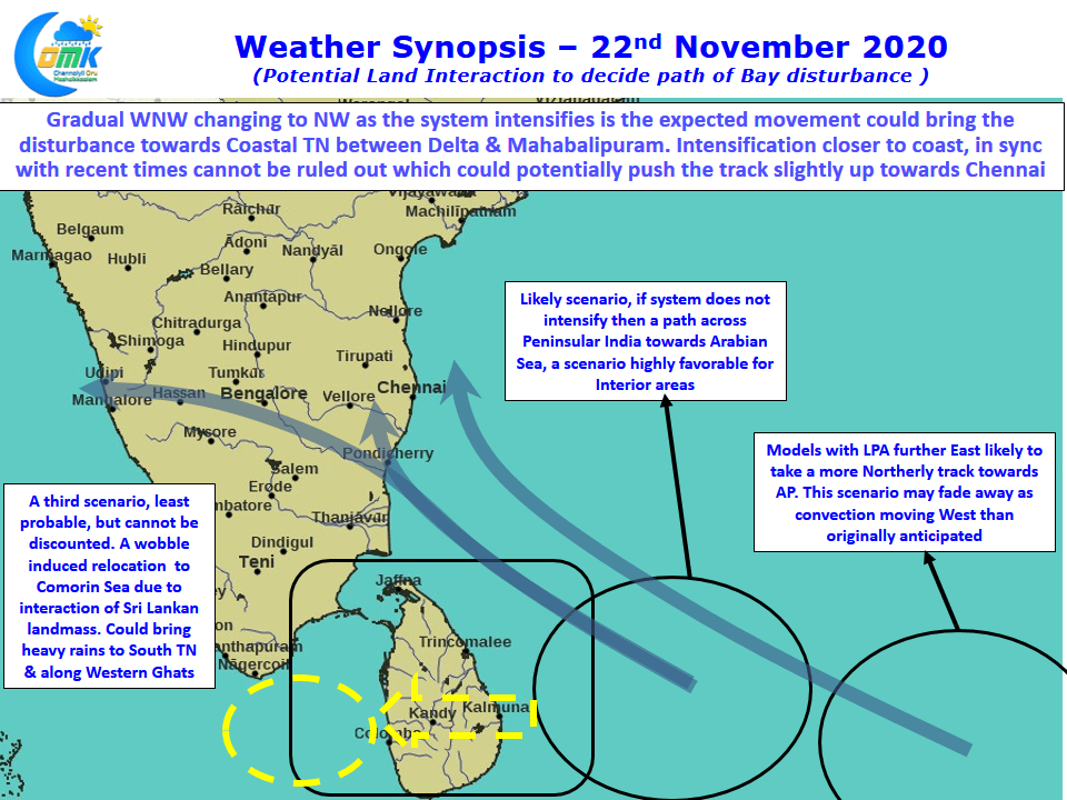
Potential Land Interaction to decide path of Bay disturbance
With low forming to the East of Sri Lanka what is in store for Tamil Nadu in the coming days. Is Cyclone Gati heading our way? A detailed COMK Post on a potentially heavy rains scenario that could unfold
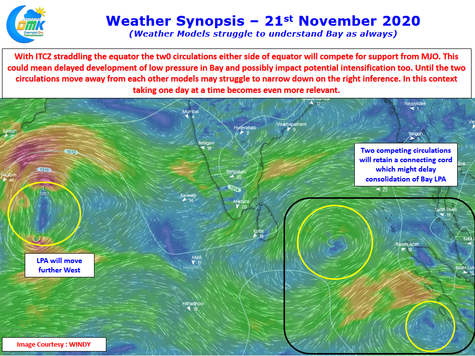
Weather Models struggle to understand Bay as always
எப்பொருள் யார்யார்வாய்க் கேட்பினும் அப்பொருள்
மெய்ப்பொருள் காண்ப தறிவு. திருக்குறள். To discern the truth in every thing, by whomsoever spoken, is wisdom holds true to weather bloggers too as Weather Models struggle to understand Bay of Bengal as always.
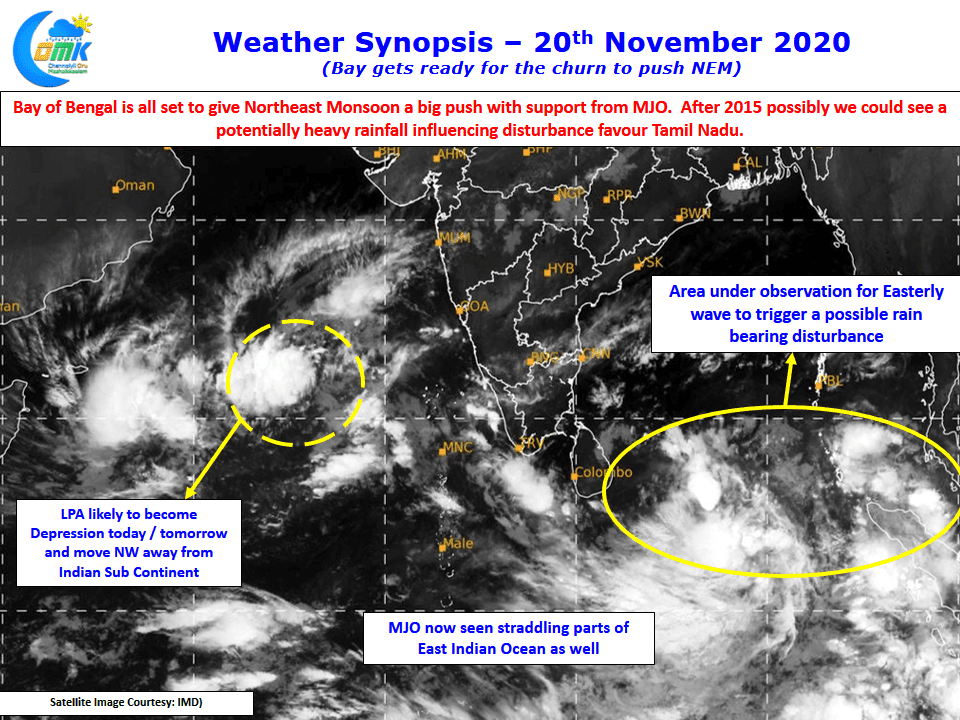
Bay gets ready for the churn to push NEM
While Bay gets ready for the churn to push NEM2020 with support from MJO, after many years a proper Rain bearing disturbance could head towards Tamil Nadu next week. In the meanwhile mostly dry Weather to prevail today.


