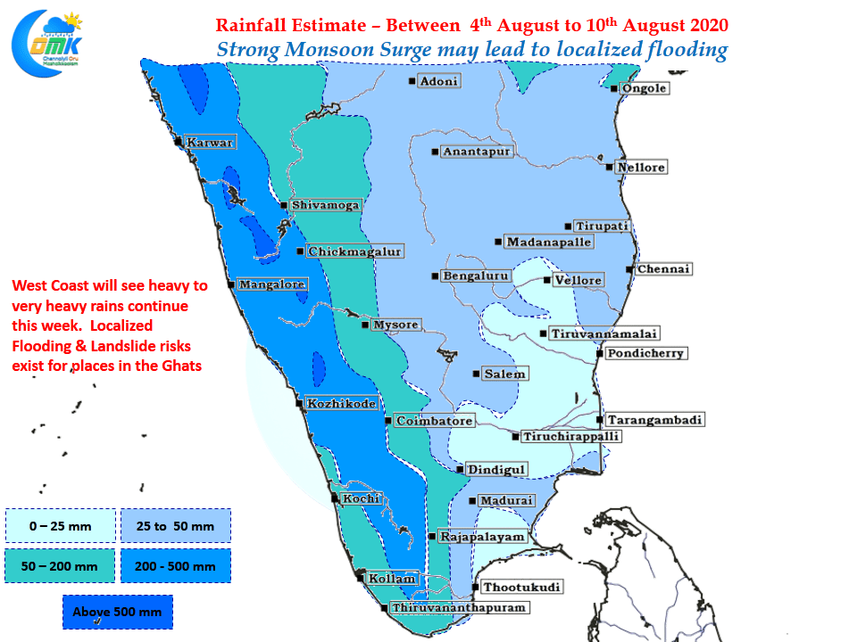
Its been more than two months since this year’s Monsoon set its foot on the Indian Sub Continent. So far it has been only been case of ifs & buts or in cricketing parlance the good innings have been coming only in patches instead of a streak. For the first time possibly we might see…
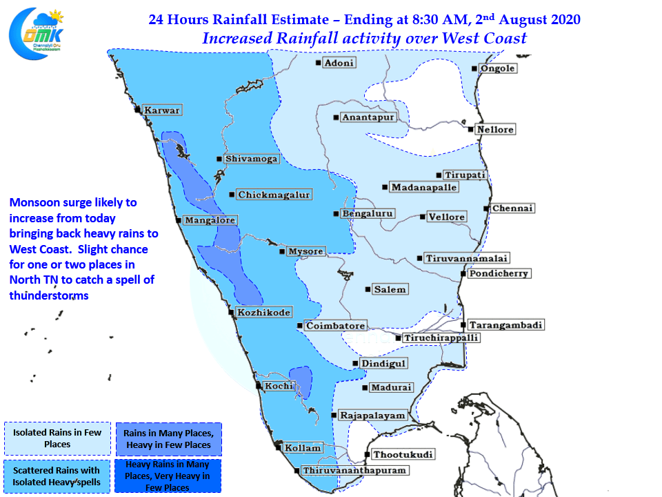
Increase in Rainfall Activity over West Coast
Last night saw Western & Northern suburbs of Chennai enjoy a very good spell of thunderstorms after midnight. While the IMD observatory in Nungambakkam missed out most of the spells accumulating only 12 mm, the other observatory at Chennai AP did not get rains at all indicating how the activity was confined to the Western…
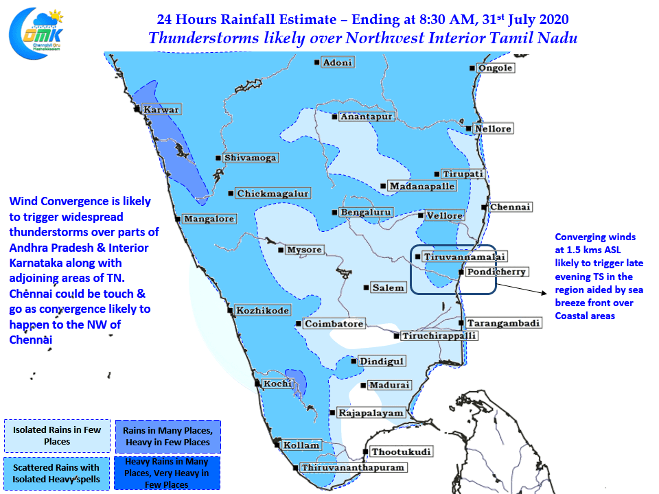
Thunderstorms likely over parts of North TN
Like a pendulum swinging back and forth Thunderstorms & Monsoon dynamics have been having their own mini battle for the past couple of days with yesterday seeing fairly active west coast though most of it was not proper monsoon dynamics but influenced by the Upper Air Cyclonic Circulation moving across Peninsular India towards the West…
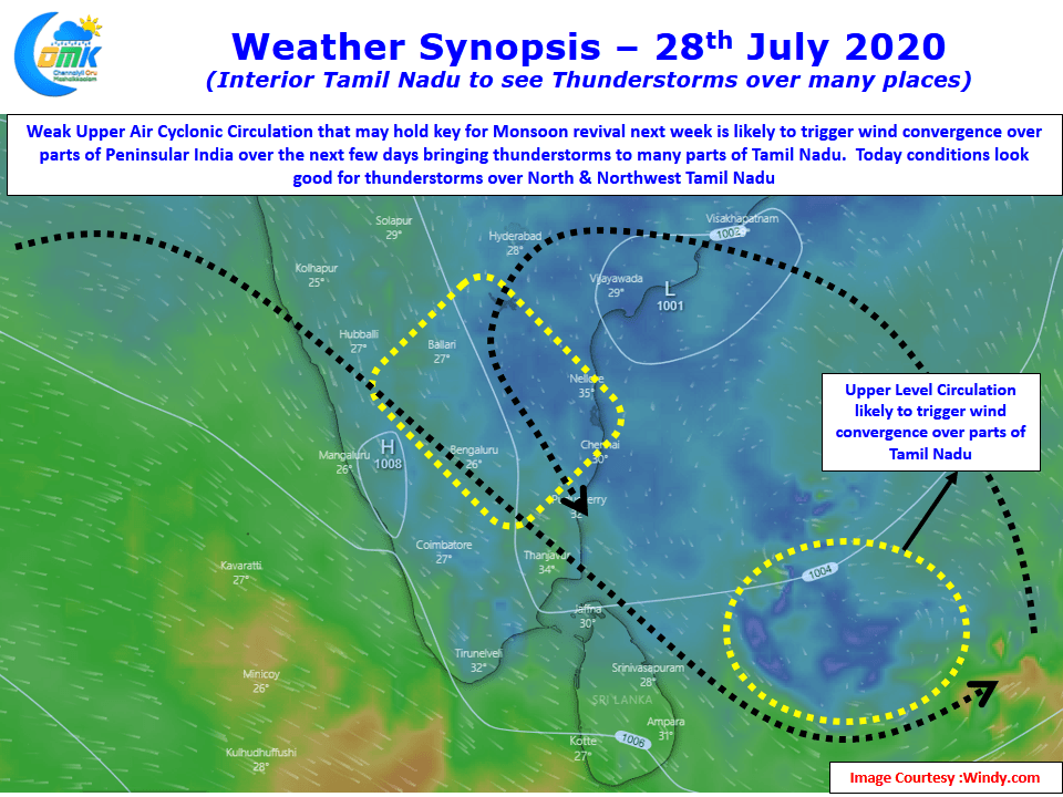
Interior TN to see thunderstorms at many places
Last few days have seen fairly good thunderstorm activity over Tamil Nadu with yesterday seeing thunderstorms over parts of Erode, Coimbatore dts in West TN while around midnight many places in Delta districts got moderate rains under the influence of an Upper Air Cyclonic Circulation developing in Bay. This developing circulation is likely to play…
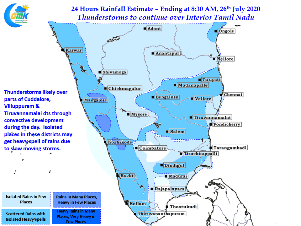
Thunderstorms to continue over Interior TN
Thursday saw one of the best days of thunderstorms this week over Tamil Nadu as many places over Erode, Salem, Krishnagiri & Dharmapuri districts recorded good rains while Vedasandur in Dindigul recorded 15 cms for 24 hours ending at 8:30 AM on Friday. While it was expected yesterday could be the turn of North Tamil…


