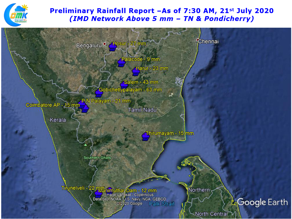
Thunderstorms continued to persist over parts of Tamil Nadu with west and Northwest interior districts like Erode & Salem enjoying a very good night of rains while Krishnagiri, Dharmapuri recorded moderate rains along with few places in South TN. Coastal places like Chennai saw quiet evening with storms not moving from interior places.

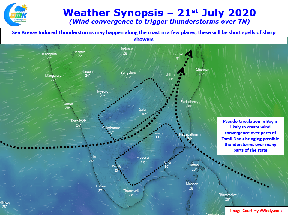
Today once again thunderstorms are likely to form in the same areas as yesterday due to convergence of winds created by a pseudo circulation over Bay. Once again its going to be West & NW districts that is likely to see the better spell while South TN around Dindigul & Madurai along with parts of Delta will see moderate thunderstorm activity through converging Westerlies deflected by the Peaks in the Western Ghats.

Unlike yesterday today the chance for sea breeze induced thunderstorms is stronger over coastal places like Chennai which could bring some sudden sharp spell of showers during the afternoon hours, particularly places closer to the coast. With clear skies seen all over TN the temperature gradient is likely to be strong enough to create a decent sea breeze front.

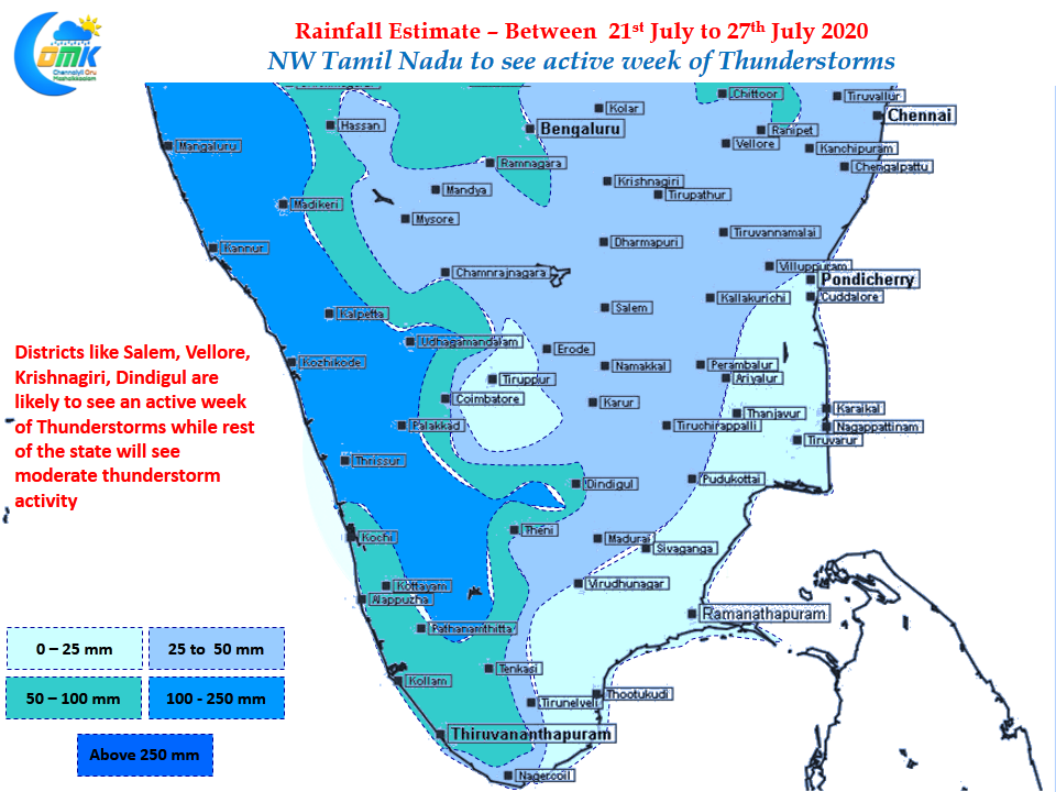
As is the case for the past few weeks every Tuesday we carry the weekly precipitation outlook for Tamil Nadu to give an idea on what to expect. Weather models indicate NW interior areas of Tamil Nadu along with adjoining parts of AP & Interior Karntaka to enjoy a good spell of thunderstorm activity this week while core monsoon area is expected to remain sub par.


