
While most of Tamil Nadu saw thunderstorm activity over the last few days Chennai was pretty much missing out until yesterday. As explained in our posts for the last couple of days the unfavorable wind pattern was the culprit for Chennai missing out. Yesterday was the day the winds streamlined to Westerlies and Bingo Chennai took its share of thunderstorms with some areas recording moderate spell of rains throwing the evening traffic off gear.
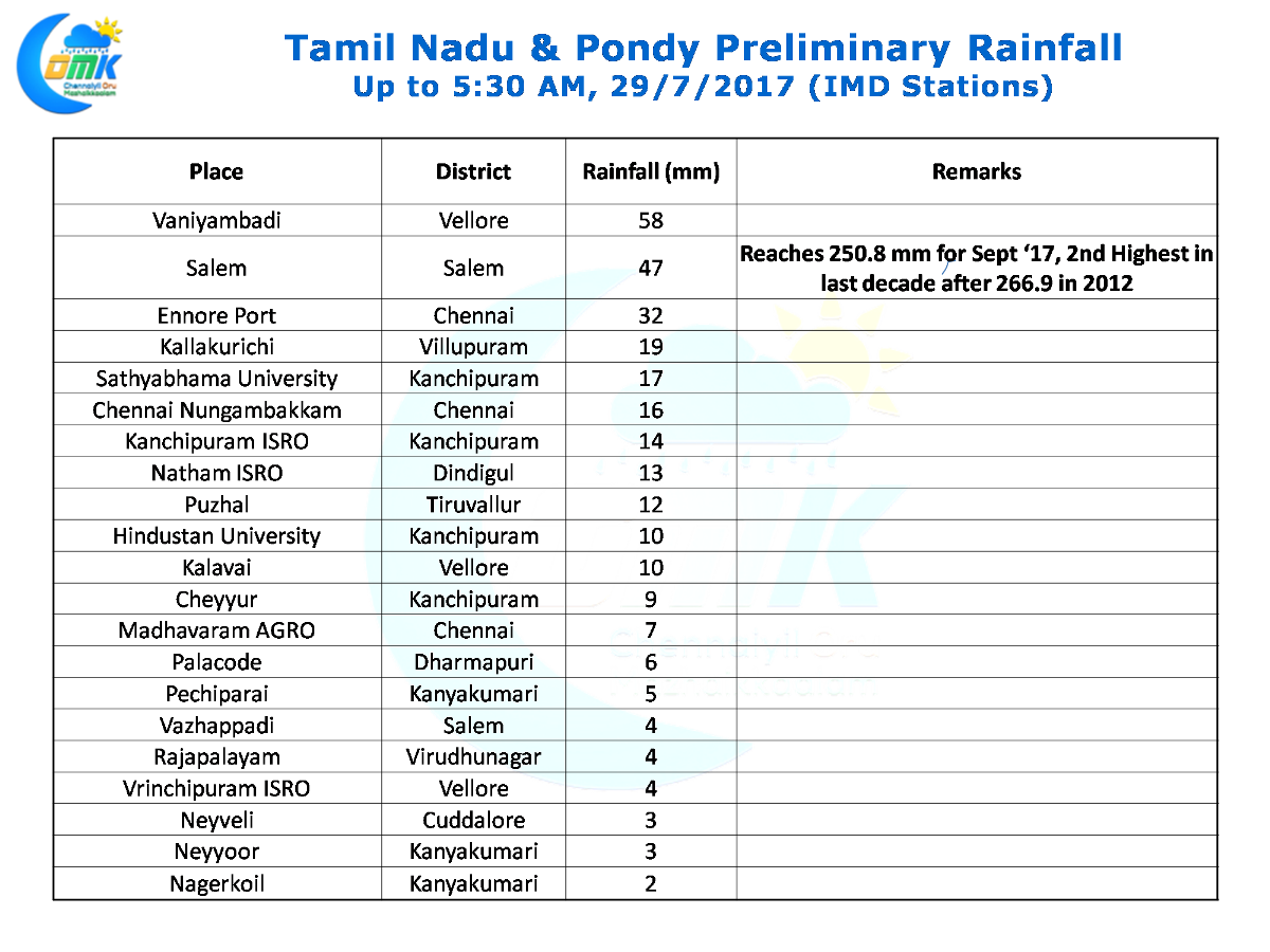
The highlight of yesterday has to be Salem which recorded an intense evening spell of thunderstorm activity bringing in nearly 5 cms for the day and taking the overall September tally to 250.8 mm making it the second wettest September in a decade after 2012. With another 2 days to go will Salem register its wettest September in a decade?
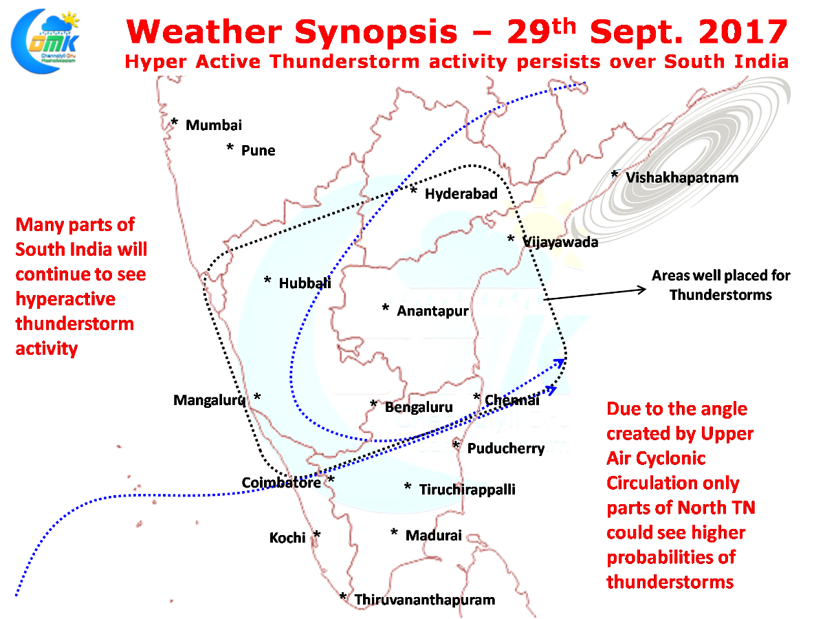
Under the influence of the Upper Air Cyclonic Circulation off the coast of AP / Odisha and associated trough thunderstorms are expected to continue over many parts of South India. In particular Karnataka is expected to see another day of widespread rains with both coastal areas and Interior areas likely to see moderate to heavy rains in many places. Similarly Rayalaseema & Telengana could also witness isolated heavy rains too.
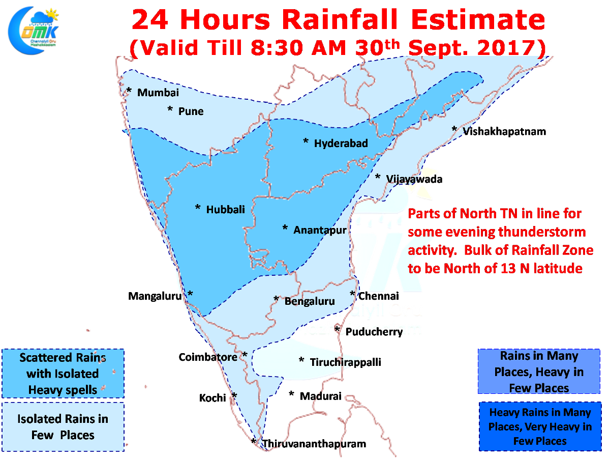
Due to the angle created by the Upper Air Cyclonic Circulation the convergence zone has slightly shuffled around over South India. This would mean only parts of North TN could effectively fall under the potential zone of instability with most rains falling may be around 13N and North of it. Chennai has a decent chance of rains today as well
Powered by WPeMatico