For most common people Chennai Summer ends when the traditional Kathri or Agni Nakshathiram period. Elders at most homes possibly would be wondering why it is still hot even though its more than a fortnight since Kathiri period ended. But as we keep repeating the real Chennai Summer starts only at the fag end of Kathiri when the Westerlies strengthen and make it impossible for Sea Breeze to move in at all.
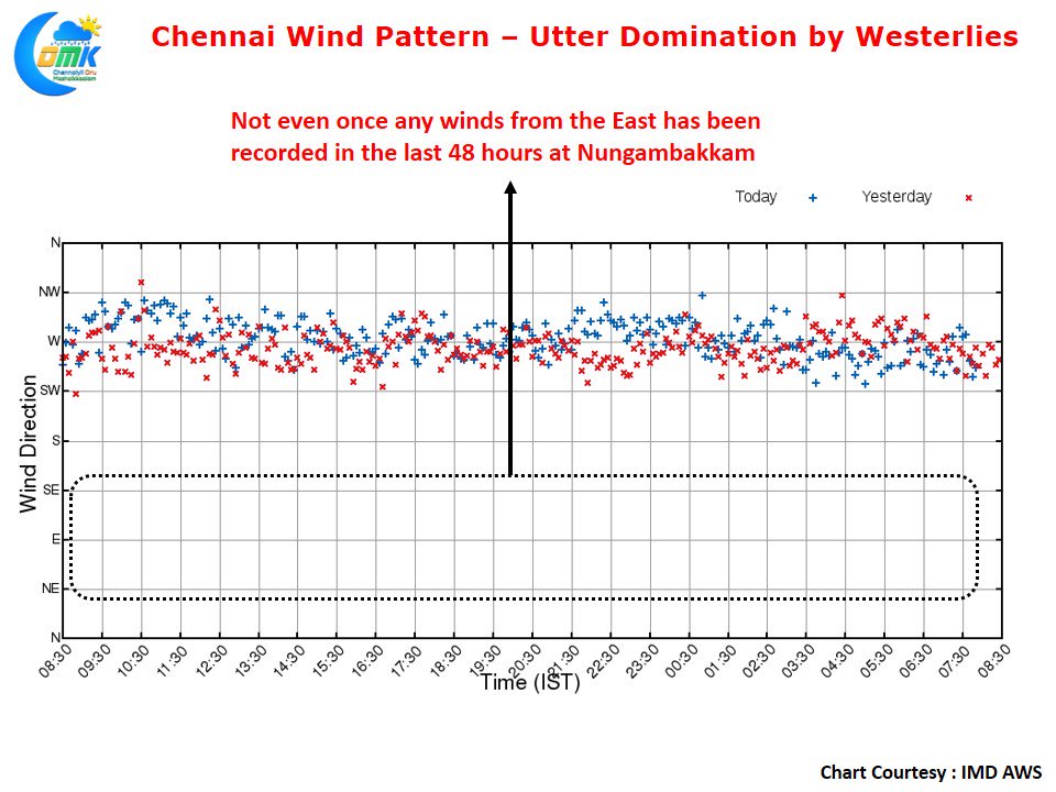
The Wind Chart at IMD AWS in Nungambakkam pretty much confirms the utter domination by the Westerlies with no reading recorded from the East even once over the last 48 hours or so. This absence of sea breeze ensures the temperatures stay high even as late as 4 PM with occasional increase also seen after 4 PM if the winds from west are strong under a very clear sky.
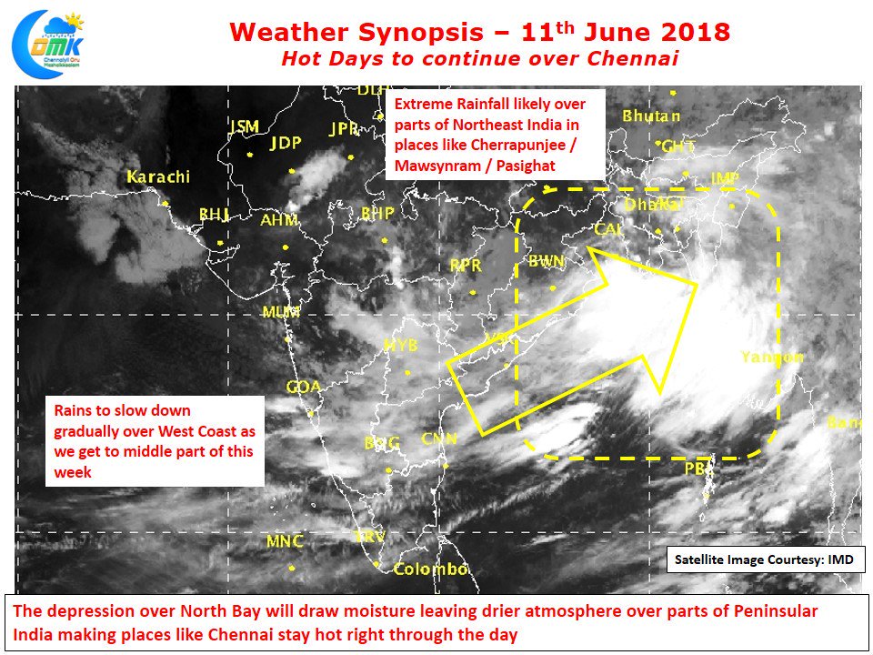
With the Bay Low Pressure strengthening into a depression it is likely to drag a lot of moisture towards itself leading to a more drier atmosphere over parts of Peninsular India. This could lead to slightly more clearer skies over places like Chennai thereby increasing the heat quotient. While we might see weak thunderstorms develop and give passing spells of showers over Coastal TN like the case for the last two days overall drier conditions are likely to continue for couple of more days.
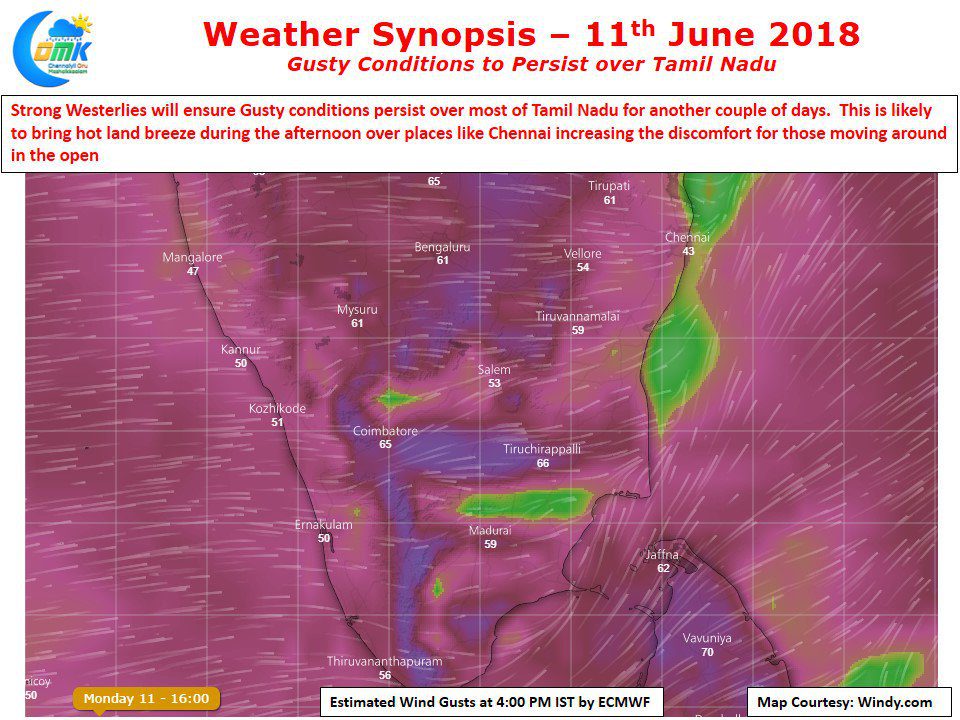
While Chennai Summer for sure has not ended what will make it very uncomfortable is the strong gusts of winds from the West. The last couple of days have been very gusty & the next couple of days are going to be like this as per model outlooks. These strong gusts from the wind increase the quotient if you are out in the afternoon, On the rainfall front while NE India & Parts of East India are likely to see an increase in rainfall activity west coast could see a gradual reduction in rains as we proceed to the middle part of this week. Similarly places along the Western Ghats in Tamil Nadu & Kanyakumari dt will see rains for the next couple of days before it slows down a soft monsoon lullaby.


