One of the biggest challenges in disseminating weather information is striking a balance. Striking a balance between not triggering a panic and people dropping the guard. A similar dilemma is how far do you crystal gaze considering weather is very dynamic. But at time one decides prevention is better than cure. Today’s post is to create that preparedness for the NEM 2024 season ahead of us.
NEM 2024 onset has been strong under the influence of the Depression that is on the verge of making landfall. The normal onset date of Northeast Monsoon is 20th October, this year monsoon checked in 5 days before. In a way the interplay dynamics between multiple circulations recently is an indicator of the season ahead of us. NEM 2024 is likely to be a season of nonstop disturbances. Even before the onset the season started on a strong wicket through thunderstorms in interior areas. This reflects in the 80% of the October average already recorded for TN & PDC sub division as of yesterday.
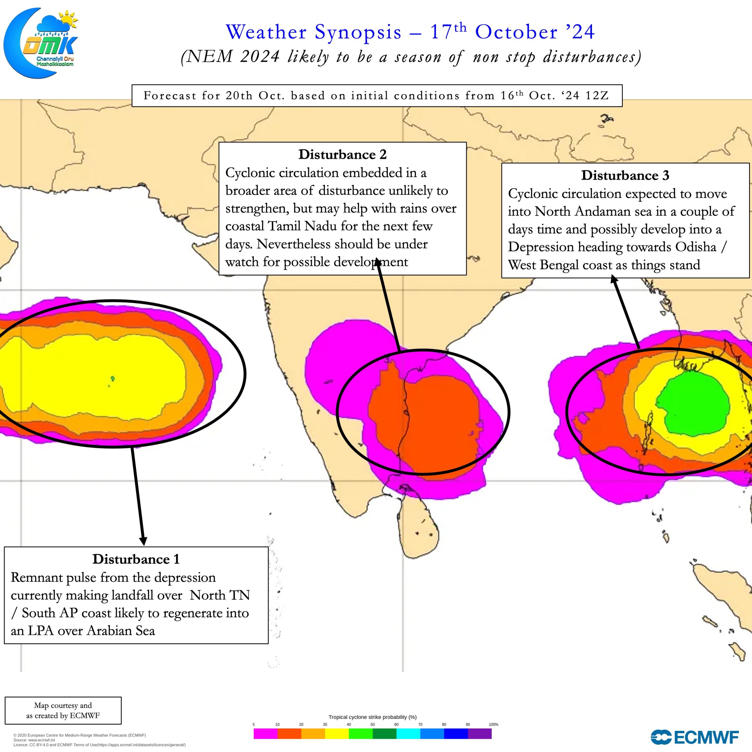
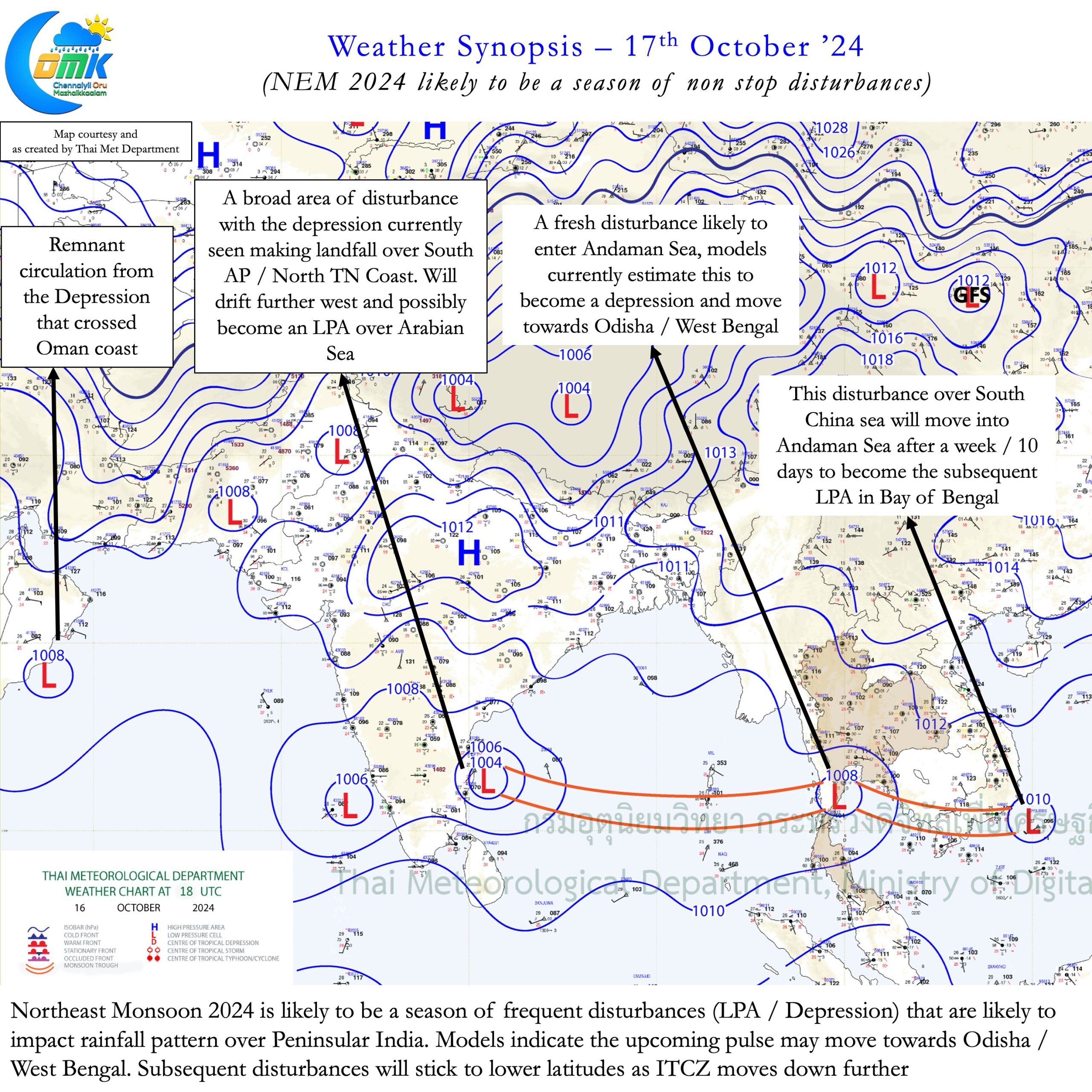
The current synoptic chart is also a microcosm of the NEM 2024 season that is likely to pan out. A string of pulses stretching all the way from Arabian Sea to Indo China Peninsula. Of these pulses two have already evolved into Depression. The 1st one crossed Oman coast while the 2nd one is on the verge of landfall over South AP. Amidst this is the remnant of the cyclonic circulation that triggered intense rains with the help of Depression over Chennai on 15th October. The fourth pulse is likely to move into Andaman sea shortly. Most weather models indicate this pulse could strengthen into a depression and move towards Odisha / West Bengal.
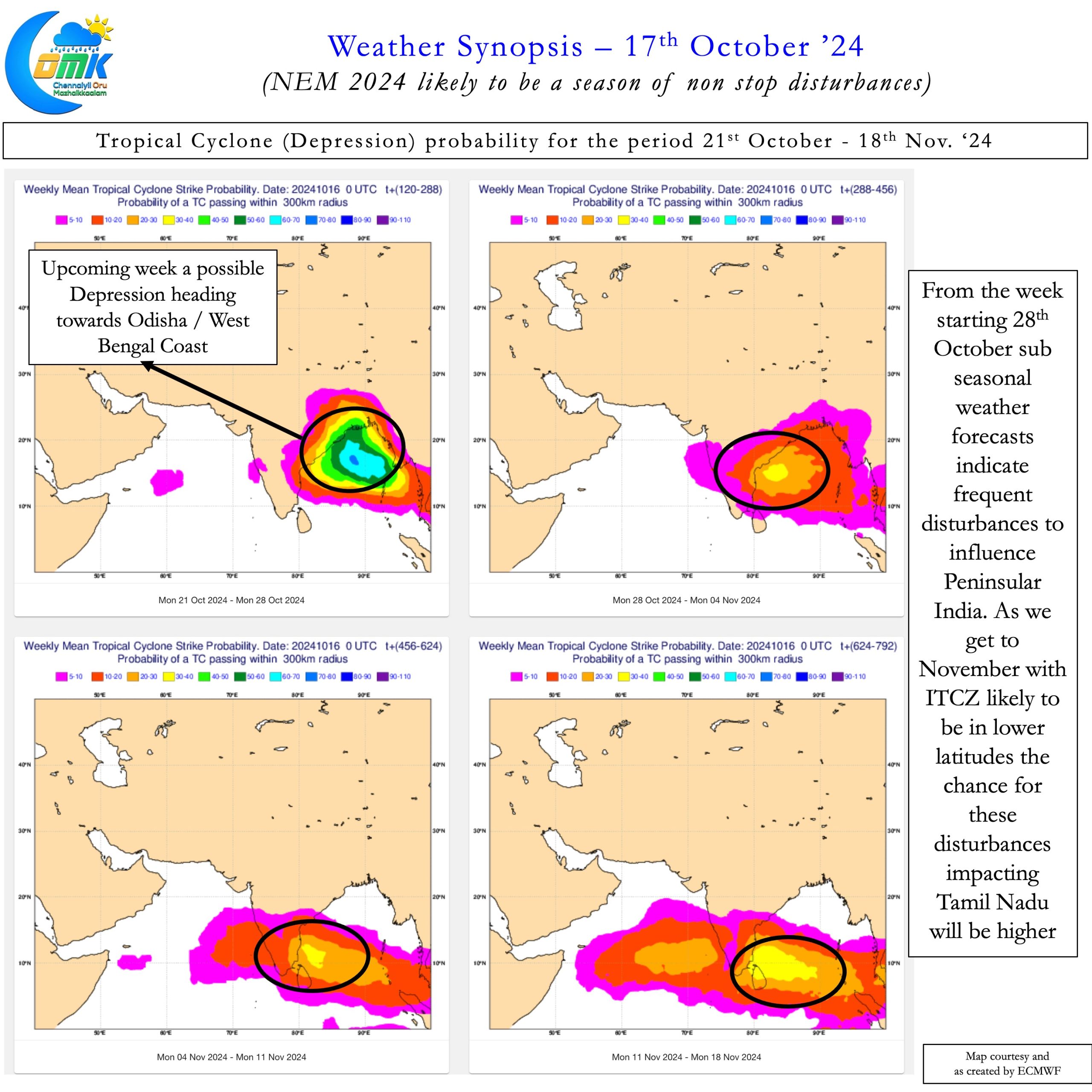
This northward movement also allows the people and disaster managers of Tamil Nadu to get prepared. To be prepared for the peak NEM 2024 season during the month of November. A period when possibly we might see back to back disturbances right through the month. As Inter Tropical Convergence Zone (ITCZ) moves towards lower latitudes the probability for these disturbances to impact TN increases. In our NEM 2024 Outlook we had mentioned about how this year could be tricky. Common public will also be on their toes as we head towards November 2024. Sub-seasonal weather models have been consistent about disturbances from the last week of October to impact Peninsular India.
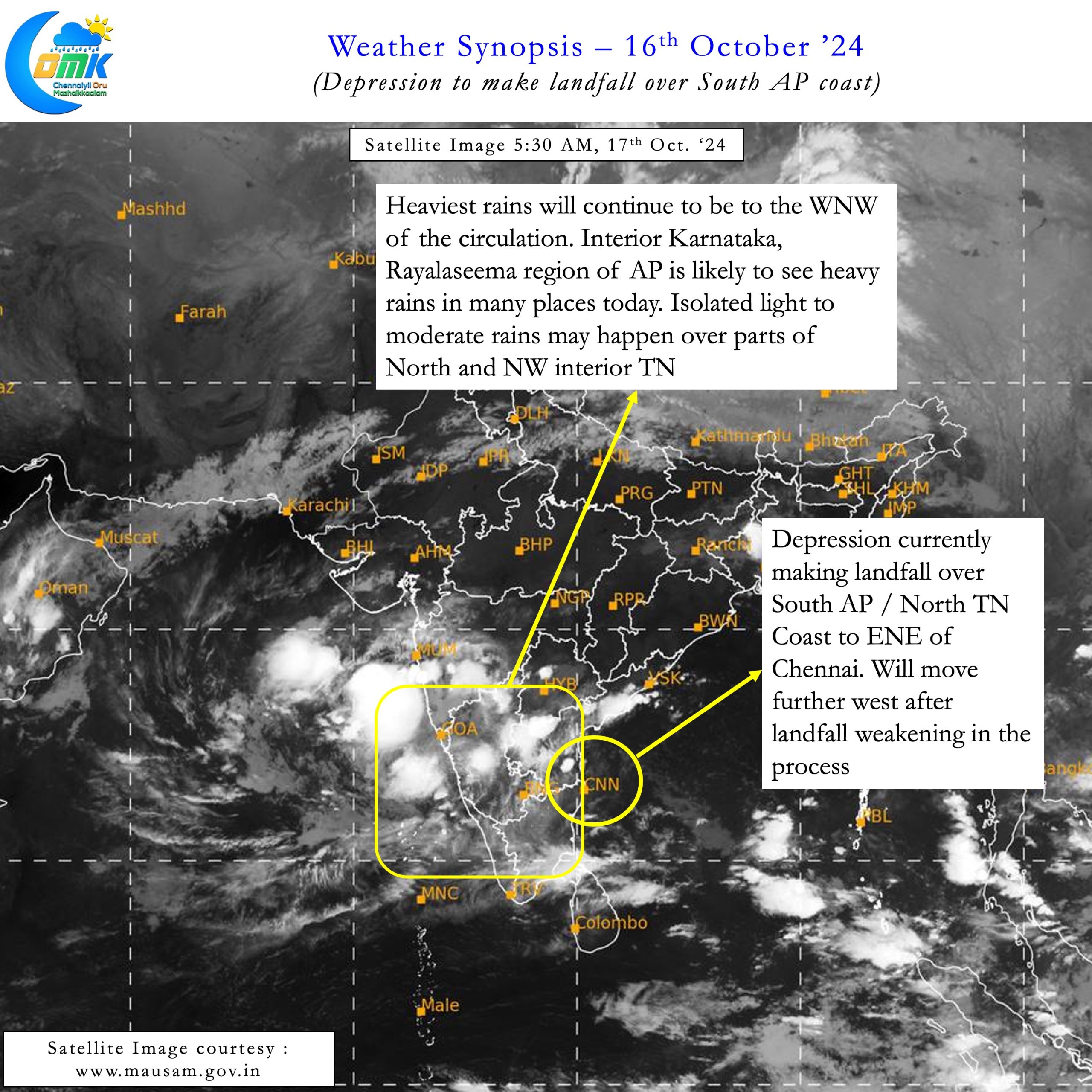
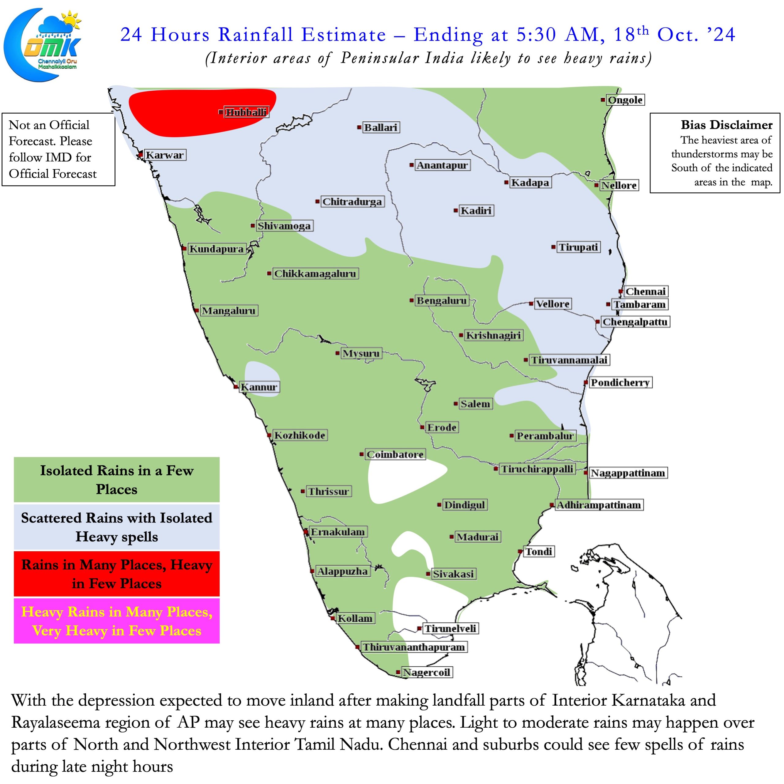
On the near future the depression has made landfall over South AP / North TN coast just north of Chennai today morning. It is expected to weaken further and move inland triggering widespread rains over interior areas of Peninsular India for the next couple of days. The remnant of the depression could regenerate into an LPA over Arabian sea in a broad area of disturbance. This broad area of disturbance is likely to bring rains on a daily basis over Tamil Nadu for the next few days. There could be a small lull in rains during the time the Indo China pulse develops and potentially heads North. One caveat though is we need to keep a watch on the weak circulation within the broad area of disturbance. Considering how things have happened this season this could become a joker in the pack too.
Chennai and rest of Tamil Nadu can expect regular rains for the next few days. In particular during late night / early morning hours. Interior areas will also see active thunderstorms with the help of the circulation over the Arabian Sea. This season’s journey has just started and we have miles to walk.

