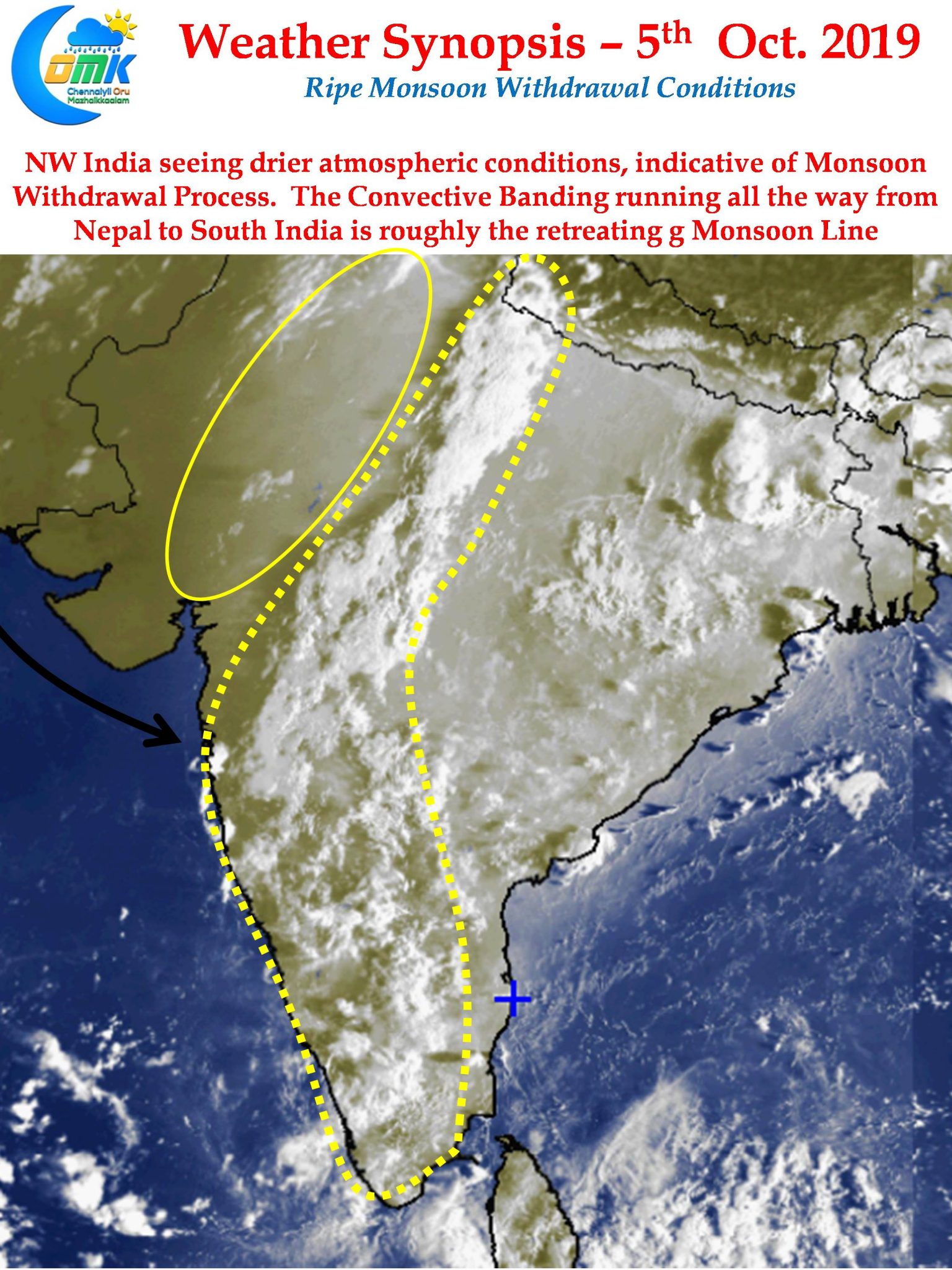
The anxious wait for the withdrawal of Southwest Monsoon continues across most parts of the country continues. While places like Tamil Nadu look forward for the arrival of Northeast Monsoon season up North unseasonal rainfall due to delayed withdrawal could play spoilsport to many a farmer. Things though finally seem to fall in place for the withdrawal process to start any time now.

On the thunderstorm front today we are likely to see storms continue over many parts of Peninsular India. As far as Tamil Nadu is concerned the West interior & Northwest Interior districts will see moderate thunderstorm activity at many places. Places surrounding Bellary / Anantapur is likely to see heavy thunderstorm activity later in the evening due to active wind convergence. Chennai will continue to remain a spectator though once again we may see thunderstorms about 50 km to the NW of Chennai.

The satellite image today morning indicates Monsoon withdrawal conditions quiet clearly. A long band of convective thunderstorms running all the way from Nepal to South India is possibly the Monsoon retreating line. Places to the west of this line will soon be out of Monsoon conditions while the ones to the East continue to remain under Monsoon conditions. As days progress this retreating line will move further East before finally ushering in the Northeast Monsoon over parts of Peninsular India.


