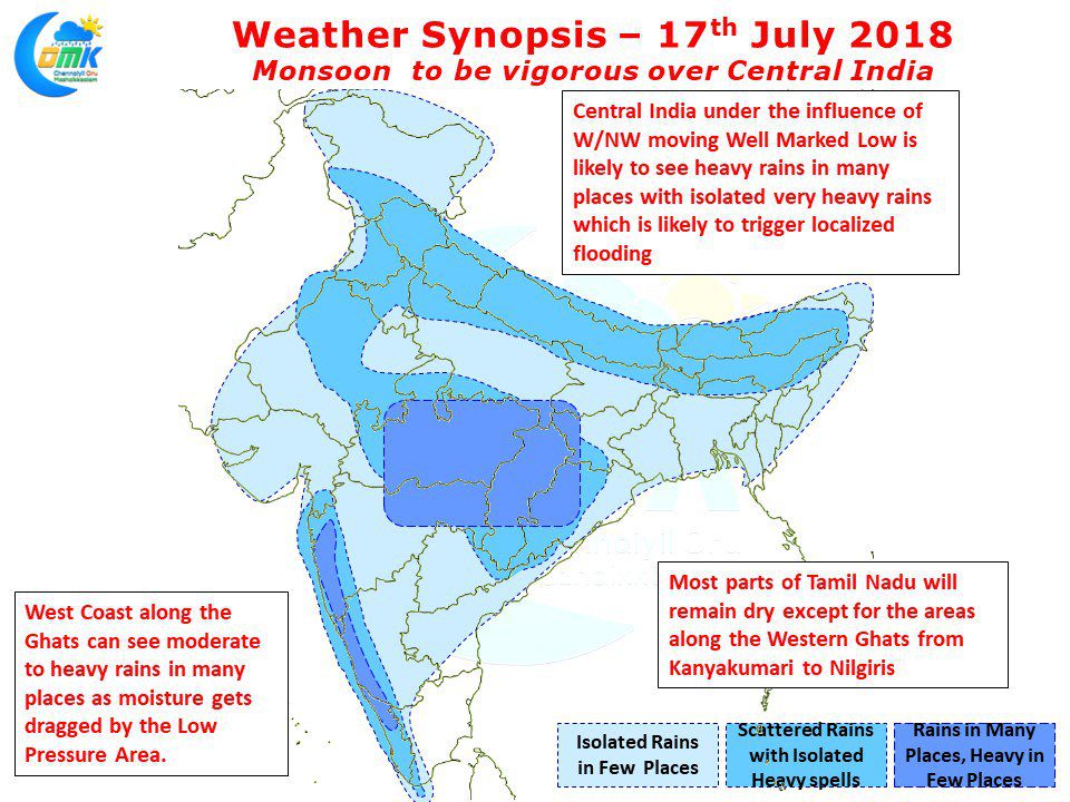
Under the influence of the Well Marked Low Pressure over Odisha region the Monsoon has been active and vigorous over many parts of the country. In what could be a landmark year for the Cauvery Basin dams with already all four major dams of Karnataka reaching FRL Mettur is on its way to FRL very soon. Last evening saw Mettur inflow touch 100000 cusecs for the first time in many years and is likely to continue for the next 2 / 3 days bringing early the original COMK estimate of July end FRL to around July 20th.
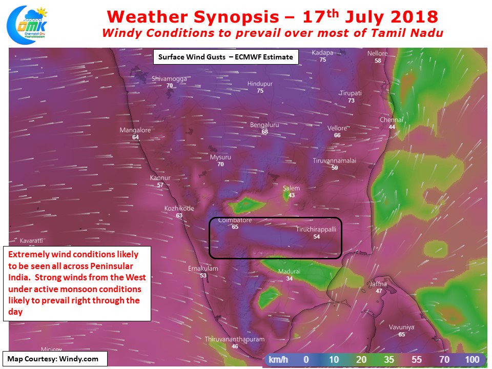
With Southwest Monsoon remaining active & vigorous we can expect most parts of Tamil Nadu to see very windy conditions with surface level westerlies expected to be strong right through the day. Also dry weather is likely to prevail across the state except for the places adjoining the Western Ghats from Nilgiris to Kanyakumari. With westerlies blowing strong we can expect places along the east coast to remain slightly warmer than normal with a few places possibly touching 37 / 38°C
The Well Marked low currently lying over Odisha is expected to move in a W/NW movement traversing across Central India bringing heavy rains as it travels and in the process weakening as well. With another Low Pressure expected to form in Bay of Bengal in a couple of days from now the next few days are likely to see peak monsoon conditions before a Break in Monsoon is likely to happen for some time. How long and how bad would the break in monsoon be is for another day.


