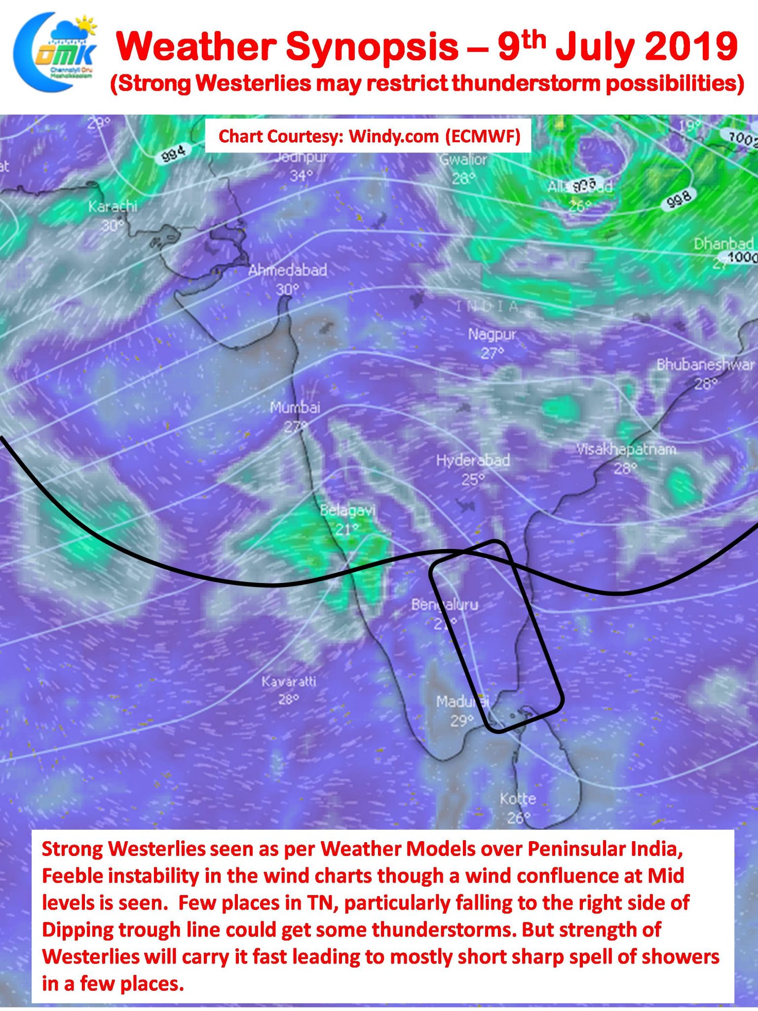
Southwest Monsoon has remained active over many parts of the country riding on the back of a Feeble Low Pressure Area persisting over parts of Uttar Pradesh & Bihar. Weather models expect this low pressure to intensify into a Well Marked Low in the next day or two as it stays around that part of the country in a pseudo stationary movement.

In the same context a feeble off shore trough like feature off the coast of South Karnataka / North Kerala could mean a spell or two of heavy rains over the Western Ghats in South Karnataka & Kerala. This could mean another day or two of moderate rains over the West Coast of Peninsular India.
As far as Tamil Nadu is concerned temperatures will remain high though compared to the past couple of days it may stay a notch lower. While a feeble confluence zone is seen to the West of Chennai, models are indicating a dipping trough feature over Interior TN which could provide necessary instability along with the clear skies over the interior areas during the day building convective process.

The concern though is the still fairly strong Westerlies which may not allow the thunderstorms to intensify heavily leading to sudden sharp spell of showers in a few places over Vellore, Salem, Tiruvannamalai, Kanchipuram, Tiruvallur & Villupuram districts along with one or two places in Cuddalore & Delta districts. A few remnant thunderstorms may interact with Sea breeze closer to Chennai to give one or two spells of rains in a places around Chennai & Suburbs.


