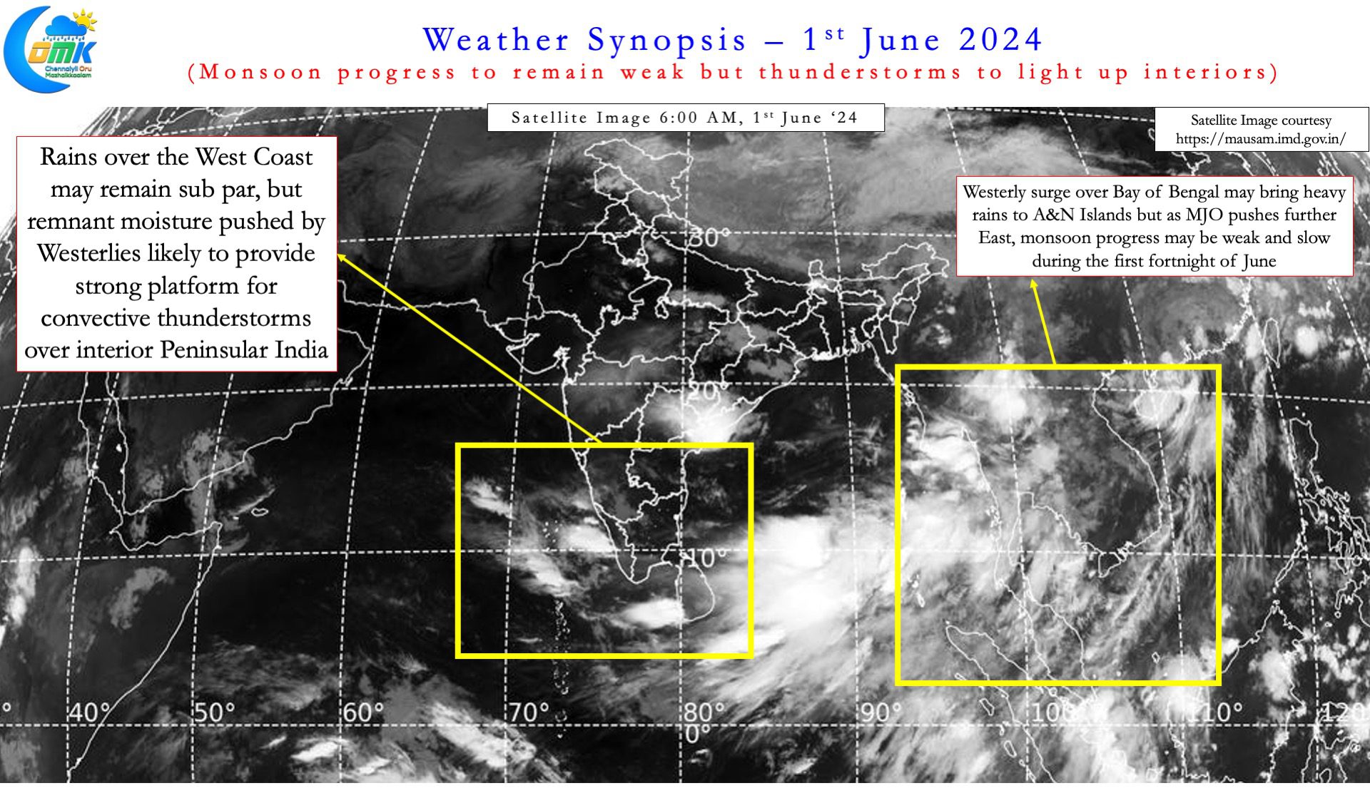
Southwest Monsoon, the most anticipated weather event globally, made onset over the Indian mainland on 30th May. 1st June is the traditional onset date for Monsoon over Kerala (MOK). But this year helped by Cyclone Remal Monsoon touched Kerala shares two days in advance. Normally while monsoon touches Kerala coast South TN also sees onset along with parts of Kerala. This year so far monsoon has covered most of Kerala but just a small portion of Kanyakumari in Tamil Nadu.
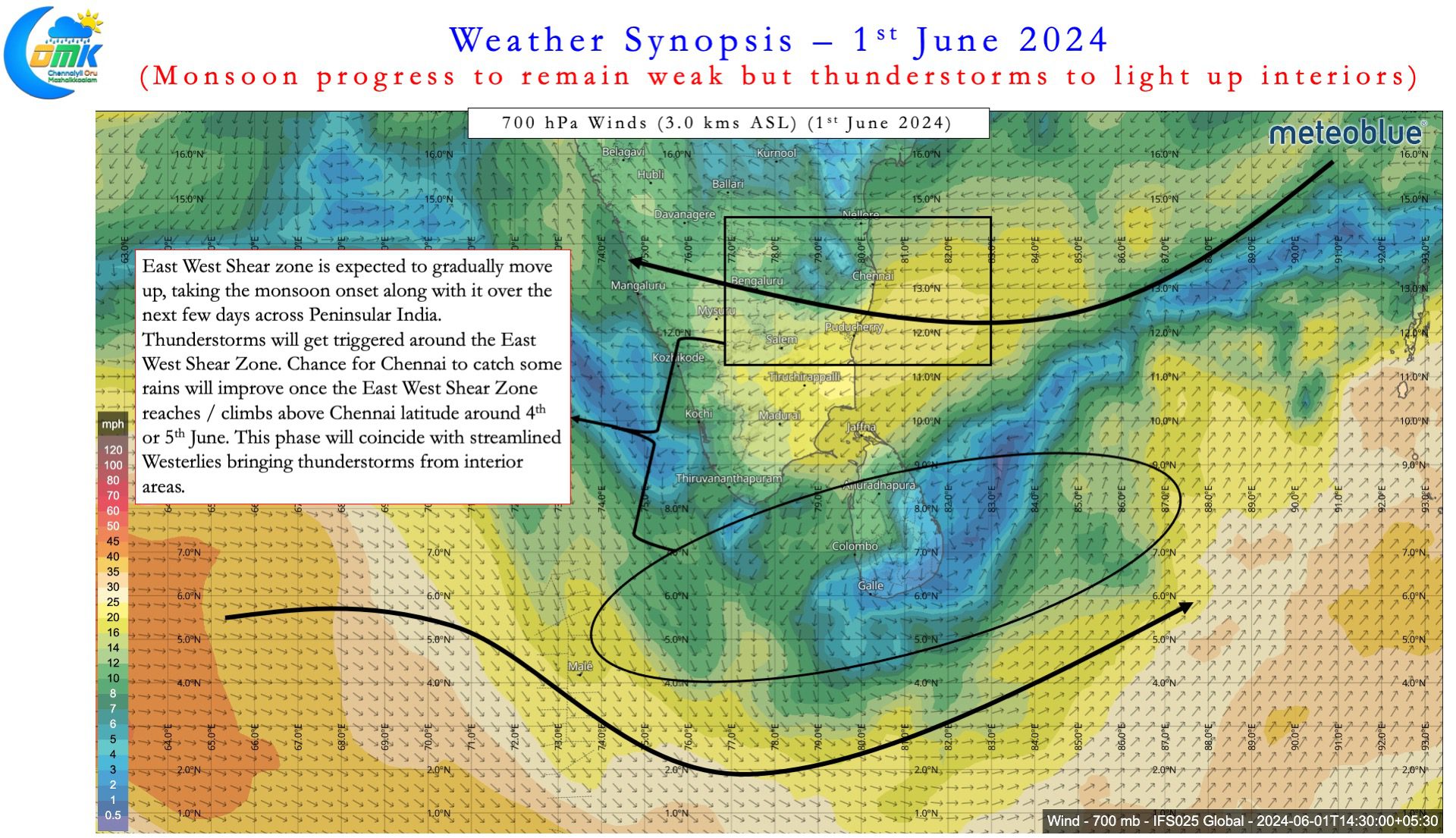
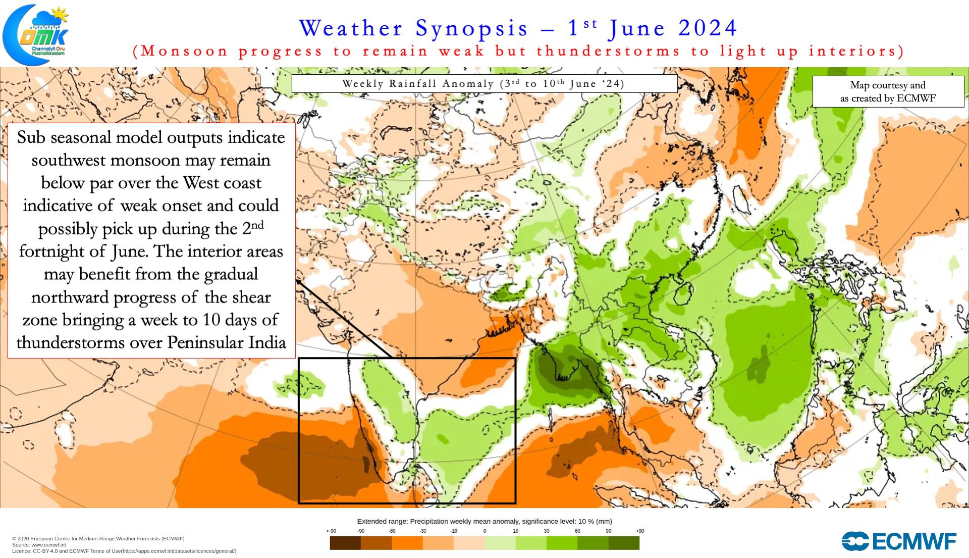
Normally a East West Shear Zone a zone where winds from opposite directions prevail, precedes the progress of monsoon. Currently this East west shear zone is over parts of Sri Lanka and adjoining areas. Weather models indicate this to gradually climb up along Peninsular India over the next few days. This movement will slowly pull the monsoon onset as well along with it. But a word of caution though. Large scale atmospheric dynamics do not indicate a quick progress for Southwest Monsoon. With MJO expected to move further East towards Pacific we may see unfavourable atmospheric conditions over Indian Sub continent. This is also visible in the sub seasonal precipitation outputs from weather models as well. Peninsular west coast, the core monsoon zone, is likely to see sub par rainfall during the first fortnight of June.


At the same time interior Peninsular India will see increased thunderstorm activity. One of the key reasons for this enhanced thunderstorm activity is the East West Shear Zone. This provides a conducive platform for thunderstorms to develop during the afternoon / evening hours. Additionally the remnant moisture from the west will ensure a supply line of energy for thunderstorms to thrive. The biggest beneficiary of this spell of thunderstorms is likely to be the Tri Junction of KA/AP/TN. There is a high chance for some places to record multiple 6 to 10 cm rainfall events. Bengaluru, Krishnagiri, Dharmapuri and possibly parts of Tirupathur, Vellore and Chittoor dts are the likely hotspots. Most parts of TN may benefit from this spell of thunderstorm with the possible exception of North Coastal TN.
Weather models indicate upper level winds to be from East over places like Chennai until possibly 4th or 5th. Until this stage Chennai will need a lot of luck for the storms to move in from West. At this time of the year without a clear circulation rains from the East will be less likely. But westerlies may strengthen once the East West Shear Zone climbs above Chennai latitude. This is likely to open the first window for widespread thunderstorms over Chennai and suburbs later next week. Suburbs to the west of Chennai may not need to wait until then as they could benefit from isolated thunderstorms.
On the heat front today could be the last day of searing heat over North Coastal TN. From tomorrow the temperatures are likely to come down. Next week we may see most parts of TN see warm afternoons instead of hot afternoons as thunderstorms light up the skies. City areas of Chennai may benefit from sea breeze by early noon today but suburbs may still see a 40 / 41°C day.

