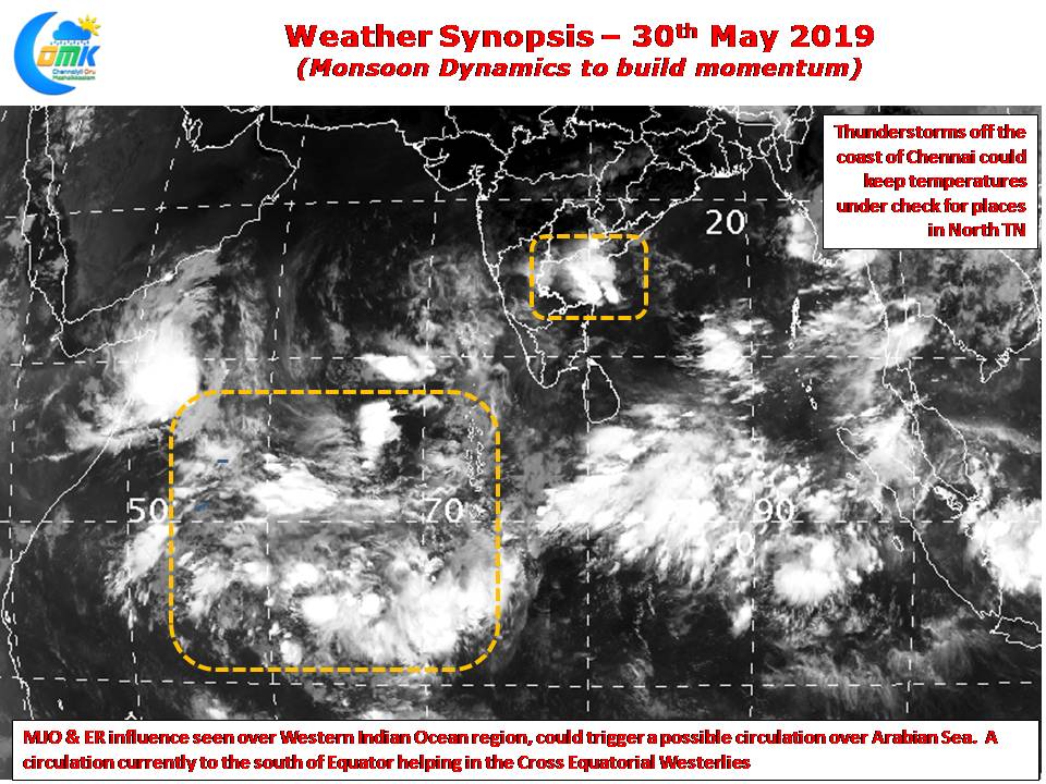
The stuttering start to Southwest Monsoon could slowly pick up pace as MJO influence has appeared over the western parts of Indian Ocean. Satellite images indicate convection improving along the Equator indicative of the improved conditions due to the presence of MJO over the region. Weather models also indicate a weak Equatorial Rossby wave influence that could help in the development of a possible disturbance over Arabian Sea.

Last few days have seen decent thunderstorm activity over Interior Tamil Nadu with yesterday seeing some moderate thunderstorms over South TN and in a few places over the Western Ghats. Today also wind charts indicate possible thunderstorms in the interior parts of TN & adjoining South Karnataka with one or two places along the ghats getting moderate to heavy thunderstorms.
Cross Equatorial Westerlies also have started improving aided by a developing circulation south of Equator. Andaman Islands could see a fresh burst of monsoon momentum as the winds pick up. So far rainfall numbers from Andaman has been below par but things could improve from today / tomorrow going by weather models.

Early morning Chennai woke up to cloudy skies as overnight thunderstorms moved close to the coast of Chennai though wind conditions is not exactly supportive for any spell of active thunderstorms over Chennai & surrounding places. Nevertheless a few areas could see light spells of rains when the storms brush the coast but temperatures may remain under control due to the cloudy skies.


