
As the effect of the Monsoon Low, currently lying over Madhya Pradesh & adjoining areas of Uttar Pradesh, the Westerlies have slowed down over the southern parts of Peninsular India. Yesterday the skies over Chennai pretty much summed up the state with clear blue skies resembling a pre Summer afternoon rather than the last leg of Monsoon season. The last couple of days also saw temperatures climb up over places like Chennai as well. The increased temperatures during September is pretty much normal as the Sun’s Rays travel down towards the Southern Hemisphere.
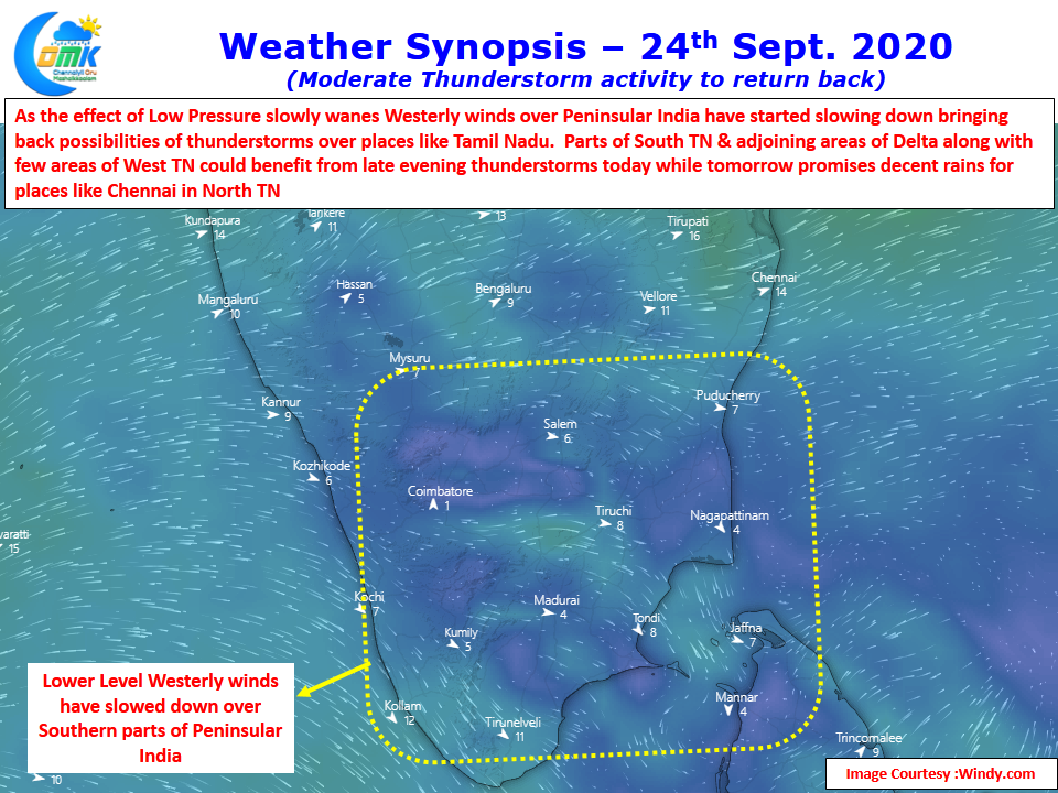
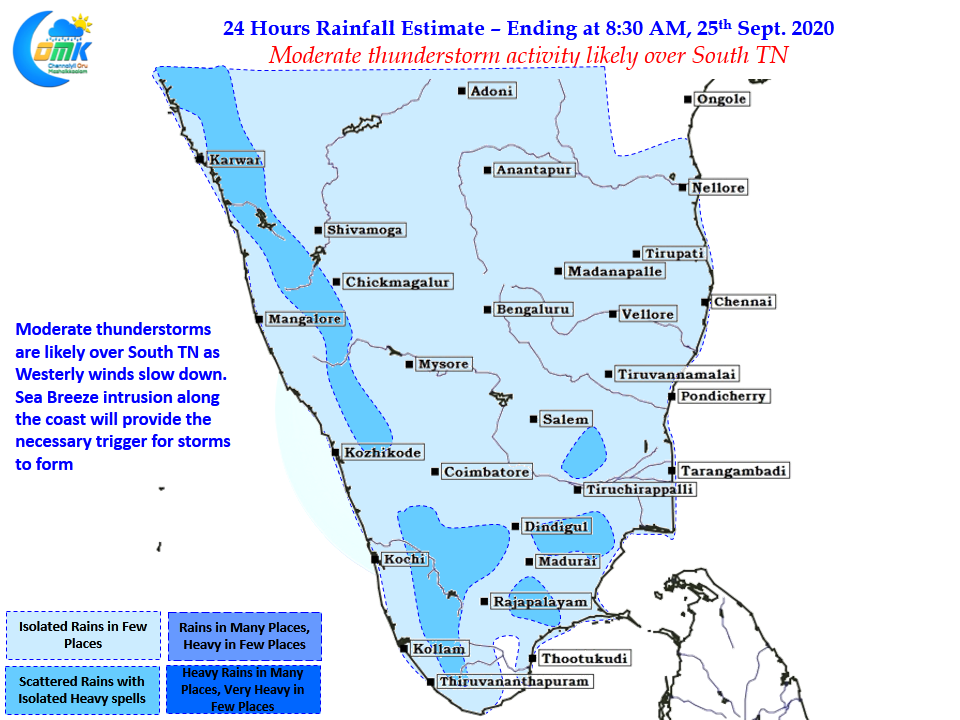
The wind charts show a distinct slow down of Westerlies at the lower levels while anti cyclone like conditions are seen over Peninsular India at Mid Tropospheric level. From today we may start seeing increased sea breeze activity along the coast of Tamil Nadu creating the necessary trigger for thunderstorms to form. Today promises a good day for South TN with moderate thunderstorm activity seen in the region as per weather models.
Chennai and surrounding parts of North Coastal TN may see sea breeze induced thunderstorms that is likely to provide sudden sharp spell of rains in the evening at one or two places. Tomorrow promises to be a better day for North TN with deepening wind instability seen over South AP, South Int Karnataka & North TN areas.
One should not also miss out looking at a larger scale suppression that is likely to move into Indian Sub Continent over the next couple of weeks as MJO makes a slow Eastward movement from Maritime Continent towards West Pacific. How much would thunderstorm activity will be overall affected by this need to be seen