
Since the weekend moderate thunderstorm activity has been continuing over Tamil Nadu though it has been scattered and not exactly as the Break in Monsoon period thunderstorms which are more widespread & intense. Yesterday saw fairly wide spread activity over parts of South TN with places in Pudukottai, Madurai, Dindigul & Sivaganga districts recording moderate to heavy rains.
In what is a welcome development coastal areas have been also seeing active thunderstorms at many places triggered by the sea breeze front consequent to the weakening westerlies. Yesterday and day before many places in South Chennai & Suburbs saw such activity though the heavier spells of rains were closer to the coast with overall wind pattern being from West to East. The IMD weather station at Taramani recorded 4 cms while the observatory at Nungambakkam recorded 7 mm though the western parts of the city and suburbs were completely under sunshine during the same period
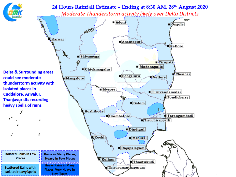
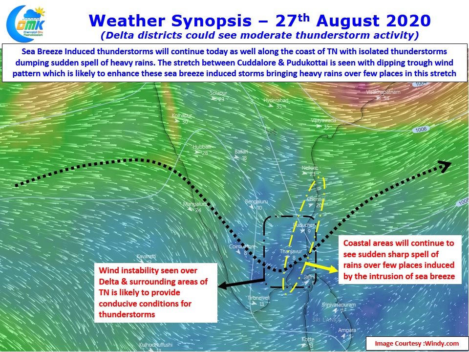
Today once again sea breeze induced thunderstorms are likely over many coastal places all the way from South AP to Ramanathapuram district. This will once again trigger sudden sharp spell of rains around late afternoon to evening depending on when sea breeze moves in. The stretch between Cuddalore & Pudukottai could see isolated heavy rains due to the trough like feature seen at upper level winds. This could enhance the sea breeze induced thunderstorms making isolated places come under intense spell of rains with heavy thunderstorm activity around Thanjavur, Ariyalur & Cuddalore districts.
As has been the case for the last couple of days coastal places around Chennai will see another day of sudden sharp spell of rains from sea breeze induced storms, they will not move much so dont be surprised if you dont get anything while your friend couple of streets away reports heavy rains.