
Yesterday saw parts of delta districts record light to moderate rains in a few places. The IMD observatory at Karaikal recorded 14 mm until 5:30 AM today morning. A few kms down south Nagappattinam observatory recorded only 0.3 mm rains for the same period indicating the isolated nature of rains. Similarly the IMD observatories at Tondi & Pamban in Ramanathapuram district also recorded light rains.
Satellite image shows under the influence of the Trough of Low, currently lying off Sri Lanka in the Equatorial waters, a fair bit of clouding over South Tamil Nadu and adjoining Sri Lanka. While parts of Sri Lanka is already getting moderate rains at many places South TN has not yet seen any spell of meaningful rains.
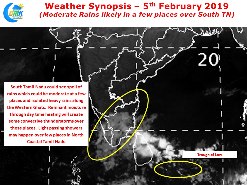
On occasions like this we need to keep in mind just like Southwest Monsoon times when remnant moisture interacts with the rising air particles due to ground radiation triggers convective activity we can see some bit of convective activity develop over South TN as the sun rises and the raising air particles start its interplay with remnant moisture pushed in by the trough of low. Also a few places along the Western Ghats could see spells of heavy rains with right conditions.
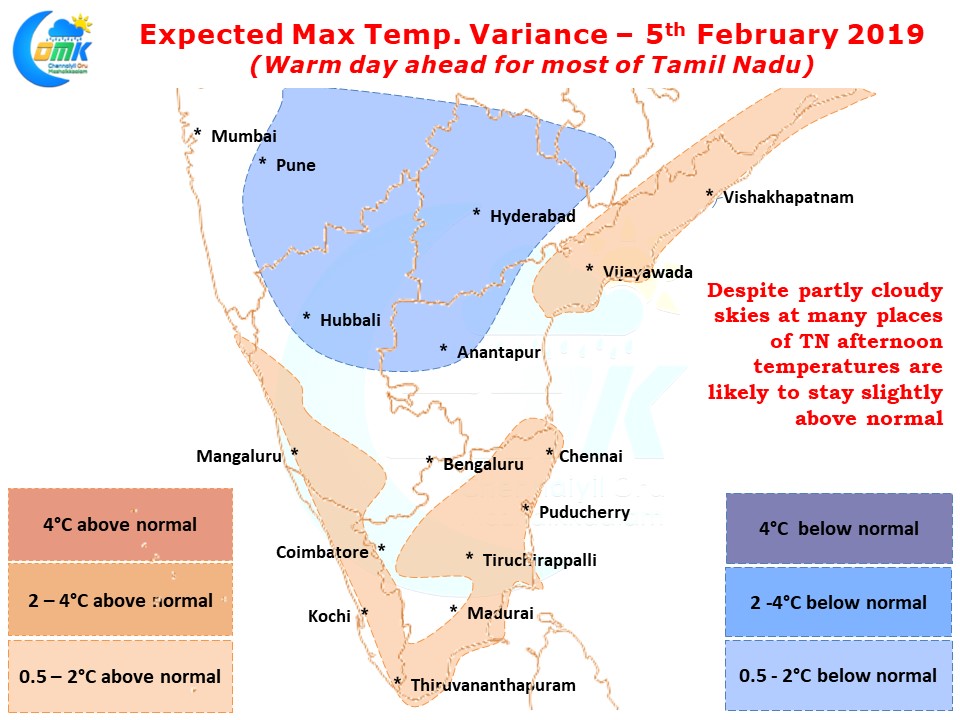
Places like Chennai in North TN could see partly cloudy skies and in one or two places like yesterday we could see passing spells of showers / light rains during the morning hours. The cloudiness though is unlikely to have a bearing on the temperatures though with warm day likely over most parts of the state.