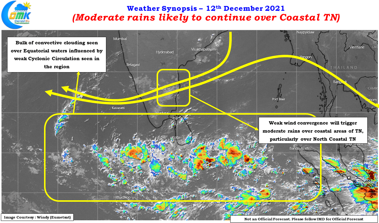
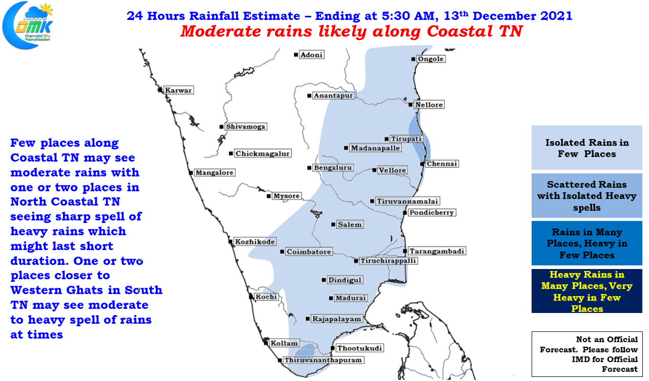
Parts of North Tamil Nadu including Chennai & Suburbs recorded moderate overnight rains with few places seeing heavy spells as well under the influence of favorable wind convergence influenced by the Easterlies. Though Easterlies by itself has not been able to bring forth widespread rains for Tamil Nadu the moisture brought by them under right conditions has been triggering moderate to heavy spells of rains in pockets of the state with North Coastal Tamil Nadu possibly in line for a spell or two which could effectively be the parting spell of NEM 21.
Weather models indicate today & tomorrow could be the best period of rains for not only Coastal Tamil Nadu but in particular North Coastal TN as wind convergence creates ideal conditions for moderate rains over a few places between Chennai & Pondicherry. The key aspect in all this is the clear skies which is seen during the day time hours that also adds a bit of convective lifting providing for some heavy spells of rains later in the night as the diurnal flavor of Northeast Monsoon conditions kicks in.
With the cyclonic Circulation staying well south of Sri Lanka over the Equatorial waters the bulk of the convection is seen over the region along with the remaining portion of ITCZ which is seen straddling the Equator. For the past couple of days sudden burst of rains is seen over a few places around Chennai, similar conditions are likely today & tomorrow as well. Additionally one or two places along the Western Ghats in South TN may also see moderate to heavy spell of rains during the evening hours while coastal areas will predominantly see rains during the late night / early morning hours.


