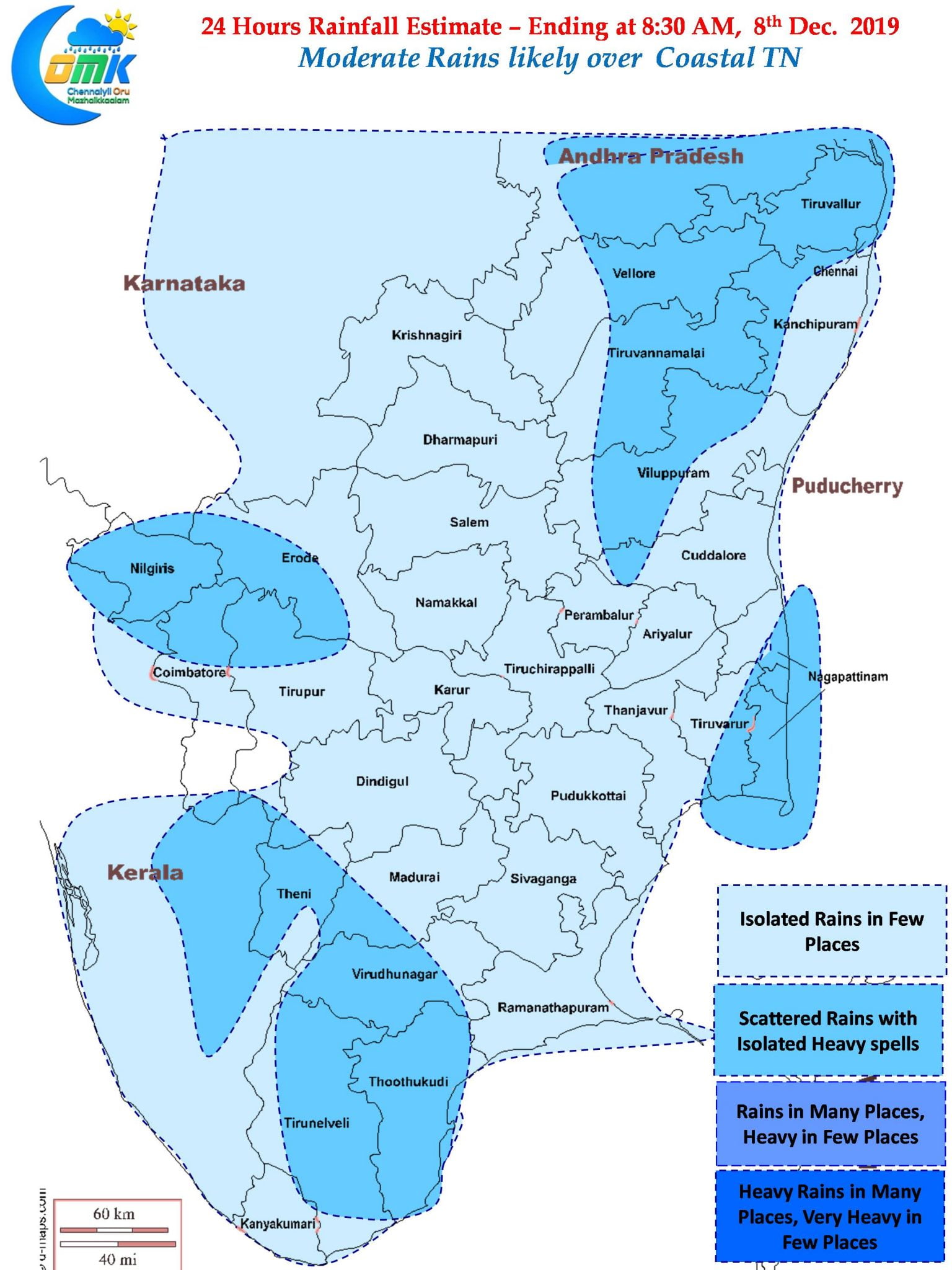
After a few days of break parts of Chennai woke up to light rains over many parts of the city. Places slightly North of Chennai and northern suburbs of Chennai recorded moderate rains in a few places. Ennore Port recorded 6 mm at the time of making the post as isolated thunderstorms slowly make their way towards the coast from Bay.
The satellite picture over the Indian Ocean looks colorful with three cyclones spinning, one in the Northern Hemisphere & two in the Southern Hemisphere, and one LPA like condition prevailing around the Maldives region. Cyclone Pawan has started its landfall over the Somalia coast as a marginal cyclone.

Interestingly going by satellite images possible MJO influence is seen over the Eastern Indian Ocean and adjoining parts of Maritime Continent. Weather models indicate MJO to maintain a pseudo stationary position over the region which could possibly spin a likely disturbance over Bay of Bengal the coming week. Irrespective of what weather models indicate about possible rains for TN and potential disturbances it will be interesting week to track weather over Bay considering the ocean waters are fairly warm, and potentially the remnant pulse of Typhoon Kammuri which was moving in a E/SE direction could push a burst of moisture into Bay of Bengal.

On the more immediate front today promises a decent day for Coastal TN as moderate rains may be expected at many places during the course of the day through Easterlies. Unlike the last week of November when we had streamlined Easterlies in Text Book fashion this time we are having a fait bit of winds from E/NE as well which could mean the overall rains may be tempered compared to last week of November. With interior areas waking up to clearer skies the remnant moisture travelling from the coast few places about 50 – 75 kms from the coast could see thunderstorms develop well and provide sharp heavy spell of rains during the early afternoon hours


