
In a late night development rains in Chennai southern suburbs came as a much needed relief to parts of the city. While most of the city area was left high and dry with possibly only sound and light show, places along OMR recorded good spells with nearly 4 cms recorded in places like Hindustan University / Satyabhama University between 1:30 AM & 2:30 AM.
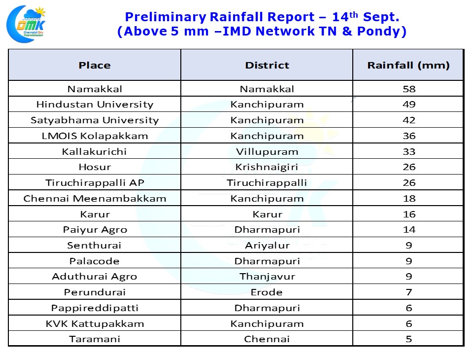
The interior places also got good rains with Namakkal Agro Observatory recording 58 mm being the highlight. Parts of Delta districts in particular Tiruchirappalli & Thanjavur districts recorded moderate rains in a few places. Tiruchirappalli AP recorded 26 mm. A spell of good rains was eluding Trichy for nearly two weeks recording 8 mm on 28th August and subsequently not recording any meaningful rains.
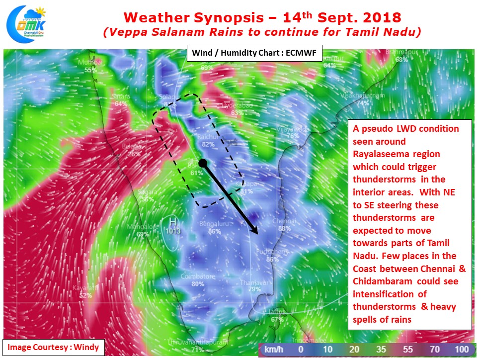
Today Veppa Salanam Rains are likely to continue over Tamil Nadu. Weather models indicate a pseudo LWD (Line of Wind Discontinuity) type of condition existing around the Rayalaseema region. Looking at the Humidity chart we can see a clear difference in the moisture levels on either side of the isobar. This is likely to trigger thunderstorms to the NW of Chennai. With a NW to SE steering expected we will see some of these thunderstorms move towards Tamil Nadu. There could be a case for a repeat of Rains in Chennai like last night with good chance for many parts of the city recording a spell or two of rains.
There is a possibility of one patch of coastal area between Chennai & Chidambaram enjoying the benefit of intensification. This could bring heavy thunderstorms & a heavy spell of rains & squally conditions. Later in the evening as thunderstorms develop we could estimate better as to which patch of coastal area enjoy this heavy thunderstorm activity later in the night.