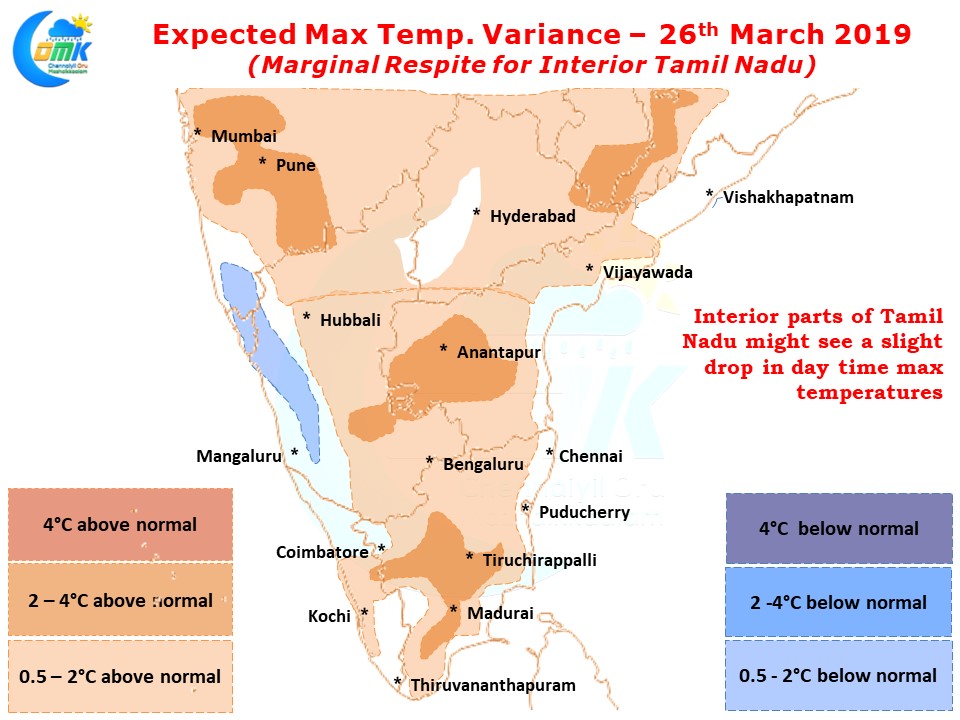
After a few days of abnormal day time heat over large parts of interior Tamil Nadu there is marginal respite seen as per weather models for day or two. Yesterday no station recorded 40+ temperature with similar trend expected today too. With Easterlies from the Bay bringing in some extra moisture compared to last week the temperatures may be slightly lesser across the state.

West Coast including parts of Kerala may remain hot with few places in Palakkad & Malappuram district of Kerala likely to see max temperatures around 40 degree Celsius indicated by the penetrating Easterlies carrying the heat from interior Tamil Nadu. With High Pressure Area over Bay moving slightly to the North coastal places like Chennai will see the moderating effect of Bay winds keeping the temperatures under check.

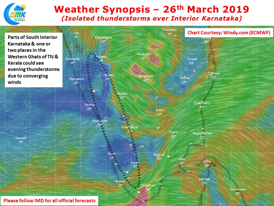
While one or two places could see thunderstorms along the Western Ghats in Tamil Nadu & Kerala a few places in Interior Karnataka will benefit from the colliding Easterlies & Westerlies. Yesterday many places around Belgaum, Hubli recorded evening thunderstorms with isolated hails also reported. Today we could see thunderstorms in South Interior Karnataka as well bringing some rains to parts of Mysore / Kodagu & Hassan districts.


