
The Low Pressure Area in Bay of Bengal aided by its equatorial twin from the Southern Hemisphere has started to consolidate showing a fair bit of convection that has developed overnight. Satellite image clearly shows the interplay between the twins which continues to feed each other in the process developing both.
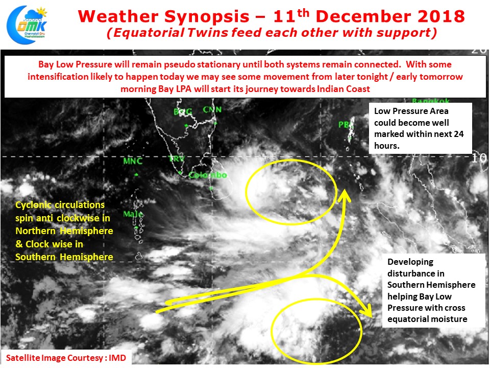
As we kept mentioning for the past few days the role of Equatorial Rossby wave is so clearly visible with the development of these two disturbances. Both the disturbances benefiting from cross equatorial Westerlies in the process.
While the presence of the equatorial twin provides developmental benefit to the LPA in Bay until such time both continue to retain an imaginary cord they will stay together either side of the equator. This would mean no visible progress likely during this phase. With the expected intensification today we can see some movement tonight or tomorrow in the form of a relocation
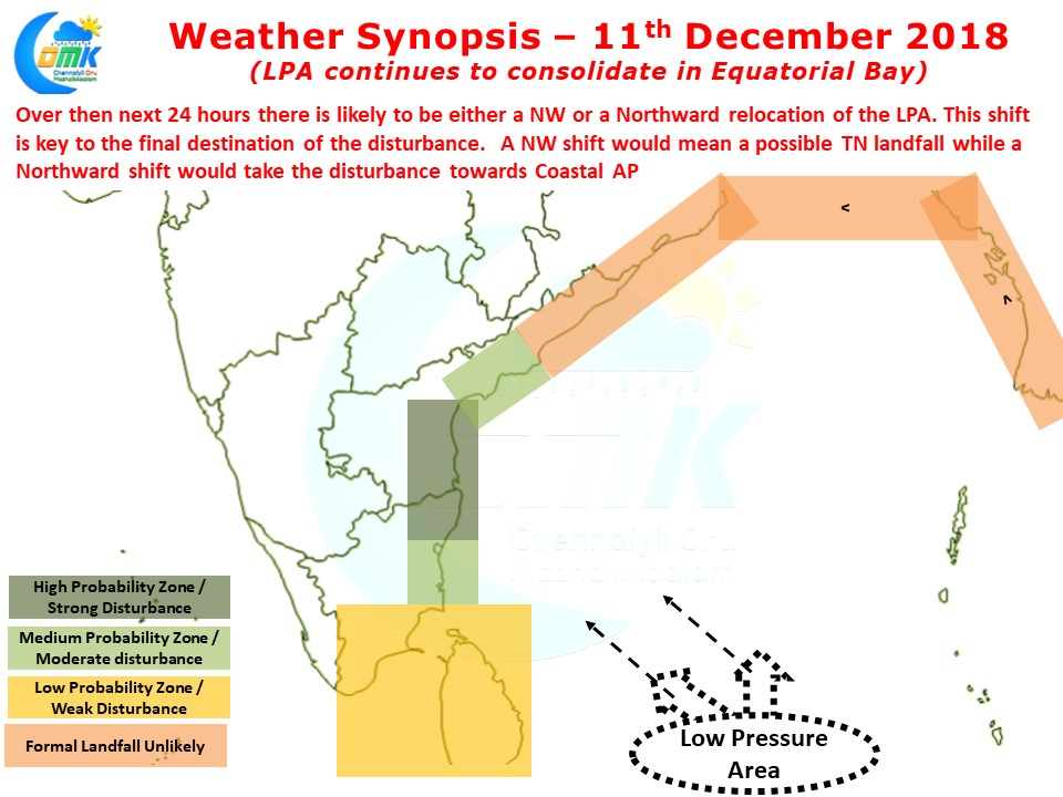
With the system likely to become a well marked low and complete its possible relocation before tomorrow morning we can see some clarity on the eventual track. This relocation is not only critical for the track and final destination of the disturbance but also the rainfall prospects for places like Chennai. A track like Roanu could mean much needed rains without cyclone impact while any track which is more than 100 kms to the East of Chennai would mean drastic reduction in rainfall probabilities