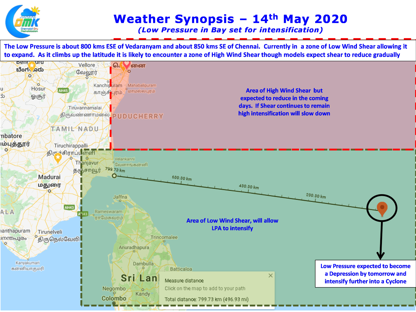
IMD confirmed the formation of Low Pressure in Bay of Bengal over the Southern areas off Andaman yesterday. Currently the Low Pressure Area is roughly about 800 kms to the E/SE of Vedaranyam and about 850 kms SE of Chennai. It is expected to make slow progress generally in a NW direction over the next couple of days before picking up pace as it intensifies further.

The satellite image today shows a fairly good convection though the structure looks still very disjointed. Crucially one can see the system starting to show signs of developing a fairly robust inflow & outflow channels with the Cross Equatorial Westerlies strengthening under the influence of ER & MJO in the region providing ample support to inflow.

The other key point one needs to keep in mind is currently the LPA is in a zone of low wind shear which will help it develop further. The areas to the North are under high wind shear though models are indicating the shear is expected to relax sufficiently enough for the cyclone to intensify without much trouble taking advantage of good atmospheric conditions & fabulous ocean conditions in the form of very warm sea surface.

On the rainfall front today we could see places in Western Ghats record moderate thunderstorms at many places while few places will see intense late afternoon thunderstorms along the ghats. As the LPA intensifies and Westerlies strengthen further thunderstorms in the interior areas will improve over the weekend. Coastal areas like Chennai will possibly benefit from wind convergence driven thunderstorms similar to Break in Monsoon time thunderstorms as the cyclone starts to climb above Chennai latitude


