
As we enter into July Southwest monsoon has finally shown some Mojo to bring relief to large parts of the Indian subcontinent. for the past couple of days Konkan coast has remain under the active monsoon conditions. Last night saw fairly widespread rains over parts of South Gujarat, Vidharba regions.

The low pressure over North Bay of Bengal has certain we brought back the momentum to Southwest monsoon. Creating a moisture drag over West Coast and Central India it is creating conducive conditions for further development of monsoon. expected to intensify into a depression by tomorrow over the next few days parts of Central India is likely to receive heavy to very heavy rains as it moves in the north west direction.
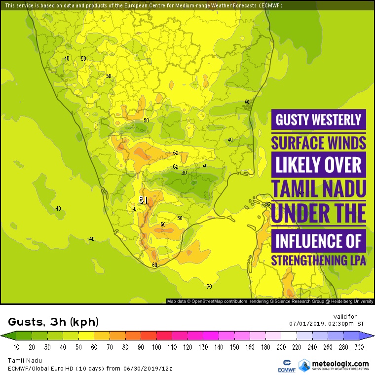
Though Peninsular west-coast particularly over Karnataka and Kerala has remained in a subdued mode for pretty much the last couple of weeks we could see some improvement over the next few days. As the low pressure strengthens parts of Tamil Nadu could see strong westerly winds over large parts of state. In particular places to the east of palghat gap are likely to see wind gusts round 50 / 60 kilometres per hour. with westerly winds picking up places like Chennai may not see much influence from the sea breeze. Similarly due to strong lower level winds India posterior development of convective thunderstorms would also be substitute making it a dry few days for interior Tamilnadu and places like Chennai.