
In what could provide some hope Equatorial Bay is all set for a Low Pressure Area over the next few days. How much of an influence it will have over the rainfall prospects for Tamil Nadu remains to be seen as we wait for it to consolidate.
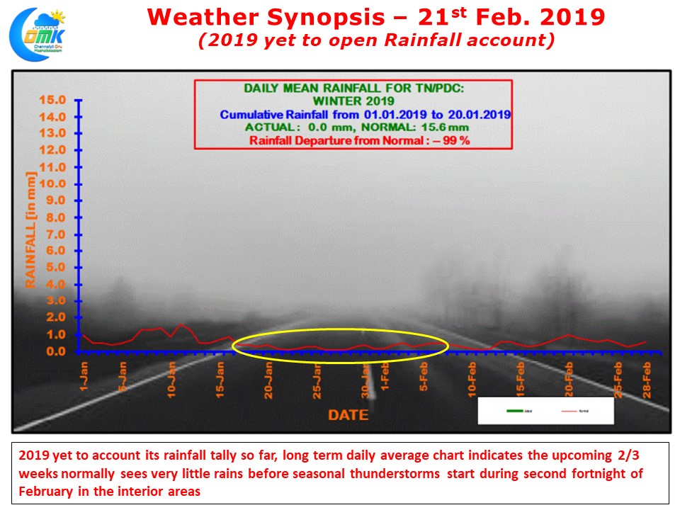
Since the turn of 2019 it has all be quiet on the rainfall front for Tamil Nadu with the IMD’s daily rainfall graph for the TN & PDC subdivision still to make a start. Though we had a very early start to cyclone season with Pabuk moving in from South China Sea it never came anywhere close to TN coast for any meaningful influence.
In yesterday’s post we had mentioned about the influence of Kelvin wave over the Equatorial waters of Indian Ocean & Bay of Bengal. Often the passage of Kelvin Waves can create tropical disturbances, some of it go on to become cyclones under right conditions.
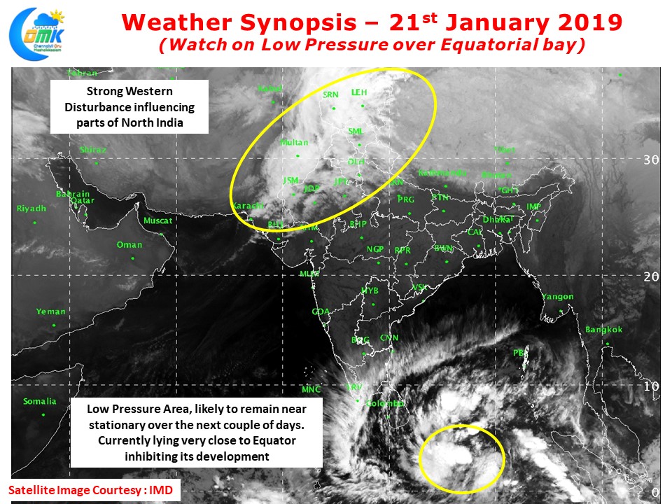
Satellite image indicates a possible Low Pressure Area to the Southeast of Sri Lanka at the lower latitudes close to Equator. This disturbance is currently too close to Equator which will inhibit not only its development but also steering & movement as well. Over the next couple of days we can expect the Low Pressure to remain near stationary while it remains to be seen if it can climb up the latitudes.
In the meanwhile as clouding increases over South India due to not only the developing low Pressure area but also some southward dip of the Mid latitude Westerly Trough we can see night time temperatures climb up slightly over most of Tamil Nadu.