Most of us can never forget the famous interaction between Dharumi and Lord Shiva in disguise in the movie Thiruvilaiyaadal. The first question Dharumi asks Lord Shiva while judging him is “பிரிக்க முடியாதது எதுவோ”. If the bloggers are asked same question about Northeast Monsoon most bloggers the answer will be Low Pressure Area and rains. Unlike the Southwest Monsoon tropical disturbances drive the performance of Northeast Monsoon. Disturbances like Low Pressure Area, depressions and cyclones. Favourable genesis and favourable tracks bring bulk of the rains to coastal Tamil Nadu during this season.
The mid October depression was favourable for parts of Tamil Nadu resulting in good rains over some parts of Chennai. Cyclone Dana went up North towards Odisha / West Bengal resulting in dry weather across the state. Subsequently NEM 2024 has been relatively weak with coastal areas seeing very little rains. Last week saw the returning Easterlies bring isolated rains though once again it was patchy within parts of Chennai and suburbs. With the imminent arrival of MJO into Indian Ocean Northeast Monsoon could receive the necessary fillip for an active period.
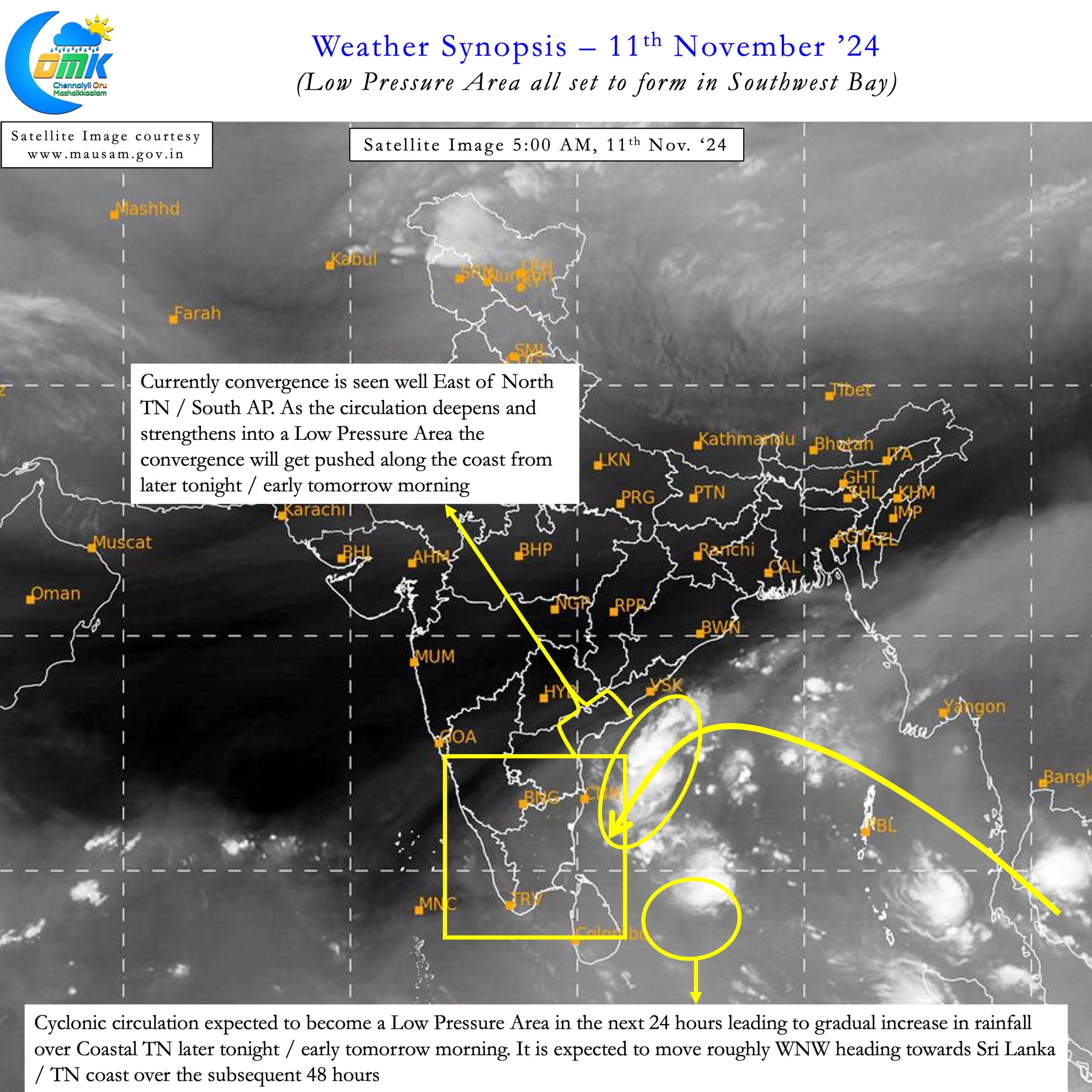
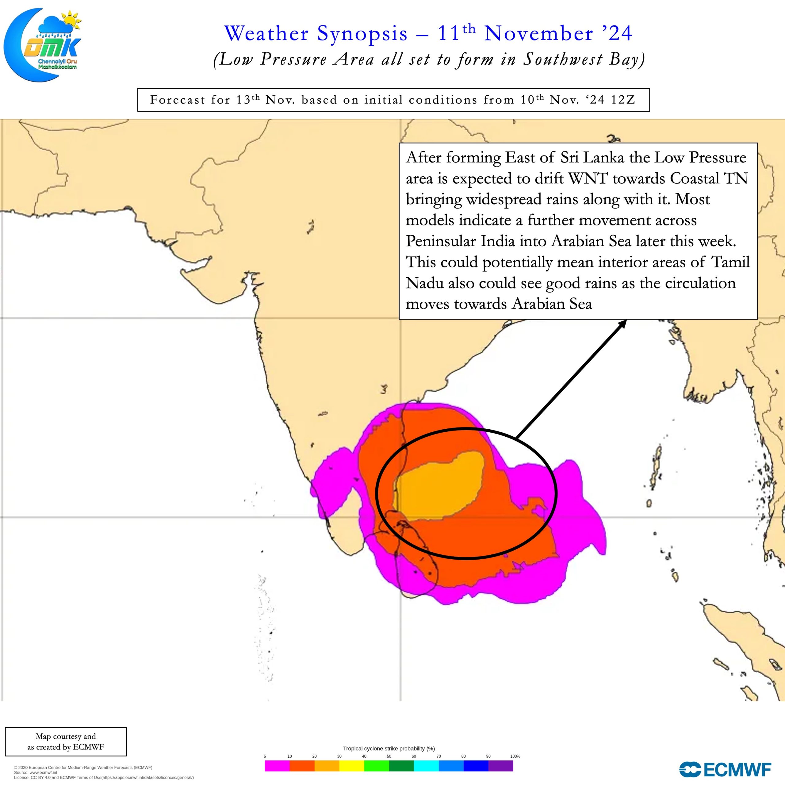
The 1st phase of the active period as explained in our earlier post is all set to start. A developing Low Pressure Area in Southwest Bay is likely to kickstart this active period. The past couple of days saw two different vortex try to strengthen at the cost of the other. There is a fair consistency among models now about the SW Bay vortex strengthening into an LPA. This increases the probability of widespread rains over Coastal Tamil Nadu and South AP over the next few days.


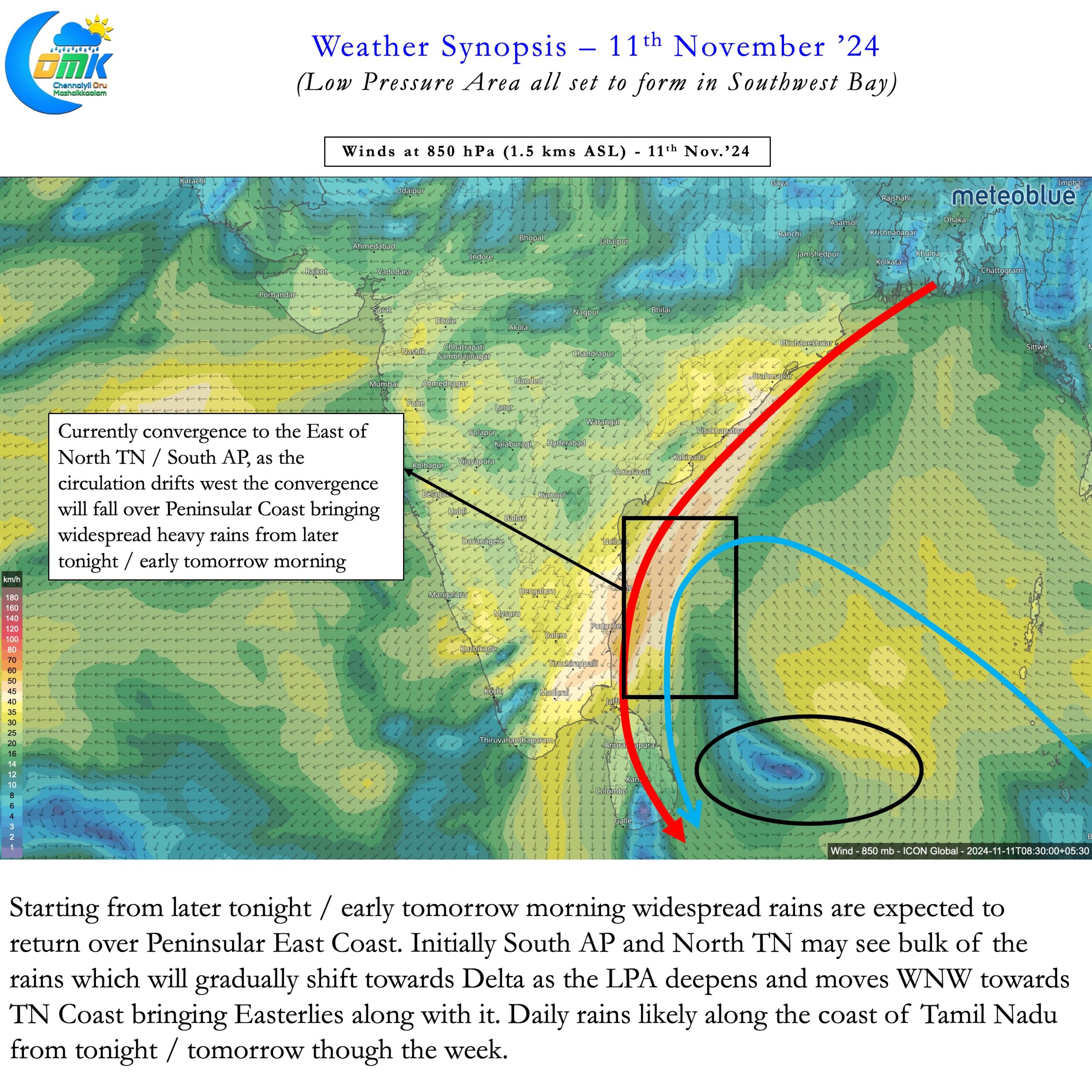
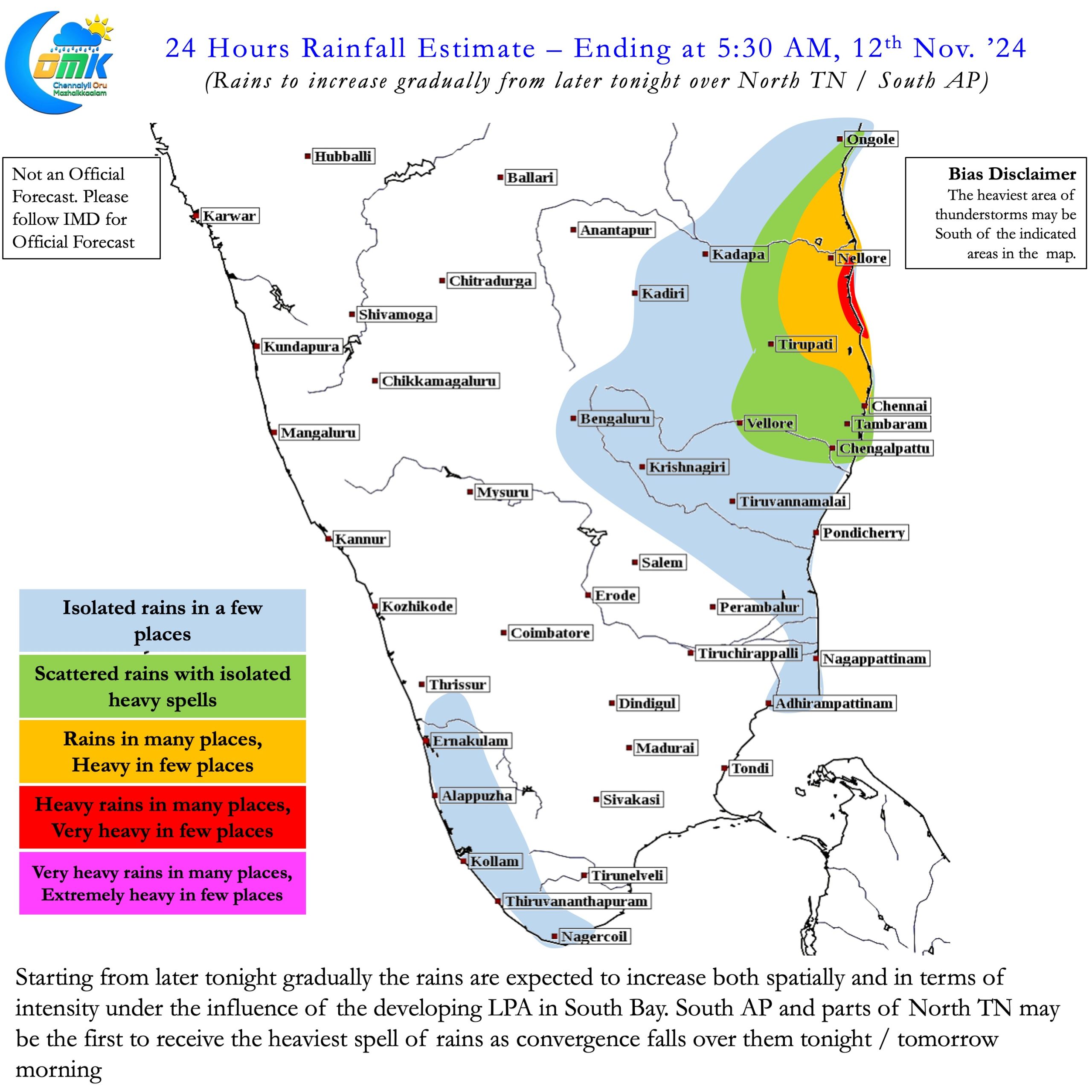
The initial convergence is likely to fall over South AP and adjoining North TN. This is likely to bring the first spell of rains to these areas later tonight / early tomorrow morning. Over the next couple of days the heaviest rains is likely to fall between Nellore and Pondicherry. Gradually as the LPA strengthens and moves towards coastal TN places like Delta will start seeing widespread rains. As the heaviest rain bands move from North to South places in KTCC, particularly around the southern parts of Chennai that missed rains so far will benefit.
Starting from later tonight / early tomorrow morning Chennai and suburbs can expect moderate to heavy rains. At times in a few places the intensity of these rains may be very heavy depending on real time wind convergence. As the LPA moves closer to TN coast most parts of the coast will see widespread rains. Later in the week interiors can also expect good rains with models expecting the LPA to move across Peninsular India into Arabian Sea.
மாமழை போற்றுதும் மாமழை போற்றுதும்
நாமநீர் வேலி உலகிற்கு அவன்அளிபோல்
மேல்நின்று தான்சுரத்த லான்
இளங்கோவடிகள் – சிலப்பதிகாரம்:1: 1-9
It is ironic and in a way reflection of the infrastructural issues most of us face that every time a rain event is expected we start panicking. Rains are an essential need for us. Northeast Monsoon depends a lot on disturbances for its performance. At times by nature these disturbances dump a lot of rains leading to water logging / localised flooding etc. With better preparedness as a society we can mitigate the impat of such events.

