Southwest Monsoon has finally started showing its might over North Konkan and parts of Gujarat as Mumbai & surrounding areas have been getting good rains for the past couple of days. Last night saw some high intensity rains happening over parts of Gujarat, particularly around the Sourashtra region.

Influenced by the Low Pressure Area off the coast of Gujarat which is pretty much stationary in position today once again heavy to very heavy rains are expected over many places in Gujarat and quiet a few places in the North Maharashtra coast adjoining Gujarat Coast. Due to this LPA strong Monsoon Surge is seen over these parts along with wind convergence as well creating right conditions for high intensity spells that is likely to dump huge volume of rains in short duration.

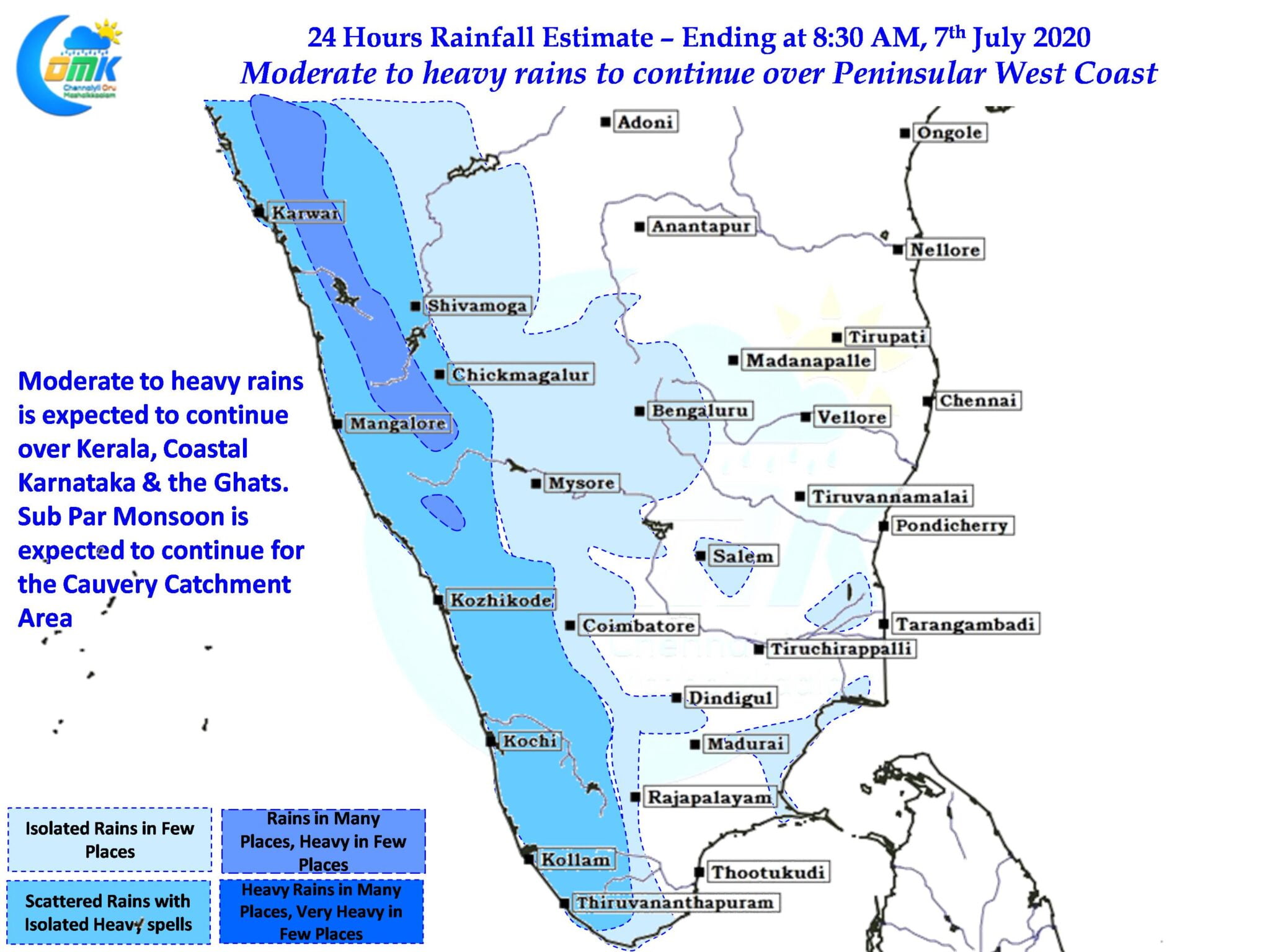
In the meanwhile moderate to heavy rains are likely to continue over the West Coast of Peninsular India in Coastal Karnataka & Kerala. The Sub Par Monsoon over the Cauvery Catchment area remains a worry though with no immediate improvement seen in the models. Tamil Nadu will remain subdued as far as thunderstorms go though the partly cloudy skies may keep temperatures under check over places like Chennai.


