
It is not often one talks of Monsoon Surge when third week of September is about to come to an end. If one goes to Mumbai the common talk is after Ganpati Visarjan Monsoon also waves a good bye with a spell of thunderstorms ending the season for the Metropolis. But here we are on 20th September talking of a late season Monsoon flourish and a possible Flooding & Landslide hazard over the Western Ghats. As we often say Nature runs at its own pace
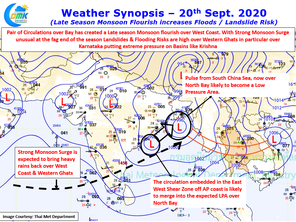
Only time can answer whether the late blooming of La Nina has a role to play in this end of season flourish for Monsoon. A pair of circulations, one home grown & the other an import from South China Sea, has strengthened the Monsoon dynamics. The incoming pulse from South China Sea is expected to become a Low Pressure Area over the North Bay and is likely to absorb the circulation, currently lying off the coast of AP, embedded in the East West Shear Zone.
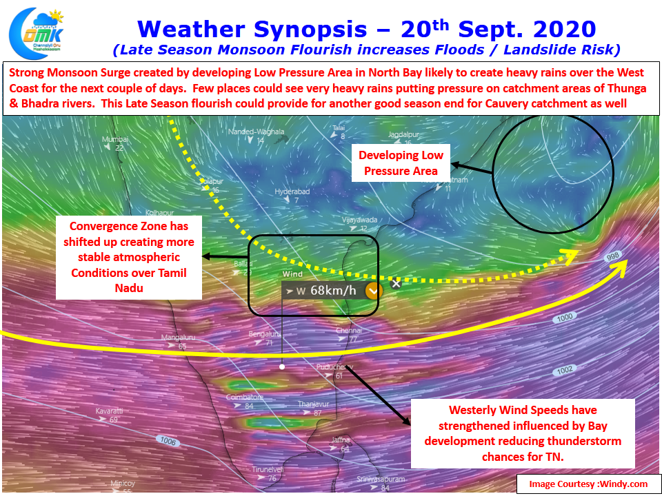
The wind charts clearly indicate the strong westerly surge currently seen over Peninsular India with wind speeds at 1.5 kms ASL exceeding 75 km/h at many places bringing with it heavy rains over the West coast & Western Ghats. Flooding risk during late season is always a risk on account of increased soil moisture after a long monsoon. This year has been a good monsoon over many parts of Western Ghats with basins like Krishna already under lot of stress. This surge is expected to put further stress on the fragile Western Ghats environment bringing with it increased flooding & landslide risk in particular over Karnataka Ghats.
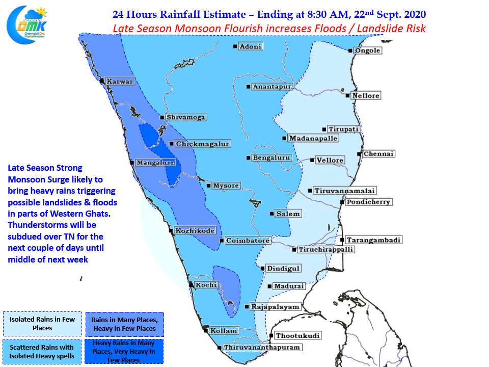
On the other hand Cauvery Basin is likely to end another Monsoon on a high note which augurs well for Tamil Nadu & Karnataka during off season irrigation in the days to come. With strong westerlies streamlined over large parts of Peninsular India & the convergence zone shifting further North we can expect thunderstorm activity to taper down over Tamil Nadu until middle of next week possibly.