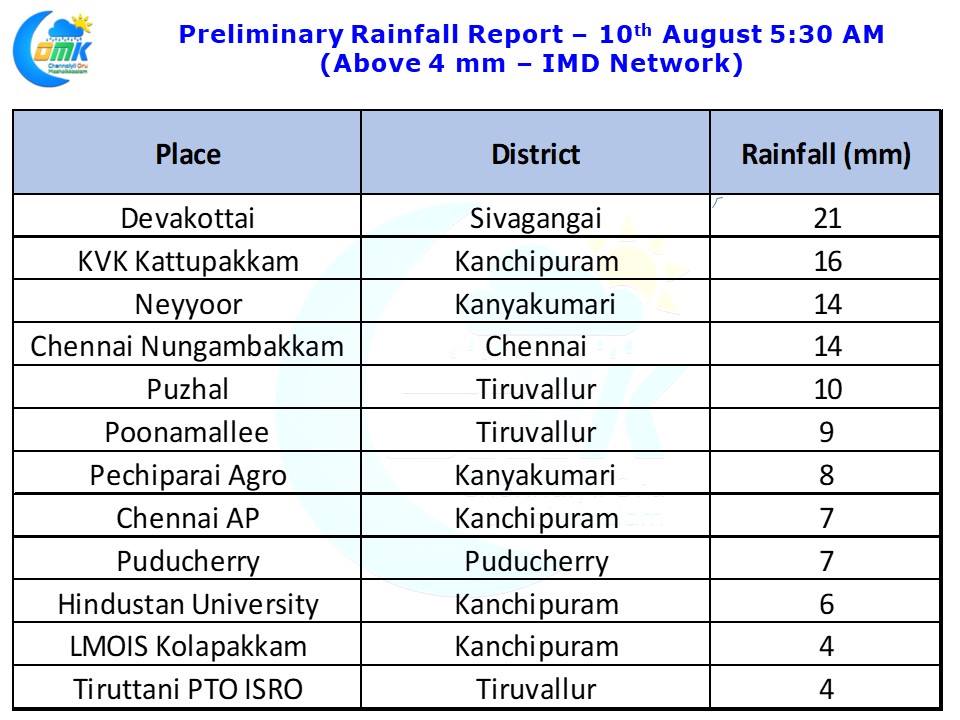
Last night saw isolated rains in Chennai and surrounding areas after what was a fairly hot day with Chennai AP recording 38.0°C, 3.3 degrees above normal and Chennai Nungambakkam recording 37.1°C, 2.3 degrees above normal for an August day. The IMD observatory at Nungambakkam recorded 14 mm bulk of it fell between 7 & 9 PM in the evening. With westerlies slightly slowing on account of the low pressure in Central India fading away it has brought some respite to Kerala which has seen the rains slightly ease from the monster spells of Tuesday & Wednesday. Though the trapped moisture in the valley could give occasional burst of heavy spells of rains the next few days could see the rains mostly stay low allowing focus on relief and rehabilitation efforts.
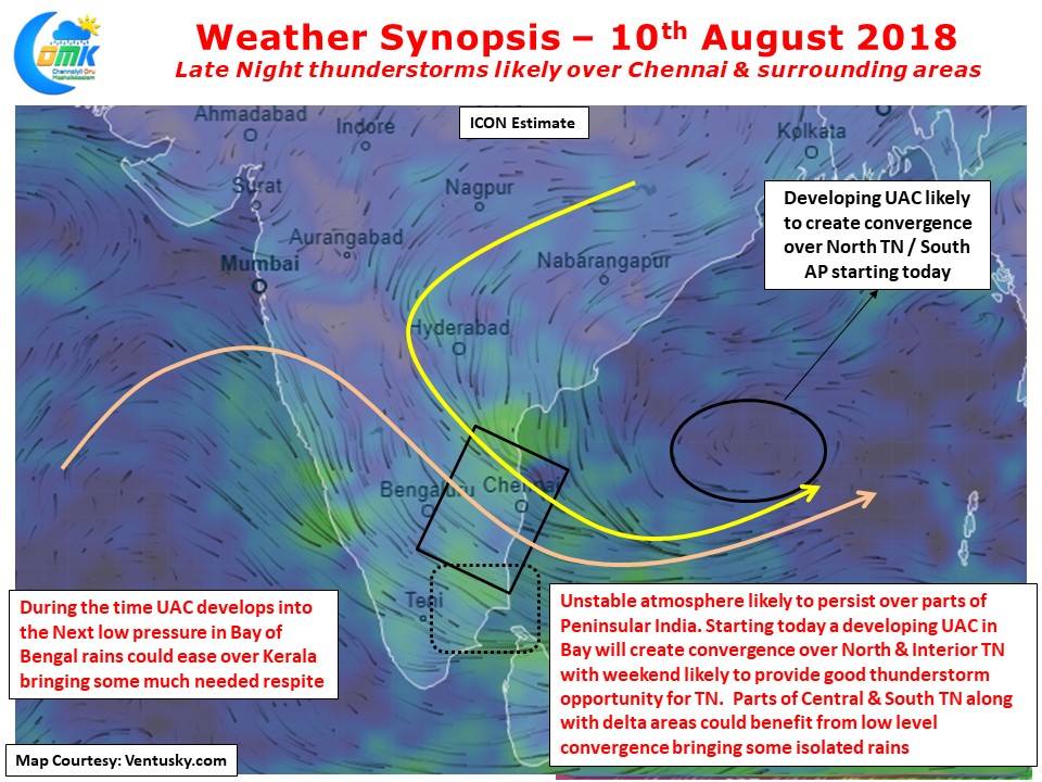
Early next week we are likely to see a low pressure develop in Northwest Bay which needs to be monitored for the next spell of vigorous monsoon conditions. This year the pattern seems to be short bursts of intense rainfall followed by subdued conditions next week’s rains could be similar too. Numerical Models indicate a developing Upper Air Cyclonic Circulation over Bay of Bengal which is likely to descend into a low pressure as mentioned above.
During this process of evolving into a low pressure this Upper Air Cyclonic Circulation will possibly play a key role in the “Veppa Salanam” thunderstorms and in the process bring Rains in Chennai and rest of North Coastal TN over the next couple of days. When a UAC develops it creates a certain disruption in the streamlined Westerlies wind pattern bringing along with it convergence / instability in atmospheric conditions etc creating conducive conditions for thunderstorms. While the wind charts indicate good mid tropospheric convergence over many parts of Tamil Nadu over the weekend there is likely to be enough instability in the atmosphere for Late Night Rains in Chennai and surrounding areas today after what is likelyt o be another fairly hot day.


