A few weeks back Manjummel Boys, a Malayalam film, took Tamil Nadu by storm. It brought audience to the theatres by droves making them go through lows and highs of emotions. The film was based on a real life incident that happened in 2006 . The audience ended up resonating with the Manjummel Boys while Subash remains stuck and eventually gets rescued. The rescue thriller highlights there is always light at the end of the tunnel. But the light may be visible for those who adopt a positive approach and decide to give a good shot.
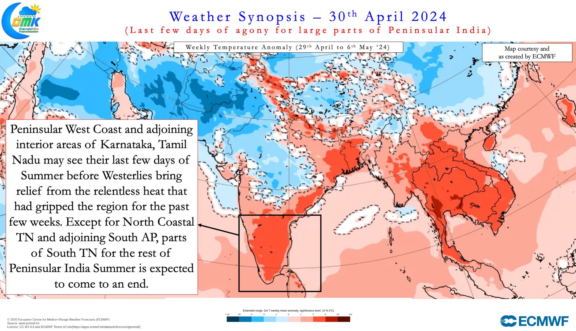
Before we get to today’s post it is essential to clarify this post may not be relevant to North TN and South AP. Real summer has not yet effectively started for these areas with Easterlies remaining strong. The last few days have seen lower level winds have a more Southerly component than ever before. Over the next couple of days Southerlies will gradually lead to Westerlies establishing over Peninsular India later this week. With Westerlies coming in not only there is going to be a change in how Summer pans out over but also a chance for thunderstorms.
In our last post we mentioned about a possibility of May 2nd week promising some relief. Weather models are increasingly consistent about thunderstorms associated with this seasonal change in winds. The arrival of thunderstorms will eventually take the sting out of the relentless heat bringing much needed rains. Peninsular West Coast, parts of Interior TN and South Interior Karnataka is likely to be the biggest beneficiary. Places like Bengaluru which has seen hardly seen rains so far this year can look forward to rains finally. Rayalaseema is also likely to see rains in the upcoming spell the afternoon heat may be there until 3rd week fo May.


But before that we have a small issue of Heatwave for the next few days over most of Peninsular India. Starting today most parts of Tamil Nadu including Chennai can see appreciable increase in temperatures. Between tomorrow and Sunday we may see interior places record 40 to 42°C during the afternoon. During this spell there is a high chance for 1 / 2 places to upto 43°C. Weak sea breeze may increase the quotient around for Chennai and suburbs too. There is a good chance places around Tiruvallur / Arakkonam may see peak temperature of around 43°C this week. Places around Palghat Gap may have to bear for couple of more days before rains can bring some cheer.
With moisture brought in by Southerlies isolated rains is likely over South TN today. Similarly this could also trigger summer thunderstorms over Kerala with 1 or 2 places around seeing intense spell of rains. Overall as Southerlies shift to Westerlies things will get better on the thunderstorm front in the days to come.
As Sijo David proved in 2006 there is light at the end of the tunnel even if it is the Guna Caves.

