
If it was Krishnagiri on Tuesday that saw rains, it was Coimbatore yesterday as Interior Tamil Nadu continued its trend of thunderstorm activity over the last few days. While the Airport Observatory in Peelamedu recorded 20 mm rains the Weather Station of Tamil Nadu Agricultural University recorded about 50 mm rains last evening. 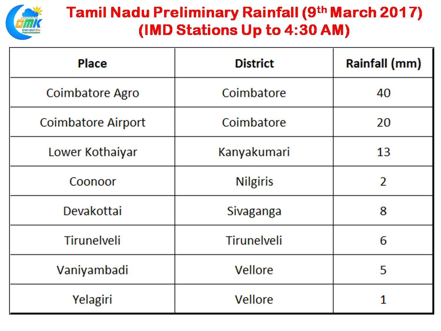
Light to moderate rains were recorded in parts of Vellore district as well along with some parts of Tirunveli and Kanyakumari district in South Tamil Nadu. Early morning saw rain bands over parts of Pudukottai and Sivaganga district with Devakottai recording about 8 mm rains in the last couple of hours. Yesterday though once again proves wind instability driven thunderstorms can dump a lot of rains in a short span of time with extremely isolated spells.
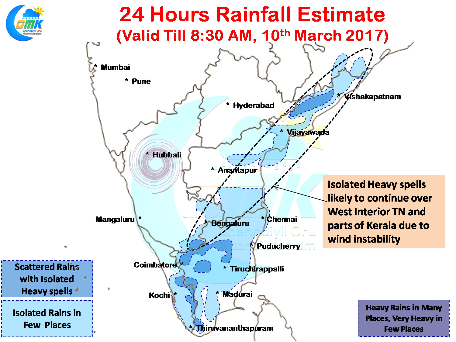 The two troughs which were giving support to the wind instability prevailing in Peninsular India has completed its life span with the Equatorial waters fairly calm and the bulk of the convection has now moved into Southern Hemisphere. Nevertheless the wind confluence continues to prevail over the interior parts of Tamil Nadu running along Coastal Andhra Pradesh all the way up to Odisha.
This likely to trigger some thunderstorms in the interior areas of Tamil Nadu today as well with possibly Erode / Salem / Namakkal / Tiruvannamalai and parts of Vellore districts likely to enjoy a spell or two of good rains later in the evening. There is a slight chance of some isolated spells of rains for the coastal areas including Chennai later in the day though the rains are unlikely to be heavy as things stand.
Powered by WPeMatico