IMD has officially acknowledged Northeast Monsoon has ended.Though the easterly winds would continue till possibly April the chances of rains would depend hugely on any synoptic conditions in the form of an easterly wave pushed in from Western Pacific or possibly any disturbance developing over in Bay of Bengal.
As has been the practice we are putting out a historical perspective of the Cyclones in North Indian Ocean during the month of January for the past 100 years. The period January to March is possibly the quietest month in terms of disturbances in the Bay. This is on account of the shift of ITCZ shifting closer to equator and then to Southern Hemisphere during the peak period of disturbances in the Southern Hemisphere. https://en.wikipedia.org/wiki/Intertropical_Convergence_Zone
Some of the key features of the disturbances in Bay of Bengal during the month of January are as follows
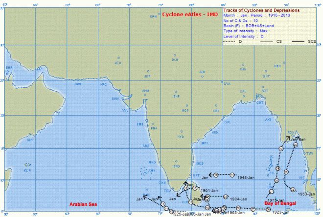
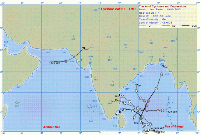
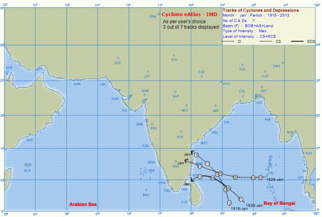
- A total of 10 depressions & 7 cyclones have formed during the month of January over the last 100 years with the last cyclone forming in the month of 2005. January 2006 saw the last depression in Bay of Bengal.
- Almost half of the disturbances do not seem to reach for a logical conclusion, landfall, with most disturbances dissipating over open seas
- Strangely in terms of probability January is the best bet for Tamil Nadu with 3 out of 10 cyclones having a landfall close to Tamil Nadu 1918 January which saw the disturbance skirt the Tamil Nadu coast received the second highest rainfall in Chennai over the last century or so
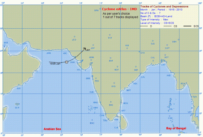
- 1935 saw a very unique phenomenon of a tropical cyclone forming in the Arabian Sea well beyond 20N latitude and making a landfall over the Kutch coast. Considering the struggle disturbances go through with Dry Air Impact in December, its pretty much a rare occurrence for a disturbance to develop into a Tropical Cyclone and going through the complete life cycle successfully.


