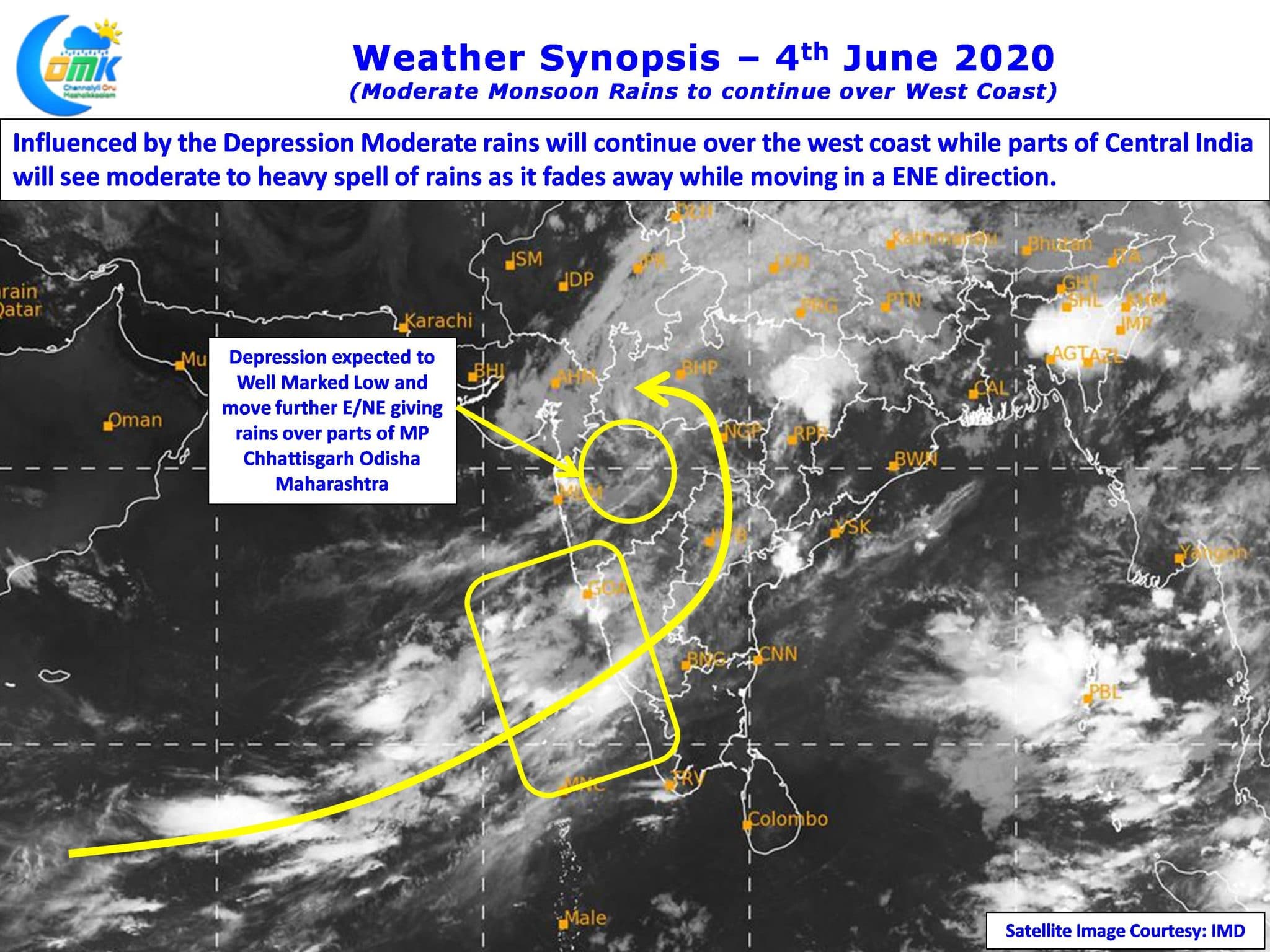
The remnant depression from Cyclone Nisarga now lies over parts of Madhya Maharashtra as it continues to move in a East / Northeast Direction over Central India. Expected to weaken into a Well Marked Low later in the day it ended up giving a scare to Mumbai but spared the metropolis of major damage after crossing close to Alibaug.

As though Nature was wondering if it needs to impact a city already reeling under the effect of an exploding COVID spread the system made a fast progress after landfall with the Western Ghats also playing a role in breaking down convection & its structure leading to rapid weakening from a Severe Cyclone to Depression in about 12 hours or so.

Though Monsoon made an on time onset over Kerala once the impact of this disturbance fades away it is expected to remain weak for a few days until a possible Low Pressure forms over Central Bay. This intervening period becomes an opportunity for places like Chennai. As they say one man’s loss is another man’s gain. So the gentle westerlies without the monsoon surge becomes a possible opportunity for thunderstorms to develop over the interior places of Tamil Nadu.

In this context the winds deflected by the two lofty peaks of Western Ghats, Anaimudi & Doddabetta, inter playing with the rising air over Tamil Nadu through convective trigger creates enough instability for thunderstorms to develop. While today may see isolated thunderstorms, things improve from tomorrow with Chennai in line for one decent spell of rains before the end of the week.


