The last few days rains have pretty much slowed down over Tamil Nadu. After the burst of Easterlies driven rains during the first week of October the development of Cyclone Titli disturbed the wind flow bringing Westerly / Northerly winds along with bringing the rains to a screeching halt over Tamil Nadu. Not only did the rains stop but it also brought with it increased heat quotient over the state.
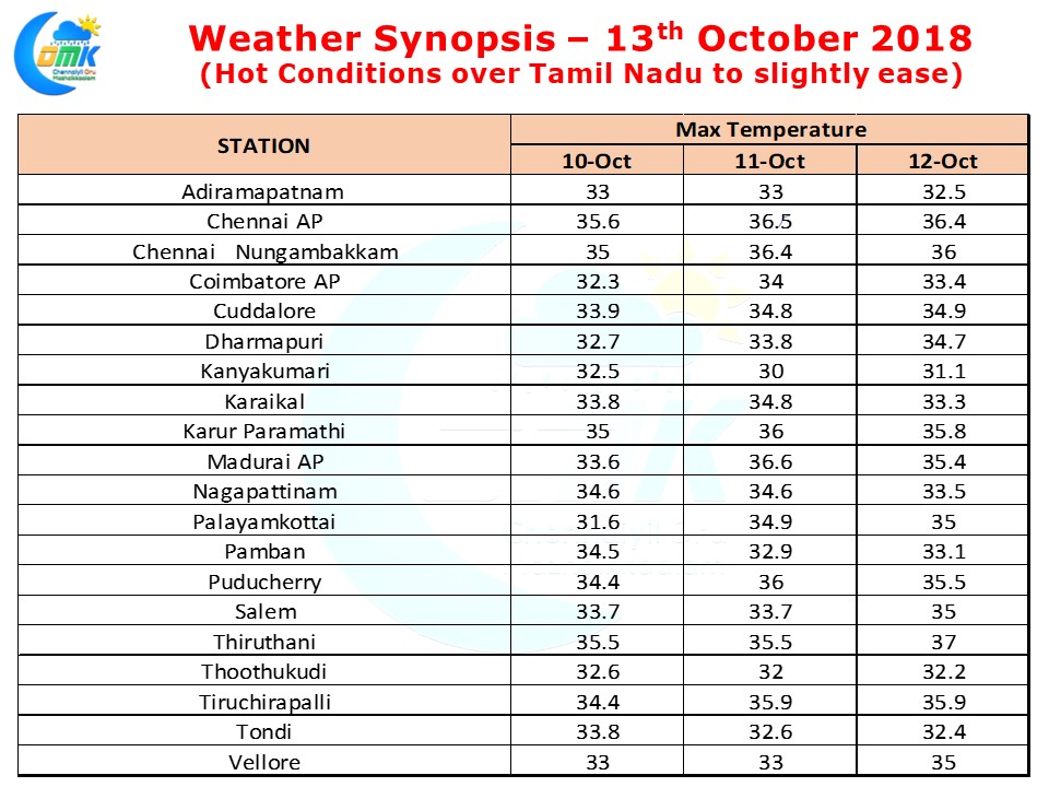
Many places in the State including Chennai were seeing nearly 2 / 3 degrees above normal temperatures for the last couple of days. Yesterday saw Tiruttani record 37°C while Chennai Meenambakkam & Chennai Nungambakkam recorded 3.4°C & 3.3°C above average max temperatures respectively. For the past 3 days both IMD observatories in Chennai has been recording 3 degrees above normal temperatures.
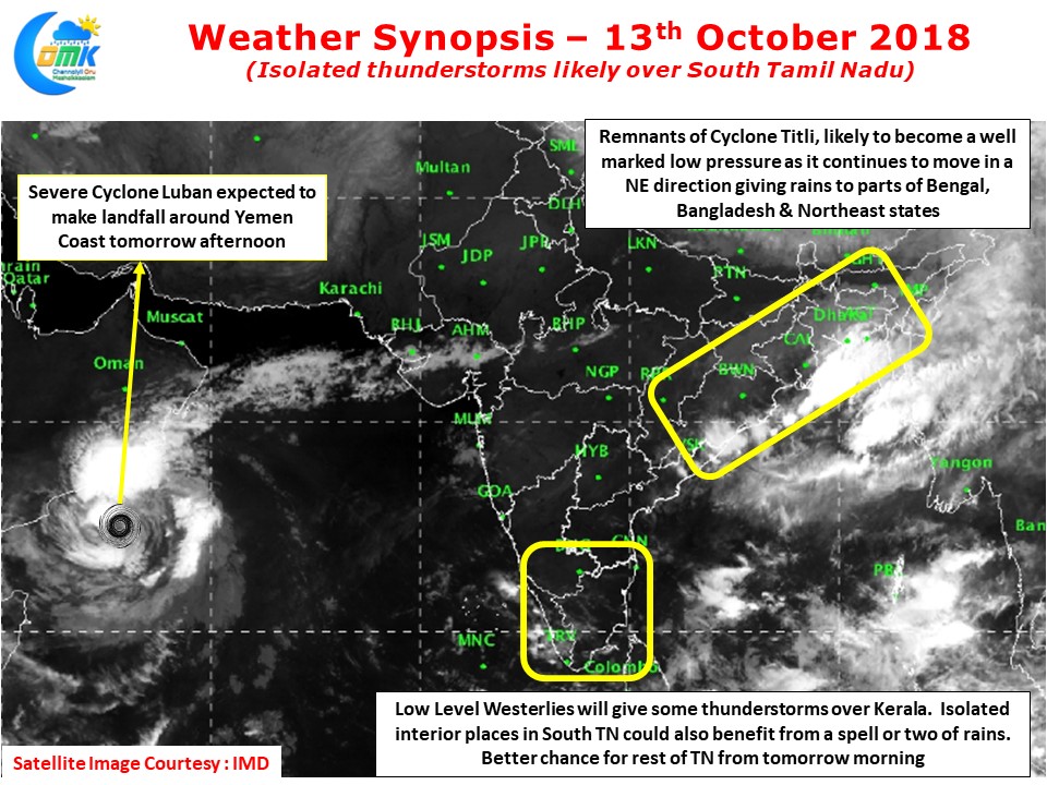
In the meanwhile Cyclone Luban has been moving slowly towards Yemen coast and is expected to make landfall by late afternoon tomorrow as a marginal cyclone system. The system could give bountiful rains to the desert areas though. The remnants of Cyclone Titli is expected to weaken into a Well Marked Low Pressure system today and continue its NE movement bringing rains to parts of West Bengal, Bangladesh & Northeast States for the next day or two.
In South India we could see some rains in Kerala today as wind pattern starts to scramble up slowly once again with the influence of Cyclone Titli remnant fading away. Places along the Western Ghats in Kerala and Tamil Nadu could benefit from possible spell of thunderstorms.
One or two places in South TN could get moderate rains while things improve from tomorrow for light to moderate rainfall activity in many parts of the state. The winds are likely to change to Easterlies soon, tonight may be too early, but from tomorrow we can see some pick up in the rainfall activity. As of now we need to wait for Easterlies from South China sea to streamline for the official start of Northeast Monsoon.


