There’s an old saying in Tamil கார்த்திகைக்கு மிஞ்சின மழையும் இல்லை. கர்ணனுக்கு மிஞ்சின கொடையும் இல்லை which pretty much sums up the peak Northeast Monsoon time for Tamil Nadu. While South TN and parts of delta will continue to see favorable conditions for rains North TN slowly gets into winter mode as we get into the second half of December.

While this is the overall pattern of events, individual seasons change in exact sequence depending on how the ITCZ moves down South on its way towards Southern Hemisphere. Satellite image indicates a possible dual ITCZ prevailing on either side of Equator which is an indicator of ITCZ moving into Southern Hemisphere shortly. Satellite image also indicates MJO influence has started to influence parts of Maritime continent more compared to Indian Ocean areas. This could mean slowly MJO will start moving further East bringing suppressed phase over Indian Sub Continent.

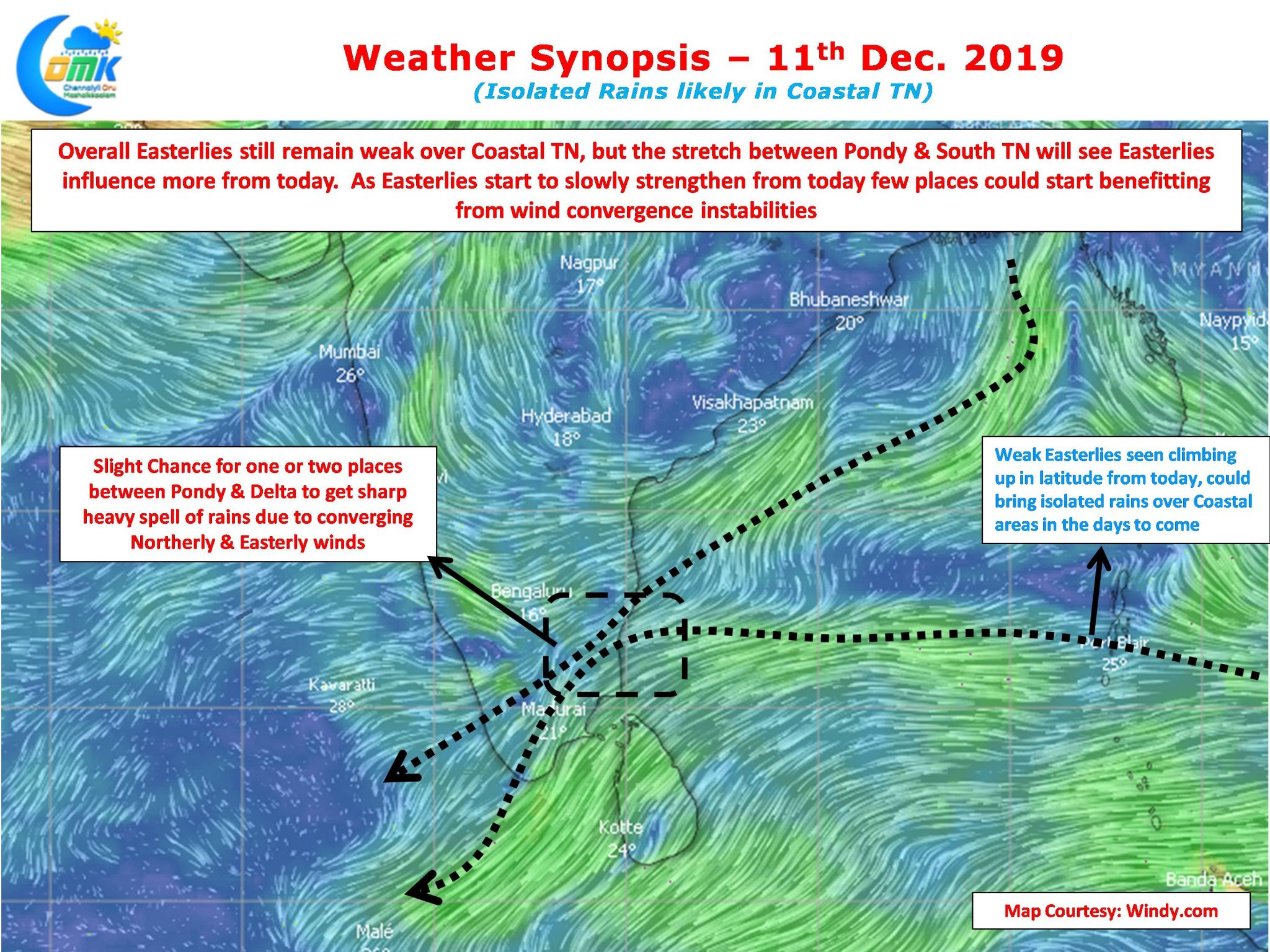
With Easterlies still remaining weak over most parts of Tamil Nadu rainfall prospects are going to be limited to a few places along the coast. But starting today slowly the Easterlies are climbing up in latitude which is likely to bring patches of rains here and there. One or two places in the stretch between Pondy & Delta could fall under a possible convergence of Northerly & Easterly winds which could mean sharp spell of heavy showers later in the evening.
Chennai is likely to see mostly clear skies with some clouding developing through convective forcing around early afternoon. This could mean some isolated light rains in one or two areas. Tomorrow morning could once again see nippy conditions before the return of Easterlies slightly push up the morning temperatures.


