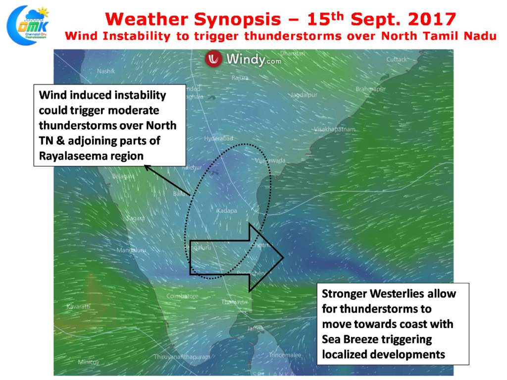
After a few days of lull in thunderstorms thanks to the winds changing back to Westerlies rain possibilities have returned for North Tamil Nadu. Yesterday saw fairly intense thunderstorms to the West & Northwest of Chennai at about 50 kms distance though thanks to the extremely weak wind pattern they did not make the movement towards the coast. Similarly some western and southern parts of the city also recorded light rains around Tambaram, Sri Perumbudhur etc.
With the wind pattern changing back to Westerlies and the Bay getting ready for the next tropical disturbance it has also given an opportunity for some thunderstorms triggered by wind instabilities in a few parts of Peninsular India. Additionally with pace picking up the storms could slowly start making their movement towards the coast as well where it could interact with sea breeze at a few places making them develop more.
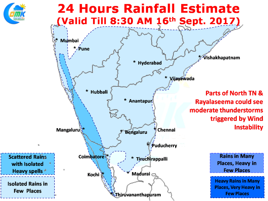
Parts of Rayalaseema & North Tamil Nadu could come under one such wind instability today bringing in some rain prospects to the districts of Vellore, Tiruvallur, Kanchipuram along with adjoining districts of Chittoor, Nellore, districts in South Andhra Pradesh.
West coast will continue to get decent spell of rains today as well while monsoon is expected to pick up momentum around the weekend for one last heavy spell before Southwest Monsoon starts retreating back from the Indian sub continent.
Powered by WPeMatico


