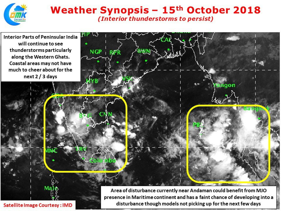
While the wait continues to the “Onset” of Northeast Monsoon thunderstorms in the interior areas of Peninsular India continues to persist with another active day seen yesterday. As mentioned in our post yesterday, with both tropical disturbances fading away in influence the wind pattern over South India has started showing signs of changing to Easterlies. This has resulted in thunderstorm activity over the interior areas.
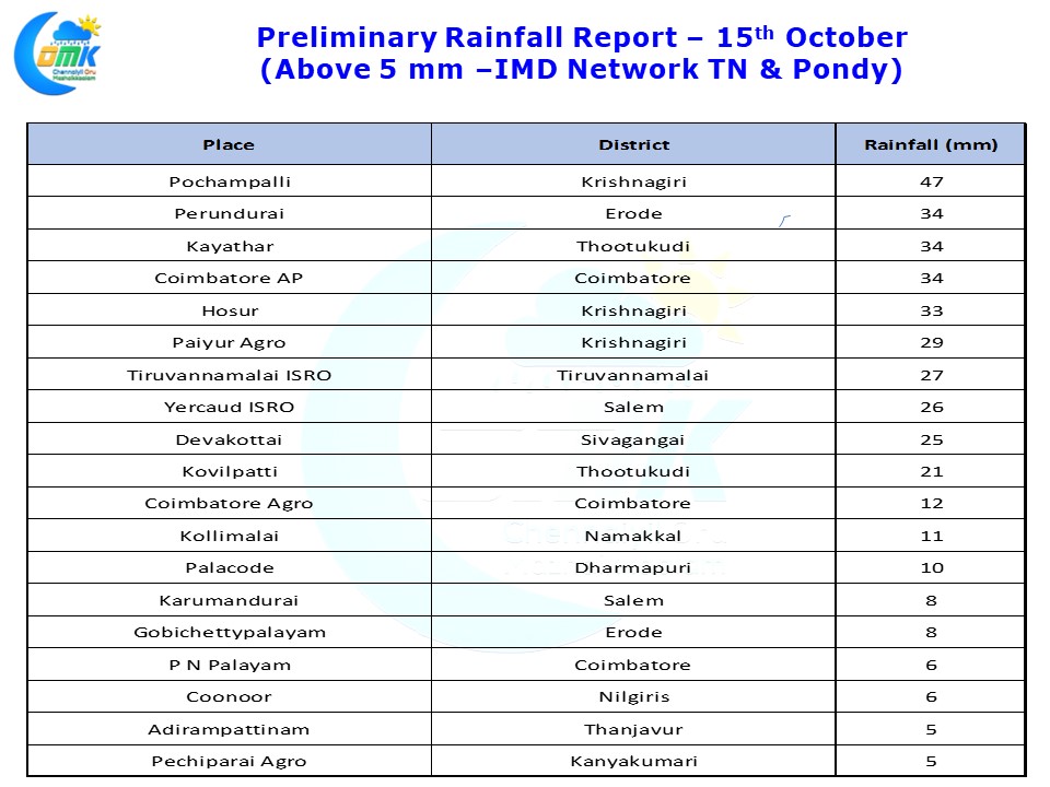
Yesterday saw good spells of rains over West Interior TN in parts of Coimbatore & Erode district while few places in Vellore, Krishnagiri & Dharmapuri districts recorded moderate to heavy thunderstorm activity in the evening. Though parts of delta districts got some light rains and Devakottai closer to coast in South TN got some moderate rains overall places along the coast of Tamil Nadu have just been left to enjoy hot and humid day time conditions and nothing beyond.
On a slightly larger scale one needs to keep an eye on the disturbance currently prevailing near Andaman Islands. While models done attach much credence to anything concrete evolving there for the next few days the presence of MJO over maritime continent could potentially give some impetus for the disturbance to develop. Whether it would work favorably for us in the event of developing is billion dollar question.
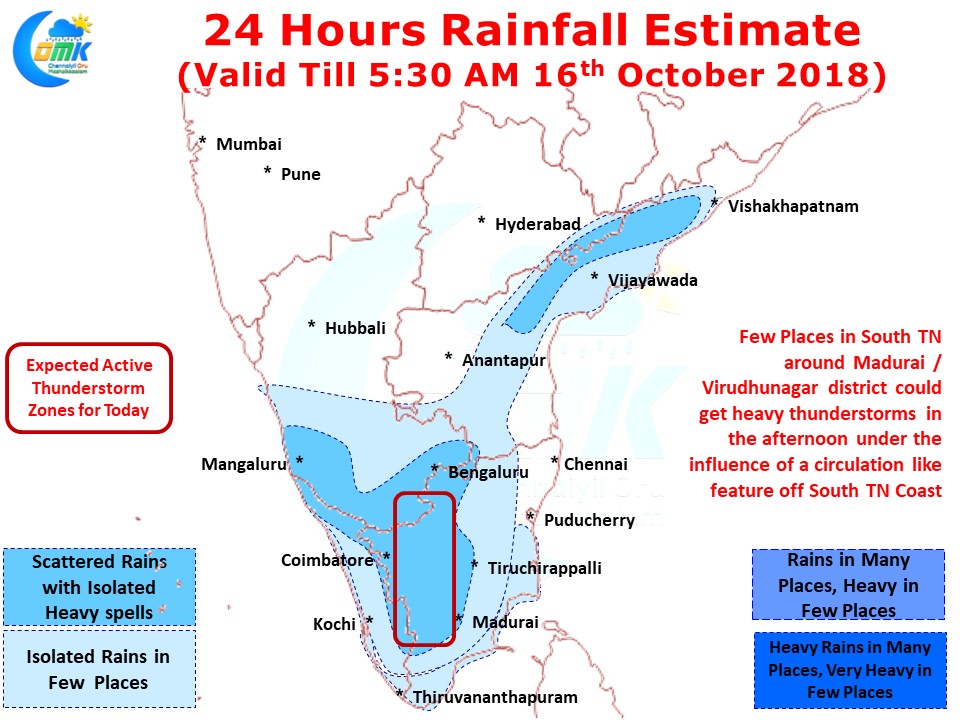
Today once again it will be an interior show with the usual suspects like Krishagiri / Coimbatore / Erode / Salem likely to be in line for thunderstorms. Isolated places in South TN could benefit from circulation like feature over Gulf Of Mannar bringing intense afternoon / evening thunderstorms over Virudhunagar, Thootukudi, Virudhunagar & Tirunelveli districts.
Though during periods of seasonal wind change models tend to struggle overall there is indeed a worry about no clear signs emerging about a proper Northeast Monsoon onset yet.


