Over the past week to 10 days weather in Peninsular India is under the influence of multiple circulations. During the onset phase of Northeast Monsoon 2024 we saw two disturbances on either side of Peninsular India. The interplay between circulations will allow moisture to get recycled regularly in Peninsular India. This also meant Interior Tamil Nadu get very good rains since the start of NEM season. On the day IMD announced onset of Northeast Monsoon 2024 parts of Chennai saw 20 cms in a few hours. The presence of a cyclonic circulation off North TN coast enhanced these thunderstorms triggering heavy rains.
Since 1st October, the start of the NEM season only 6 days have seen below average rainfall for TN & PDC. This has meant the seasonal tally of NEM as of yesterday stands at 70% excess compared to average. The important point to consider here is the performance of interior districts of Tamil Nadu. Chennai and rest of KTC districts have been getting the headlines but districts like Coimbatore, Tiruppur and Karur are also having a very good season. Except for parts of South TN most parts of the state have seen above average rains. Nagappattinam is the only coastal district that is currently seeing negative anomaly.
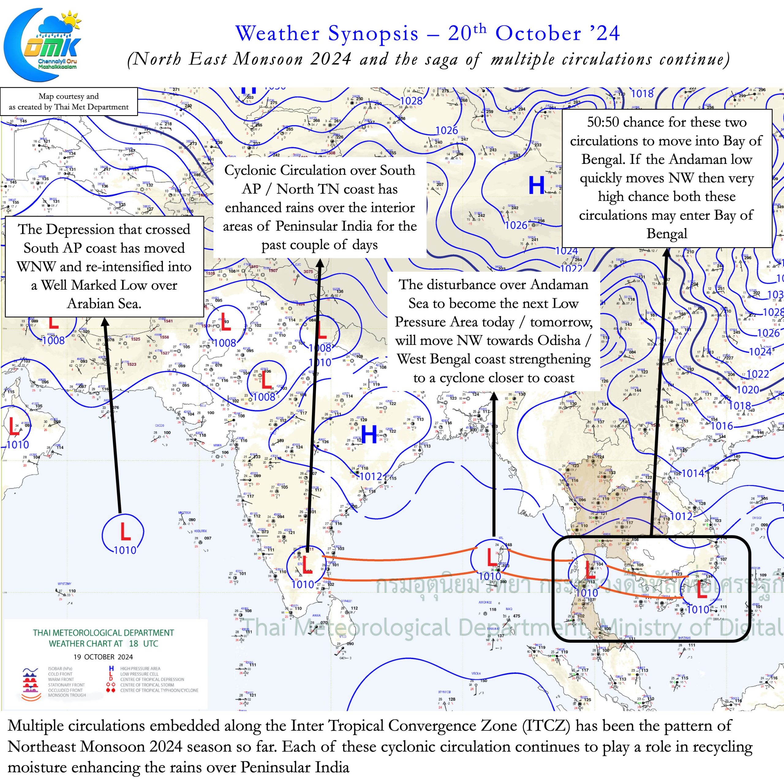
In our post on 17th October we mentioned how frequent disturbances could be the pattern of Northeast Monsoon 2024. The events over the past few days and the events currently happening is pretty much an example of the same. A string of pulses in North Indian Ocean and South China Sea is embedded along the ITCZ. The movement of Intertropical Convergence Zone (ITCZ) drives monsoon dynamics. During Summer the movement of ITCZ from South to North brings Southwest Monsoon. The retreating North to South movement of ITCZ brings Northeast Monsoon. This retreating movement also gives NEM another name “Retreating Monsoon”.
The Depression that crossed South AP coast continues to move WNW becoming a Well Marked Low once again over Arabian Sea. In the meanwhile a fresh Low is likely to form over Bay of Bengal in the next 24 hours. Currently seen as a cyclonic circulation over North Andaman sea it will gradually intensify into a depression over the next 48 hours. Weather models are consistent about this disturbance intensifying into a cyclone as it gets close to Odisha / West Bengal Coast. For the next 3 / 4 days while this circulation intensifies rains will continue over Peninsular India.
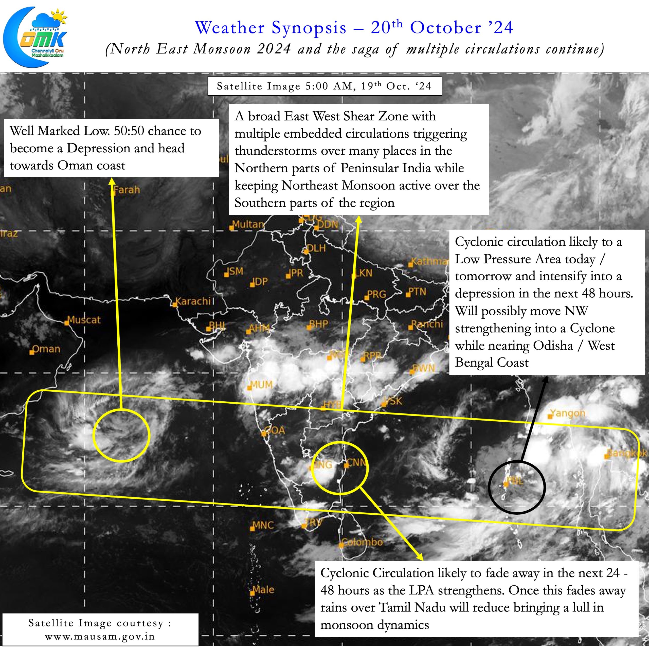
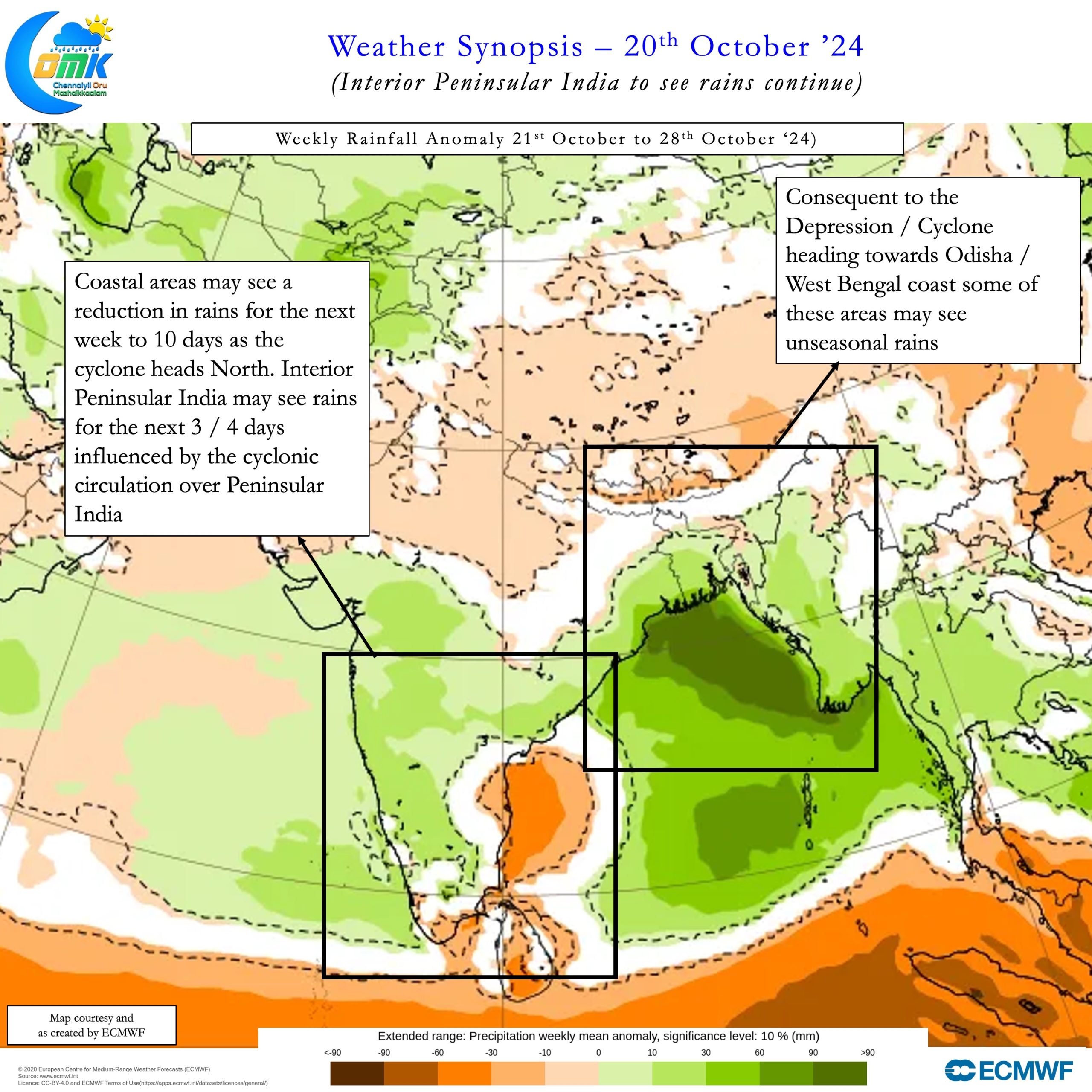
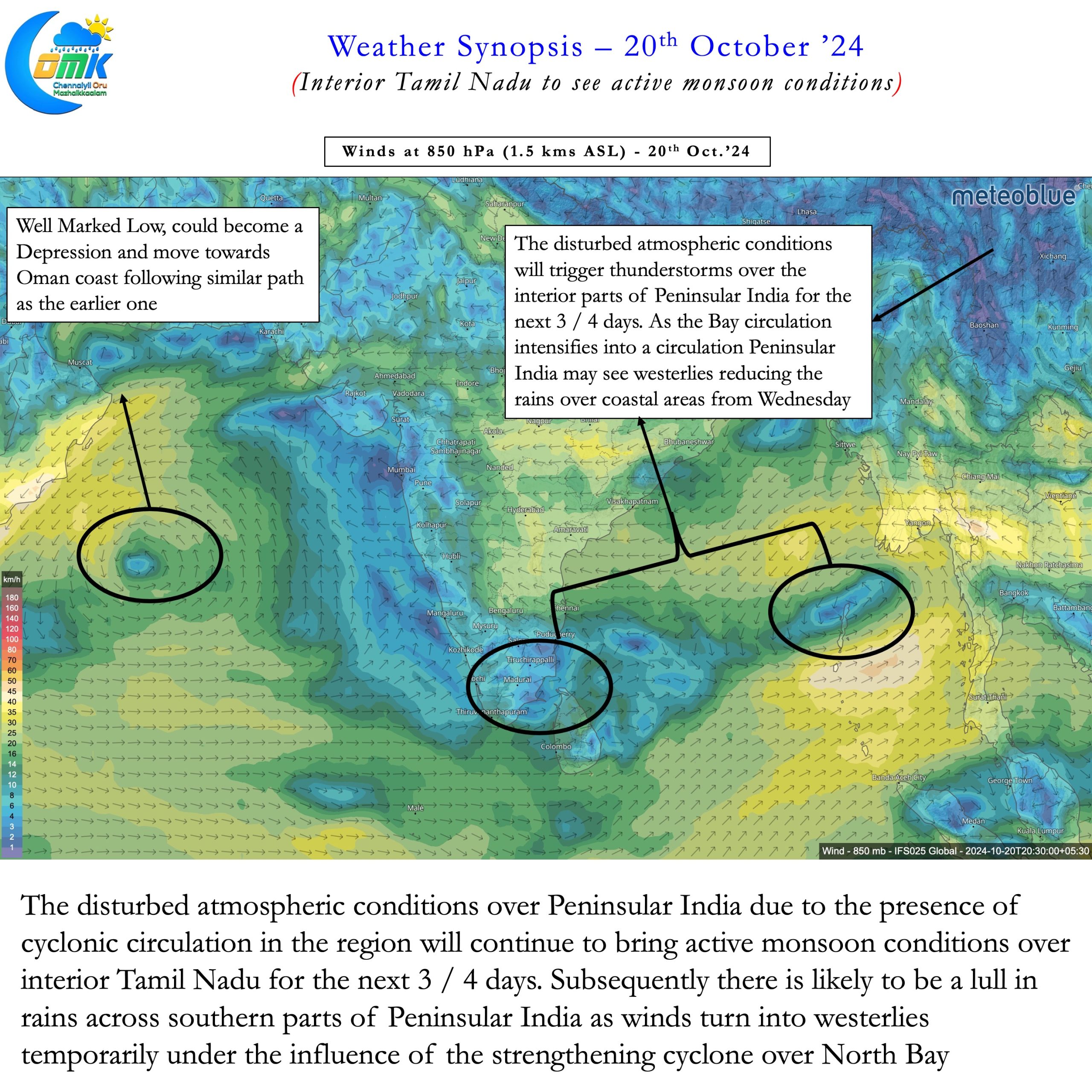
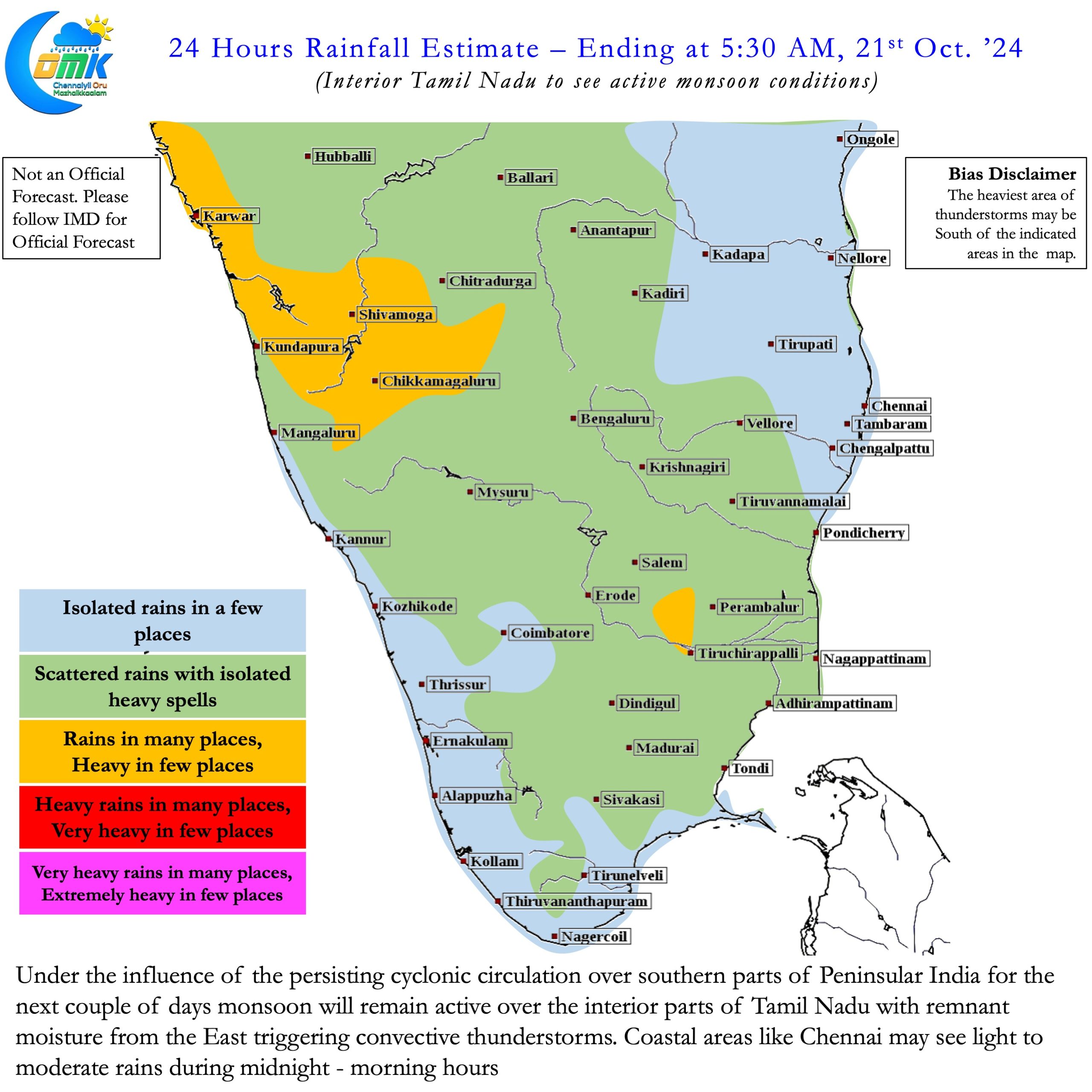
Interior areas of Peninsular India may benefit more than coastal areas due to the presence of the East west shear zone. Weather models also indicate by around Wednesday / Thursday winds may turn temporarily to Westerlies. This change is due to the strengthening of the cyclone and is likely to continue for about 3 / 4 days. This phase of westerlies may also bring about a lull in rains over Peninsular India until possibly end of October. While the rains may not completely stop active monsoon conditions is unlikely for a period of 7 to 10 days.
The upcoming 3 / 4 days may see Interior Tamil Nadu benefit the most compared to coastal areas. In a way this may be good for these regions as well. Come November with sub seasonal models indicating NEM to return to active phase Coastal areas may see widespread rains again. As far as Chennai goes for the next couple of days we may see rains during night / morning hours. Rains will gradually reduce from Wednesday when the winds change to west. The lull phase may continue until Diwali as things stand.

