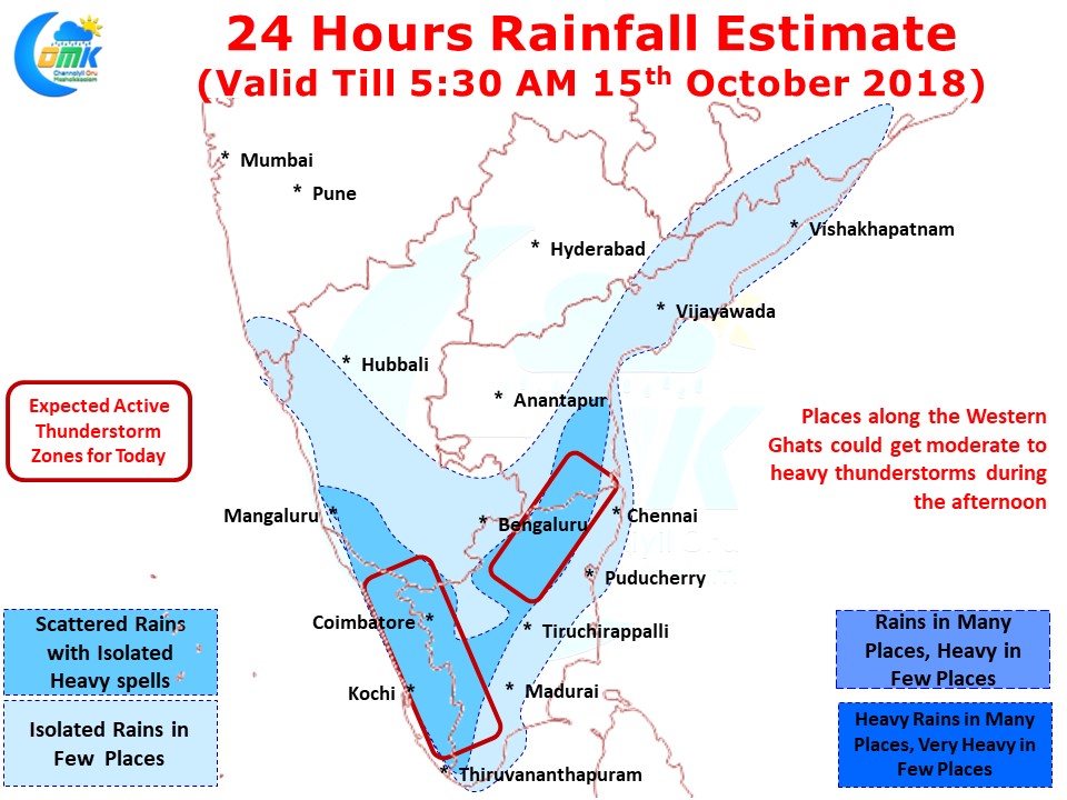
With the influence of both tropical disturbances fading away yesterday saw the return of thunderstorm activity over parts of Tamil Nadu. In particular few places in Tiruppur and Coimbatore district over West TN and places along the ghats on Theni and Kanyakumari district in South TN recorded moderate rains.
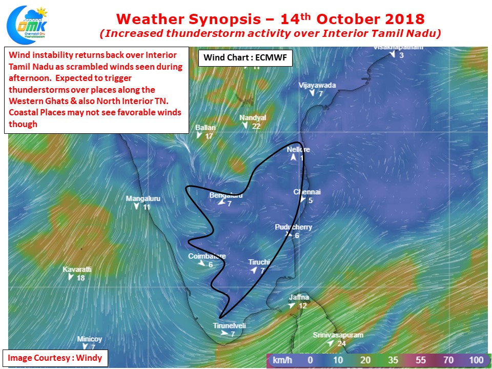
Compared to yesterday the wind induced Instability looks more pronounced in the charts today. Especially at around 1.5 kms ASL the scrambled wind pattern is likely to provide right conditions for thunderstorms to develop after what could be a good day of convective heating.
Today once again we are likely to see good Thunderstorms on both sides along the Western ghats. Over the next few days Kerala could record some good spells of rains which could go a long way in supplementary storage in the hydro reservoirs.
Today we could also see some isolated thunderstorm activity over North interior Tamil Nadu. Places along the Karnataka, South AP and Tamil Nadu border areas could benefit from these spells of rains. While coastal areas may not benefit like the interior areas one or two places though could get some light spells later in the night. Once the Easterlies return back completely the chance for coastal areas like Chennai improve.


