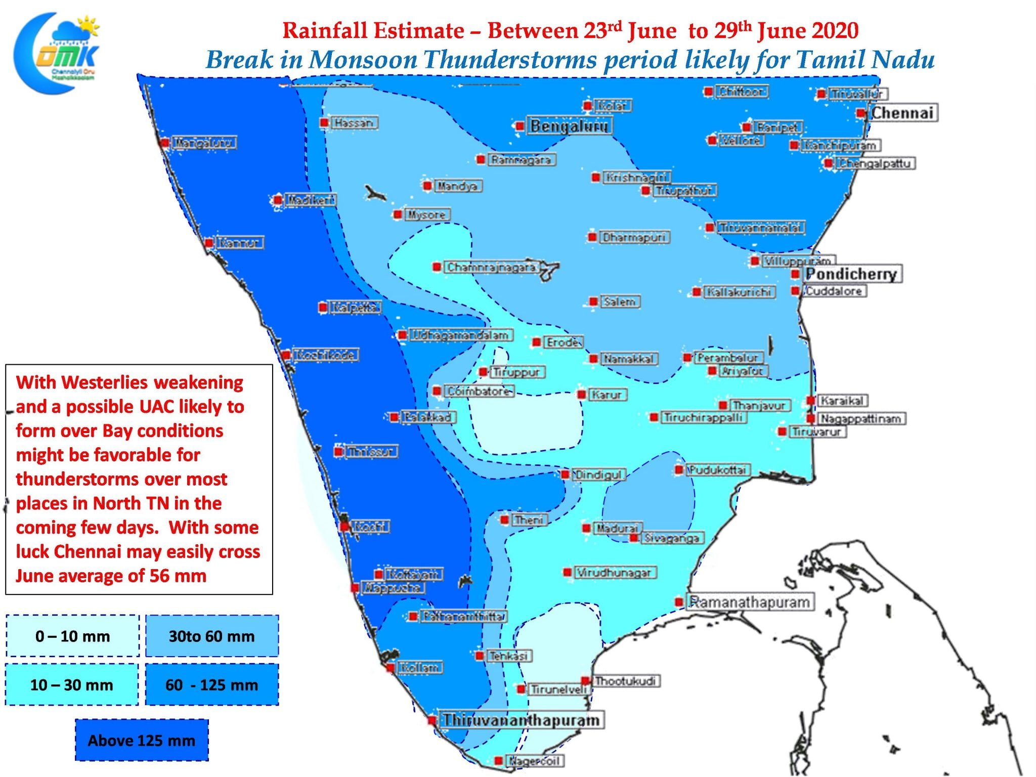
Last night saw parts of Tiruvallur & Vellore record fairly heavy thunderstorms while the western suburbs of Chennai like Poonamallee, Thirumazhisai. Tiruttani recorded 55 mm while neighboring Arakkonam about 70 kms to the West of Chennai recorded 66 mm from the late evening storms yesterday. Yesterday’s thunderstorms also indicated the changing atmospheric conditions as well.

With Monsoon Onset remaining stagnant over the past couple of days weather models indicate Westerlies have started slowed down. This was reflecting in yesterday’s rainfall pattern as well with thunderstorms not making the journey across the coast near Chennai though they were seen at around 50 kms to the West. Additionally a developing mid level Upper Air Cyclonic Circulation in Bay is likely to provide support for thunderstorms to develop over large parts of TN.

The coming few days look good for thunderstorms over interior Tamil Nadu with weakening westerlies & developing UAC. This could also create wind induced instabilities over coastal areas like Chennai providing a good chance for Chennai to catch up on its June average of 56 mm. While it is not practical to expect daily Thunderstorms / Rains the next few days look good for a couple of moderate spell of rains across Chennai & rest of the places in North Tamil Nadu.


