
Last night saw Western & Northern suburbs of Chennai enjoy a very good spell of thunderstorms after midnight. While the IMD observatory in Nungambakkam missed out most of the spells accumulating only 12 mm, the other observatory at Chennai AP did not get rains at all indicating how the activity was confined to the Western areas of Chennai. Private weather stations around Korattur / Padi recorded more than 10 cms rains in a matter of little more than an hour during this spell.
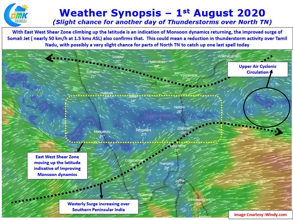
Among weather watchers it is a very common observation of how Chennai gets its best spell of rains when the break in monsoon is just about to end. With models indicating strengthening westerlies & a Northward climb of the Mid Tropospheric East West Shear Zone it seems the end to break is only a matter of time and not a question of whether. The only question that remains to be answered is whether yesterday was that spell which could be the last before the return of monsoon dynamics or could North TN sneak one more spell today as wind charts indicate a possible instability around South AP.
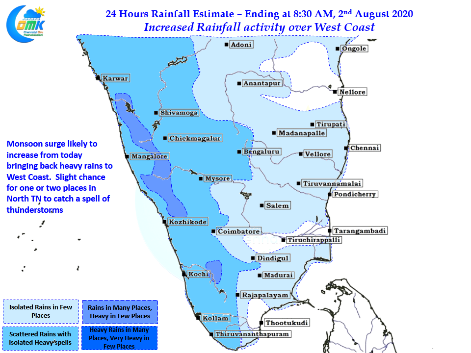
With Somali Jet ( low level Westerlies) surge increase and shown well in excess of 50 km/h from today over Southern parts of Peninsular India the west coast is likely to see an increase in rainfall activity from today. This would also mean except for the Northern fringes of TN most other places have seen the last of the current spell of thunderstorms as strong westerlies is unlikely to allow TS formation due to shearing effect. With satellite image indicating the presence of upper level clouds over most parts of TN it remains to be seen if indeed any thunderstorms may form.
But please keep in mind if at all Chennai gets lucky with one more spell the spell has to happen only later in the night as chance for sea breeze induced thunderstorms may be less.