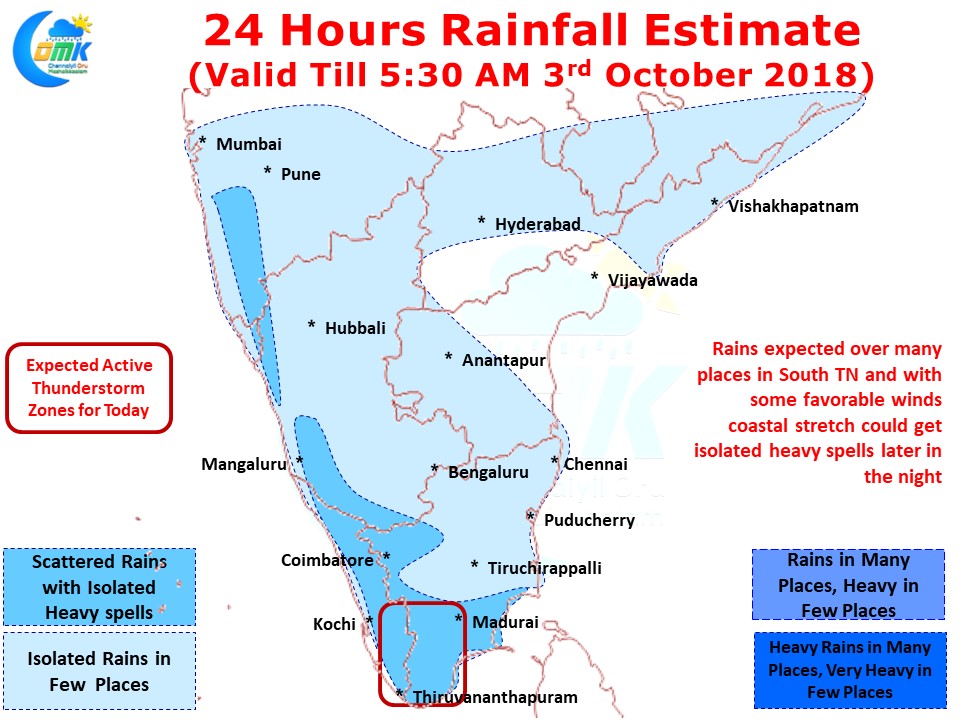
After a few days of relatively subdued thunderstorm activity over Tamil Nadu rains are expected to pick up once again on the back of a developing disturbance close to Sri Lanka. Parts of South Tamil Nadu are already the effect of this disturbance with places in Ramanathapuram district getting good rains since early morning today.
More places in South Tamil Nadu is likely to see moderate rains today with isolated places along the ghats likely to receive heavy spells. As moisture from the East gets pushed across the interior parts of Tamil Nadu the interplay between Day time convective heating and the travelling moisture could trigger these heavy thunderstorms along the Western Ghats.
Also one needs to keep in mind Western Ghats is not one long stretch of mountains with high elevation everywhere. There are sections not only consisting passes like Palghat & Aryankavu but at few places the mountain altitude stays around 1500 ft providing perfect orographic lift giving rains to places in Kerala as thunderstorms.
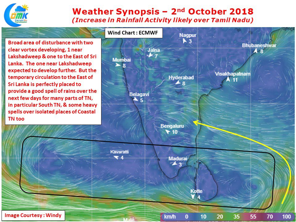
Over the course of the next few days one key development that is likely to keep most of Tamil Nadu under the spell of rains is the broad based circulation with two clear vortexes on either side of Sri Lanka. While models are fairly confident of the circulation near Lakshadweep to eventually evolve into a Low Pressure Area the temporary circulation to the East of Sri Lanka is crucially placed in an ideal location to circulate moisture into Tamil Nadu bringing moderate to heavy rains to places in South Tamil Nadu while isolated places in Coastal TN also could benefit from isolated heavy spells particularly around late night / early morning times.
As far as Chennai goes, stop looking West for Rains from now on. We will be seeing typical Northeast Monsoon type weather for the next few days with sudden sharp spell of rains during the nights / mornings. Places to the South of Chennai could sneak in a spell or two of good rains in the coming days.


