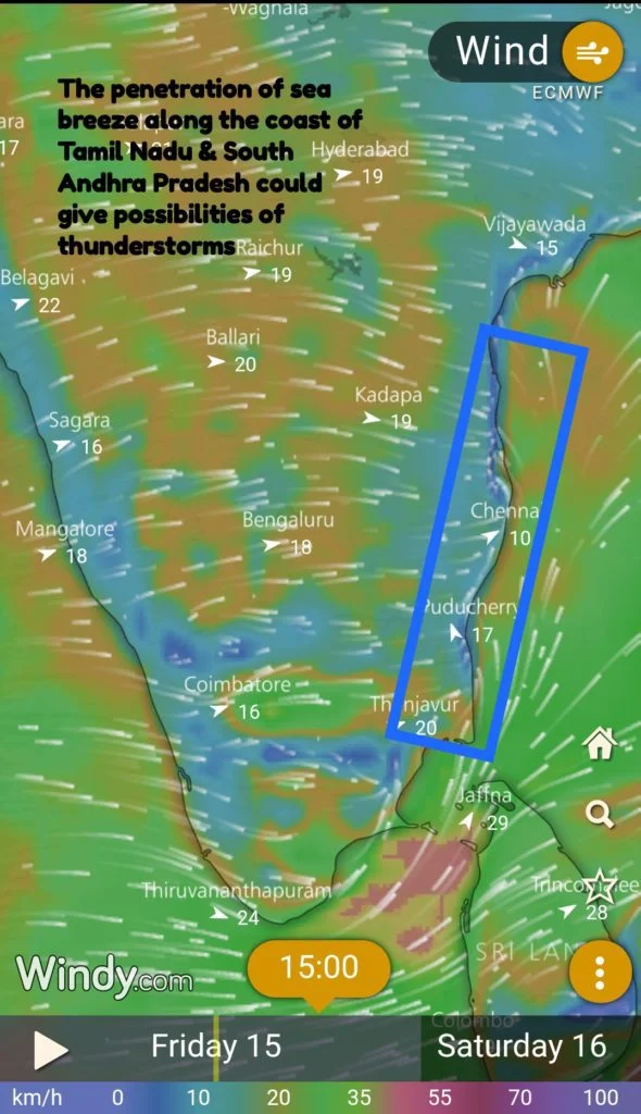
As monsoon started to weaken over the West coast yesterday saw Chennai Nungambakkam IMD observatory reached the highest temperature of the year of 39.8°C recorded earlier in the year during late May. While on Wednesday a fairly strong sea breeze front brought some respite yesterday saw a YoYo battle between Westerlies and sea breeze taking the temperature up and down during the evening.
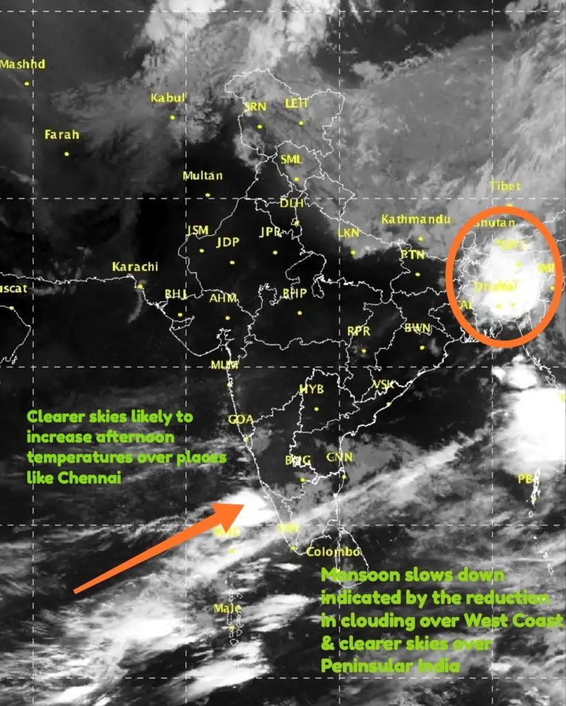
Satellite image clearly indicates the weakening of Monsoon over the West Coast with rain bands reducing over the ghats of Kerala & Karnataka. This is likely to slow down the rains for a few days bringing much needed relief to some of the areas seeing flooding so early in the Monsoon season. Places along the Western Ghats in Tamil Nadu is also likely to see a reduction in rains. The other change which one can observe from the Satellite map is the clearer skies over Rest of Peninsular India. In particular over North TN and South AP which will increase the temperature quotient over places like Chennai.
With Westerlies ruling the roost till late in the afternoon around 4 PM the heat from adjoining parts of Rayalaseema is transferred to Chennai & surrounding areas. Between today and tomorrow there exists a firm possibility of Chennai Nungambakkam recording it’s first 40°C of the year. With the slowing of monsoon current the weaker upper level winds has given an opportunity for convective thunderstorms to develop in the interior areas particularly around areas where the broken Eastern Ghats provide a left to the remnant moisture from West coast. Along the East Coast the sea breeze moving inland not only provides a sudden burst of moisture but also creates an environment of wind shear with the right wind pattern for thunderstorms to develop. Just like the firm possibility of 40°C existing for Chennai today and tomorrow from today till Sunday there exists a good possibility of thunderstorms to show up over Chennai.


