
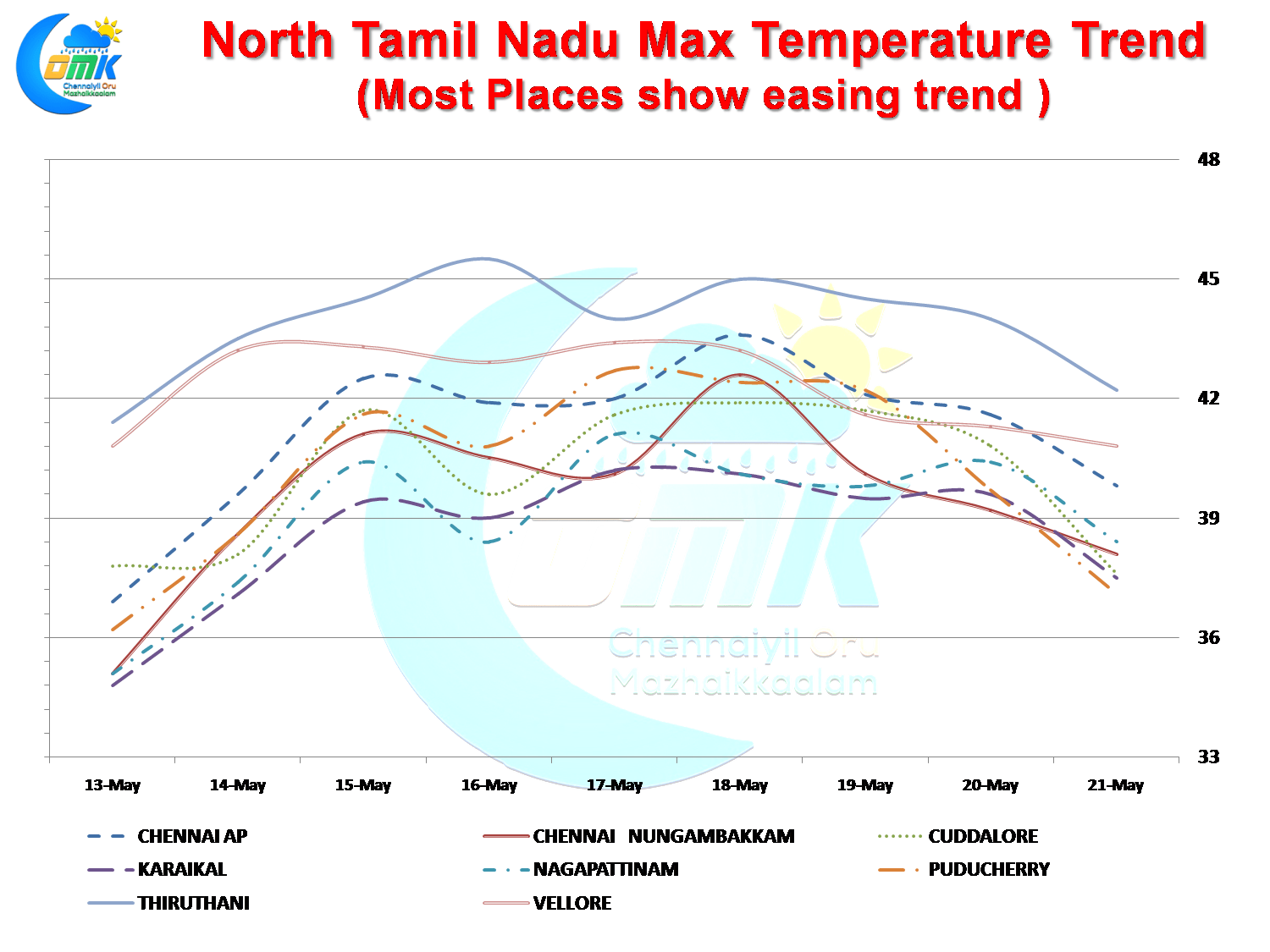
The Hot Days streak for Chennai and coastal areas of North Tamil Nadu eased yesterday as both the observatories recorded sub 40°C for the first time since 13th May 2017. While Nungambakkam recorded 38.1°C the airport observatory at Meenambakkam was slightly hotter at 39.8°C falling just short of the 40°C which is classified as the threshold for Hot Days. Even interior places like Tiruttani, and Vellore recorded lower temperatures with Tiruttani settling at less than 43°C for the first time since 13th May.
Things are expected to continue in similar fashion for the coming days as well with numerical models indicating most of Tamil Nadu expected to see temperatures closer to normal in the coming days. During the early part of last week we had a trough running from Coastal AP & South TN along the coast increasing the strength of Westerlies thereby creating heat wave conditions for most of Peninsular India East Coast. With large scale synoptic changes slowly evolving over North Indian Ocean in the form of possible Upper Air Cyclonic Circulation over Bay of Bengal near Andaman Islands things could take a backseat on the heat front.

Temperatures are likely to be slightly on the higher side today for North Interior Tamil Nadu and parts of South Tamil Nadu but things are expected to ease and get closer to normal most of this week as one can surmise from the 7 day temperature anomaly charts. Parts of Coastal AP is going to get much needed relief from the oppressive heat wave that has engulfed the region for almost 10 days now.

On the rain front parts of West Interior Tamil Nadu and adjoining parts of Kerala could see moderate rains at a few places with some light rains possible as well in parts of Rayalaseema & Telengana where there could be a temporary wind confluence triggering instability. Coimbatore, Erode, Nilgiris & Tiruppur districts could be the beneficiaries of today’s spell of rains.
Powered by WPeMatico