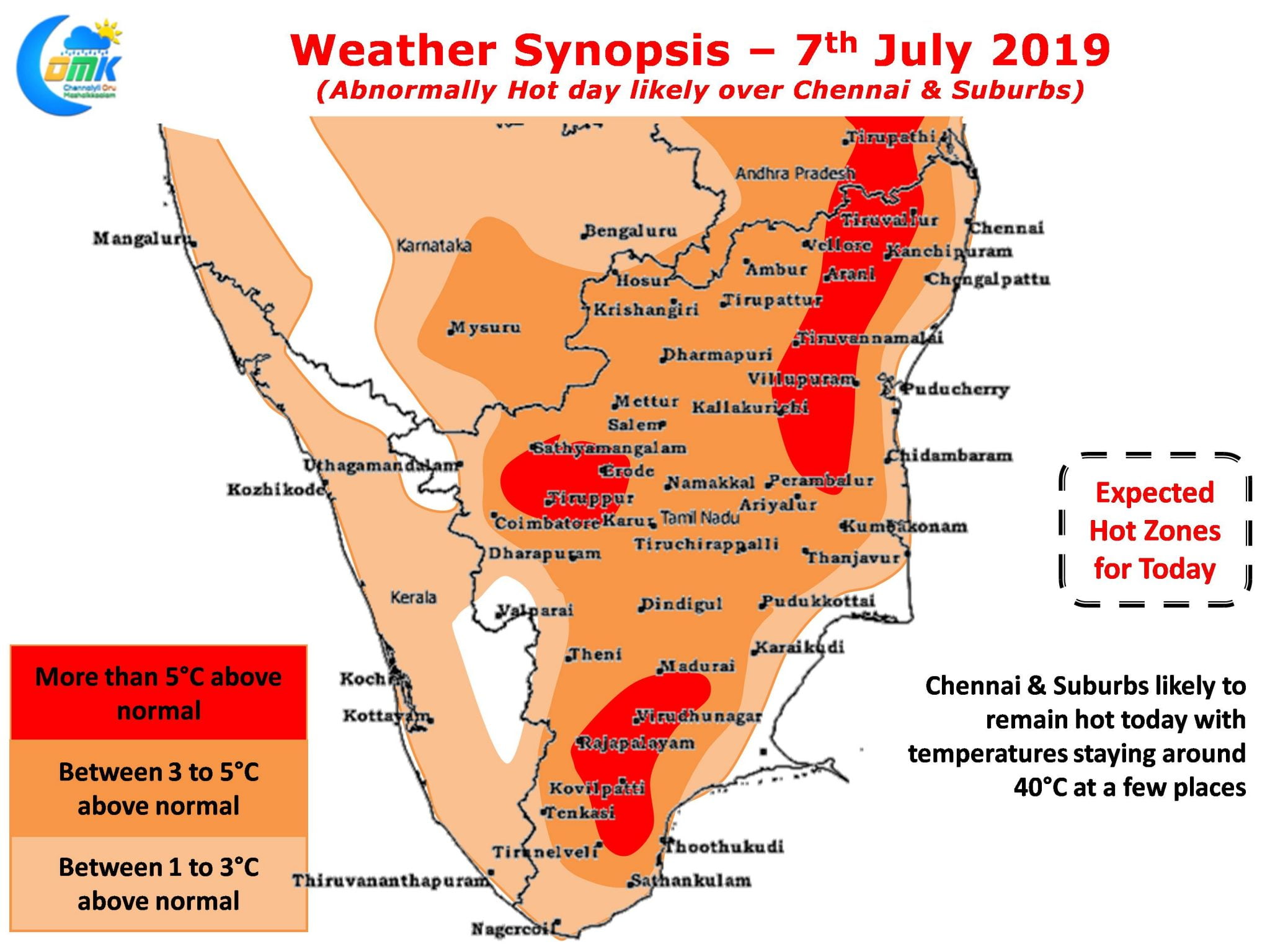
As Southwest Monsoon ebbs and flows at West Coast over here at the East Coast of Peninsular India Chennai sees its day time temperatures also oscillate. In the last 10 days or so Chennai AP has crossed 40°C more than a couple of times when drier conditions and stronger Westerlies have ruled the roost.

Yesterday under cloudy conditions despite stiff Westerlies the temperatures did not cross 36°C as active monsoon conditions & subsequent remnant moisture travelling across the Peninsular India created what was effectively a shield against heat. Weather models indicate moderate monsoon conditions likely to persist over the West coast though Konkan & Shahyadris possibly enjoying better share compared to the Southern Western Ghats.

A weak low pressure over East India is likely to influence wind patterns keeping Westerlies strong for another day or two which will influence likely thunderstorms over Tamil Nadu though the window of opportunity opens from today for Coastal Tamil Nadu. These strong westerlies will also keep the temperatures high over many places of North Tamil Nadu including Chennai & Suburbs. Once the Westerlies slow down slightly we could possibly see thunderstorms improve in intensity till then thunderstorms triggered by convective process or through sea breeze will provide sharp spell of showers as strong Westerly winds push these thunderstorms out into the sea even before we realize.


