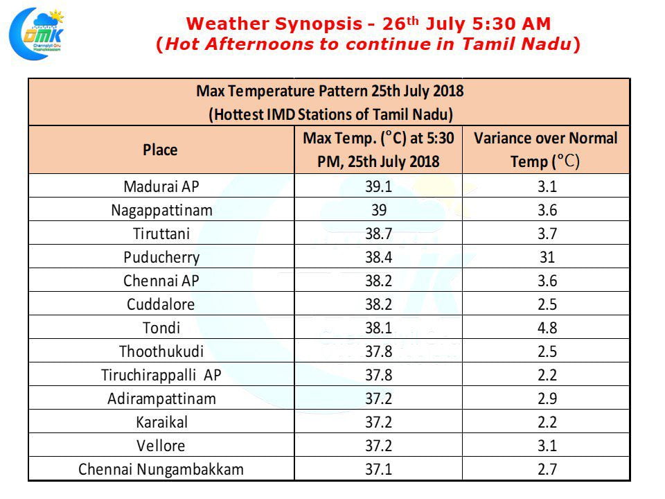
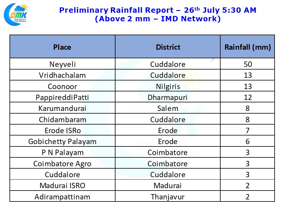
Most parts of Tamil Nadu have seen an increase in day time temperatures coinciding with more clearer skies on account of weakened monsoon dynamics over the west coast. Though Monsoon dynamics have weakened we have not got the classic break in monsoon conditions for thunderstorm activity to pick up over Tamil Nadu.
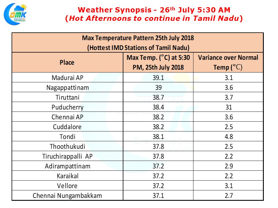
Last evening saw some moderate thunderstorm activity in Villupuram & Cuddalore districts with Neyveli recording 50 mm most ow which fell in two hours between 9:30 & 11:30 PM. Vridachalam and Chidambaram also recorded light rains from this spell while parts of Erode recorded late night rains bringing some relief from the hot winds that were blowing during the day. Madurai AP was the hottest IMD station yesterday having recorded 39.1°C yesterday which was nearly 3 degrees above normal. Nagappattinam recorded 39°C which was once again 3.6°C above normal. Tondi in Ramanathapuram district was nearly 5°C above normal recording 38.1°C yesterday.
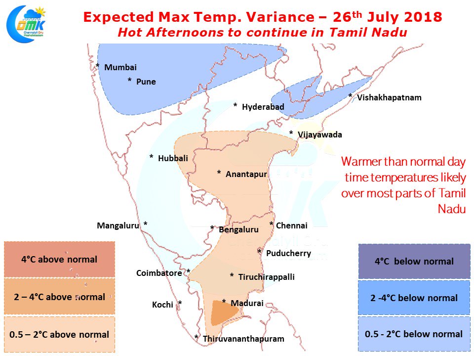
Numerical Models indicate another hot day ahead for most parts of the state with parts of South Tamil Nadu seeing 3 / 4 degrees above normal max temperatures during the afternoon. Weak Monsoon over Peninsular India resulting in clear skies is the key reason for this spike in temperatures. Early part of July saw active monsoon conditions bringing cloudy skies & upper air moisture support preventing heat radiation which is absent now. The flip side to this heat is development of proper temperature gradient between land & sea resulting in strong sea breeze fronts over most parts of Coastal Tamil Nadu.
It is a pity though in the absence of a proper synoptic conditions / Atmospheric wind instabilities we are seeing less intense thunderstorms that are extremely isolated. Today could be no different with some isolated thunderstorms along the coast triggered by sea breeze front. There is a possibility of some stray showers over parts of Chennai & suburbs during evening on account of Sea Breeze but its unlikely to disrupt the city’s rhythm


