The Well Marked Low in Bay of Bengal now lies roughly around 800 kms ESE of Chennai and about 500 kms to the West of Port Blair in Andaman Islands. It is expected to intensify into a Depression within the next 24 hours or so and subsequently become a Deep Depression (Tropical Cyclone strength) possibly by tomorrow. Numerical models are in tight agreement about the North / Northeast Movement of this tropical disturbance.
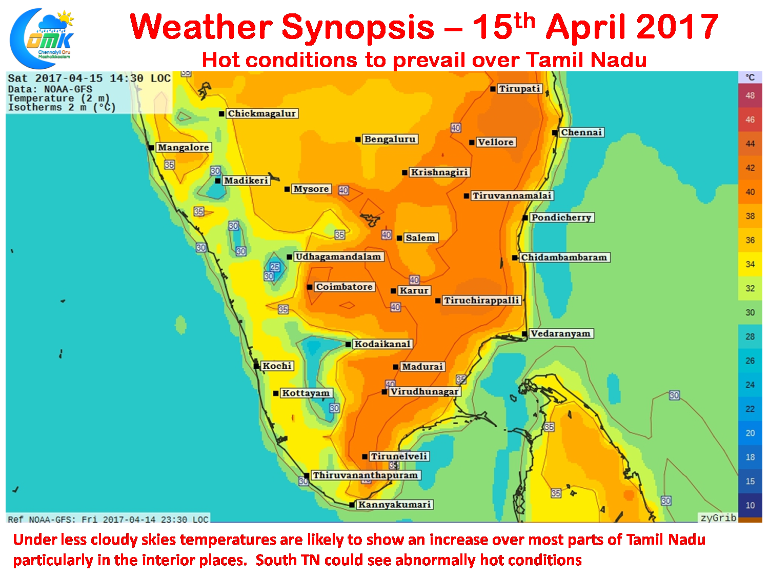
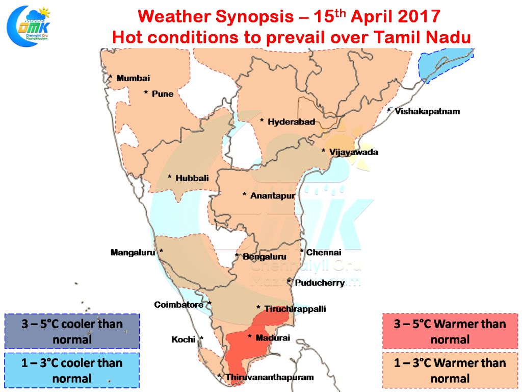
With the Bay Low Pressure moving away from us the hot dry conditions that most of Tamil Nadu has been seeing is likely to increase in the coming days. Yesterday saw a bit of high level clouds moderating the temperature with most places of the state staying close to normal. Today we are likely to see more clearer conditions that could increase the day time temperature with numerical models indicating almost all of the state seeing maximum temperatures a couple of degrees higher than normal while parts of South TN could see temperature abnormality of almost 5 degrees with not much moisture around
Most parts of Interior Tamil Nadu particularly around the Central areas are likely to see temperatures in the region of 39 / 40°C while the coastal areas of North Tamil Nadu is also likely to see temperatures notch up a degree or two compared to yesterday with possibly Chennai seeing 35 / 36°C a good two or so degree higher than yesterday.
Powered by WPeMatico


