
With August giving way to September slowly the discussion among weather bloggers start moving towards withdrawal of Southwest Monsoon & the thunderstorms associated with it. But over the last few years the monsoon withdrawal process has started only towards the end of September which has prompted IMD to revise the normal withdrawal dates over NW India.
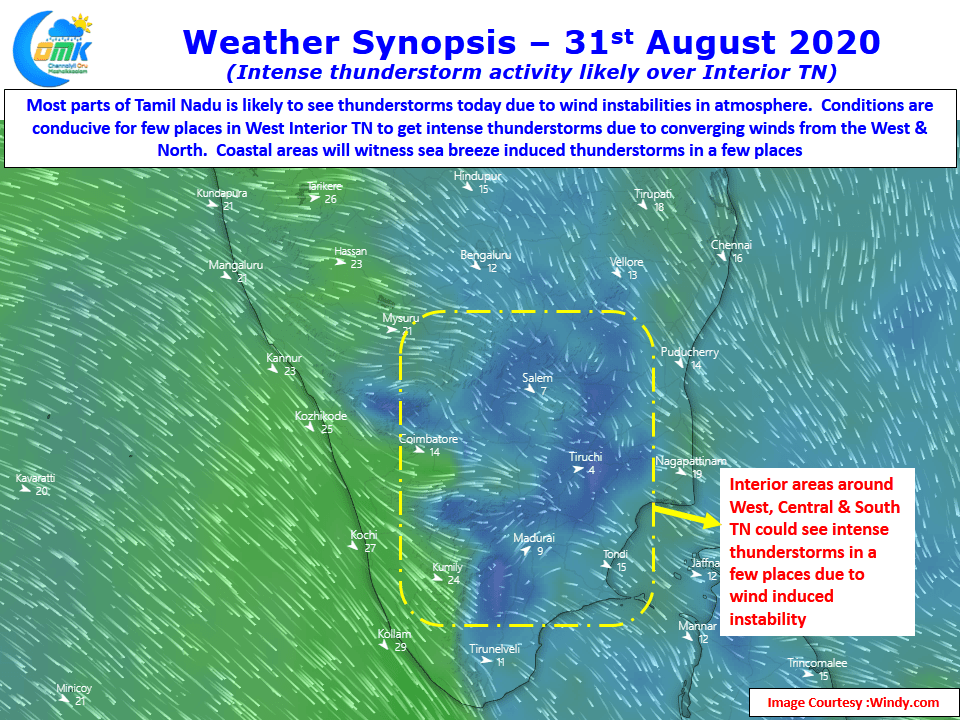
Looking at weather models the current wind charts look very scrambled thereby creating conducive atmospheric conditions for thunderstorms to thrive. Westerlies have weakened drastically leaving coastal areas looking East for sea breeze to provide some trigger so that thunderstorms could develop closer to the coast. Similarly interior areas also benefit from not only the westerlies slowing but the scrambled winds also end up creating wind convergences in a few places. This wind convergence sets up the platform for active thunderstorms once the convective trigger is provided by the heat radiation provided by the clearer skies.
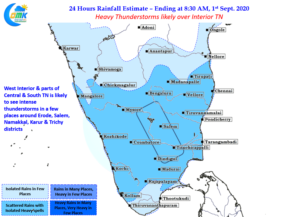
Today parts of West Interior TN & adjoining areas of Central & South TN could see intense thunderstorm activity in a few places due to winds converging from West & North. With weak steering winds seen the thunderstorms are expected to move very slowly hence dump heavy spells of rains at places close to where they form. Karur, Namakkal, Salem, Trichy & Dindigul districts look to be the hot spots for rains today though most of Tamil Nadu has a chance to receive a spell or two of rains.