
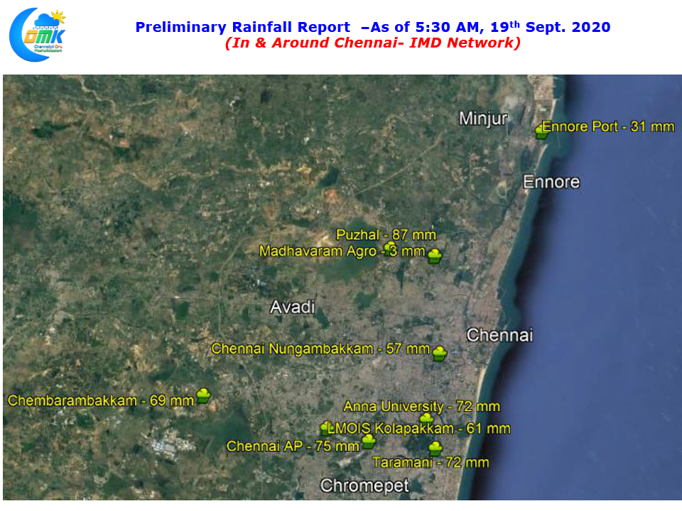
In a welcome relief after many close misses & disappointments not to forget the by now Iconic “Chennai Bermuda – Vada Poche” moments yesterday saw one of the best spell of thunderstorms of this monsoon season for Chennai with the IMD Observatory at Nungambakkam scoring its first half century of the year recording 57 mm as of 5:30 AM today morning. Almost all across the city & suburbs recorded good rains including the catchment areas like Puzhal & Chembarambakkam which recorded 87 & 69 mm respectively.
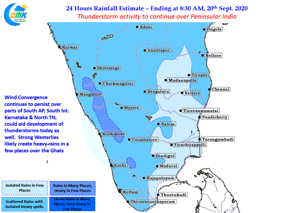
The models did hint about yesterday’s event with fairly strong wind convergence seen at multiple levels creating conducive conditions for thunderstorms to develop & sustain through the night. The day after a strong event like last night is always going to be tricky in terms of estimating what is in store. With weather models indicating wind convergence to continue, though less stronger compared to yesterday, we may see thunderstorm activity continue over Peninsular India today too aided by the UAC over Bay.
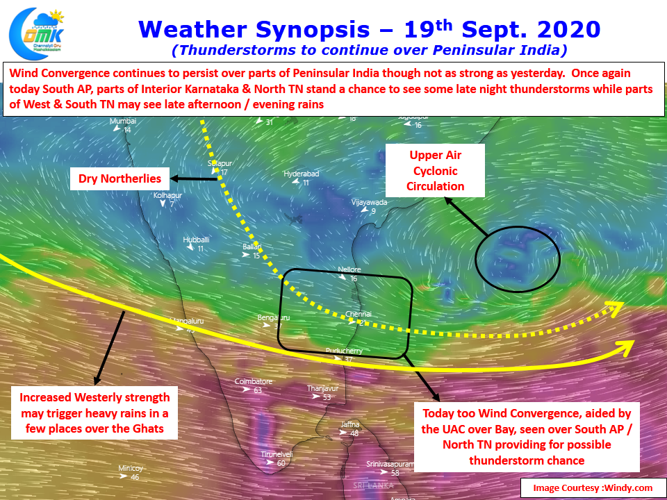
With westerlies picking up strengthened by the incoming pulse from South China Sea, expected to become a Low in Bay, we may see an uptick in the rains over West Coast as well. Few places in the Ghats particularly around Wayanad / Madikeri / Nilgiris may see heavy rains today on the back of strong Westerlies. Closer home we may see thunderstorms happen in the plains of Tamil Nadu as well with South AP & North TN coming under wind convergence today as well.
After Yesterday’s Super Spell anything is a bonus today, Lets enjoy what ever comes our way.