
The last week saw an increase in temperatures across Tamil Nadu due to the presence of a trough over Peninsular India changing the wind pattern. Land breeze became more dominant during the afternoons reducing the impact of the moderating Easterlies. Consequent to this was the arrival of the thunderstorms as well. The last couple of days as the Westerlies penetrated deeper into Peninsular India thunderstorms with hails occurred at many places over South Int. Karnataka, Andhra Pradesh and parts of Tamil Nadu in the North Interior & West Interior areas.
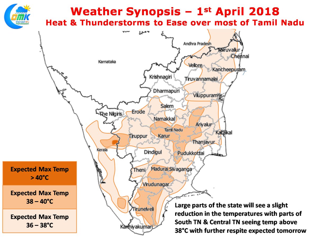
Starting today the effect of the trough is waning giving strength to the Easterlies once again. This will reflect in the day time temperatures which are expected to reduce. While today will see most of North TN record temperatures around 35°C tomorrow could see reduction in temperatures over South & Central Tamil Nadu as well. Numerical Models indicate parts of South TN & Central TN to see slightly above normal temperatures today from tomorrow for most of the coming week almost all of Tamil Nadu will see near normal temperatures while North TN could see slightly below normal temperatures.
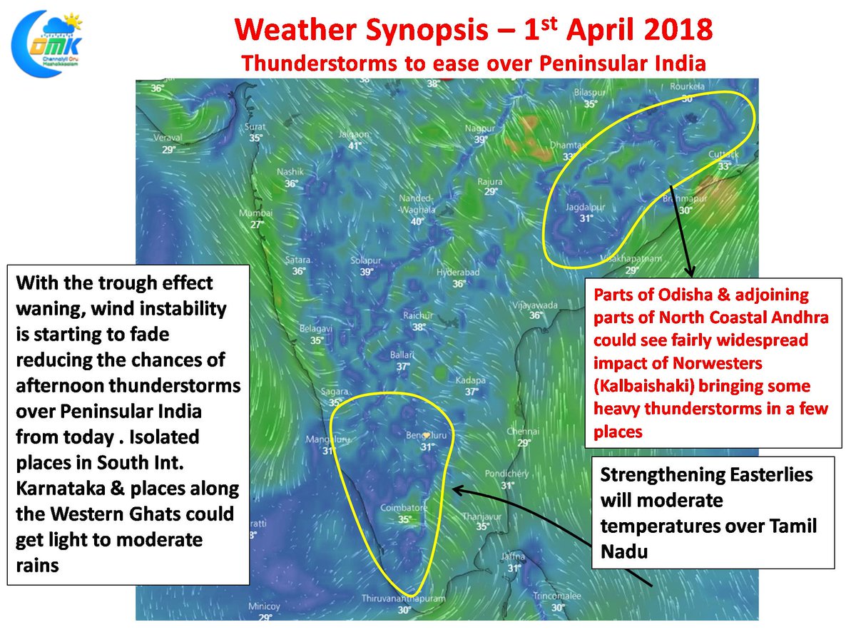
As explained above the effect the trough which was holding the key for atmospheric instability over Peninsular India over the last few days is expected to wane as per weather models. This trough was the key in bringing wind convergence and the consequent thunderstorms and hailstorms. With the trough fading the Easterlies are expected to strengthen not only moderating temperatures but also reducing the chances of thunderstorms to places along the Western Ghats & Kerala. While today could see some isolated thunderstorms over the interior parts of Tamil Nadu particularly along the Ghats near Nilgiris & Valparai overall the rains are going to reduce from today.