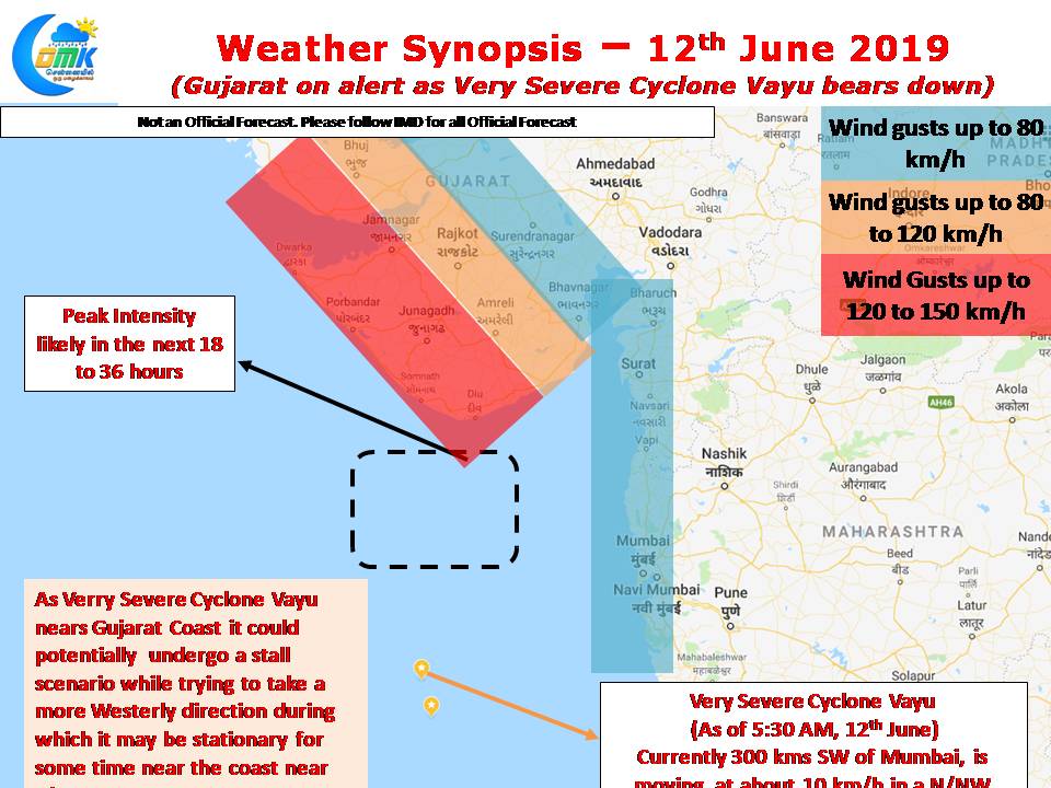
Very Severe Cyclone Vayu has been slowly moving towards the Gujarat coast, as it continues to intensify under conducive sea surface and atmospheric conditions. Currently lying around 300 kms to the Southwest of Mumbai its been moving at a jogging pace at about 10 km/h in a rough North/Northwest direction.

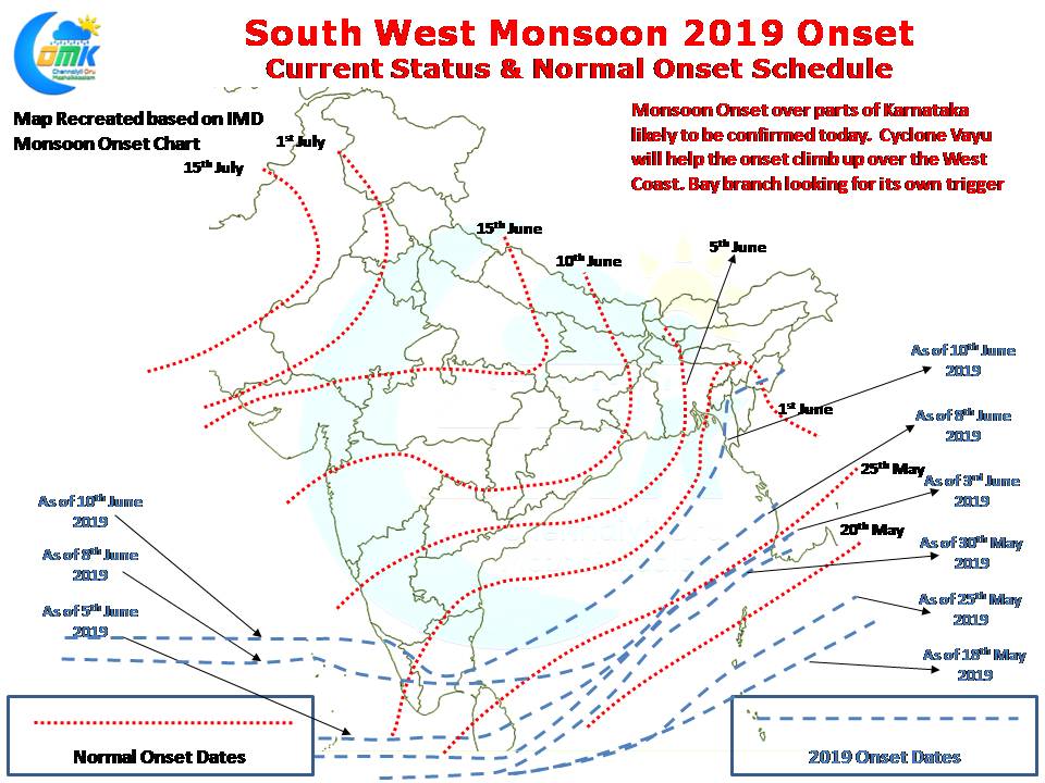
While all the talk has been on Cyclone Vayu the overall monsoon dynamics has been moving slowly so far. While the West Coast may benefit from the Northward moving Cyclone Vayu which will possibly drag the Monsoon dynamics up to Maharashtra / Gujarat the East Coast has been languishing looking for its own trigger. Except for a small patch of Mizoram so far the Monsoon dynamics is yet to make a tangible impact over the Northeast & East India.

In the meanwhile Severe Cyclonic Storm Vayu has intensified into a Very Severe Cyclonic Storm and is now likely to attain peak intensify over the next 24 to 36 hours as it nears the Gujarat Coast. While most weather models are consistent on a Northward movement there exists a possibility of a potential stall due to a likely Westward recurve probability which could make Very Severe Cyclone Vayu stationary off the coast of Diu. This is something one needs to keep a watch, irrespective of which many parts of Gujarat coast could see wind speeds gusting around 150 km/h as the cyclone nears the coast.
On the Rain front West Coast will continue to receive rains all the way from Kanyakumari district to Maharashtra with the heaviest spells of rains now likely over the Konkan & Karnataka Coast as Very Severe Cyclone Vayu moves up the latitude. In the same context when the influence of Very Severe Cyclone Vayu fades from Peninsular India we could see slight altering of wind pattern bringing the window of thunderstorm opportunities for North Coastal TN including Chennai.


